The Eastern Silver Spring Communities Plan (ESSCP) team is working with residents, business owners, and other stakeholders to take a comprehensive look at how people live, work, play and shop in their community, now and in the future. Together we will create a vision for the future of the community and make recommendations to help achieve that vision.
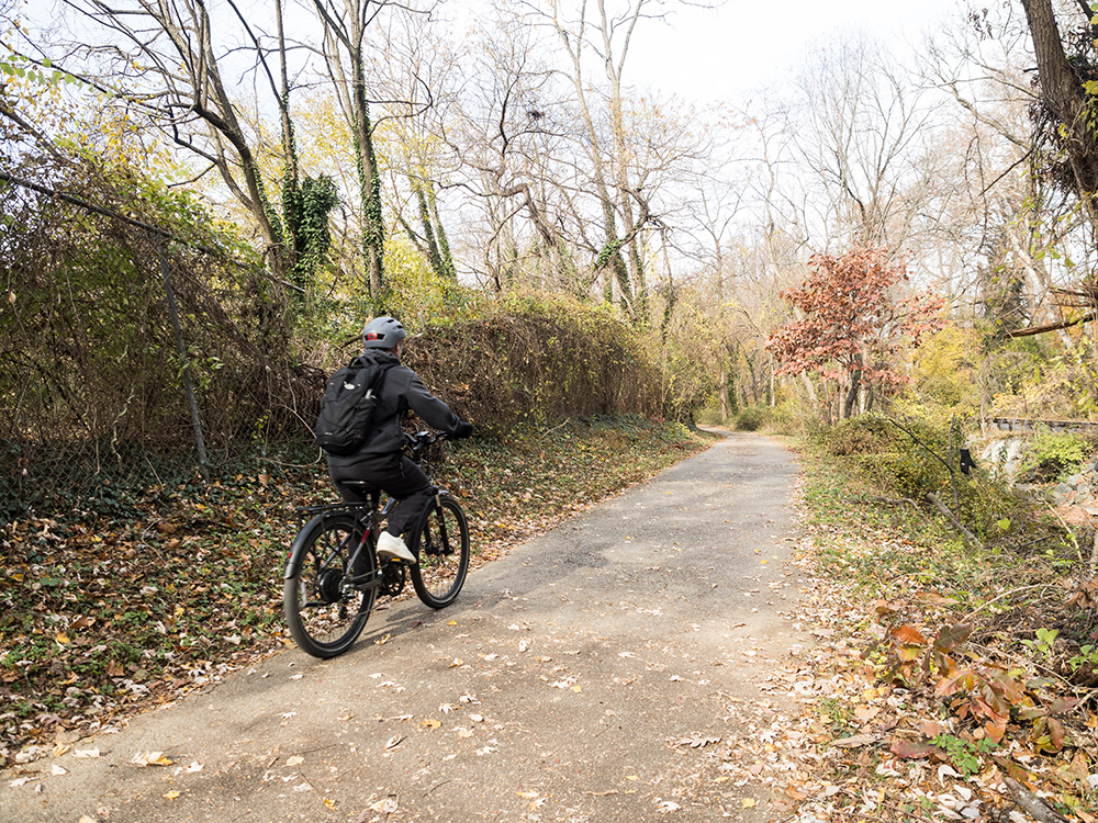
The Plan will make recommendations about the types, sizes, and uses of new buildings, transportation, schools, parks, and more. This plan will also address housing, historic preservation, pedestrian networks, trail systems, and environmental issues.
Current phase: Analyzing feedback and revising recommendations
We’ve taken what we heard—along with planning best practices, county policies, data analysis, and staff expertise—to create a set of preliminary recommendations.
Since releasing the preliminary recommendations, the planning team has met with community organizations and leaders and hosted a community open house with approximately 140 attendees. The team also received 331 responses to an online questionnaire, numerous emails, telephone calls, and facilitated many individual and small group conversations.
The team is now hard at work analyzing the feedback received and preparing revisions to the recommendations. The revised recommendations will be released with the Working Draft Plan, anticipated this fall.
Explore the Preliminary Recommendations
Watch the Video Series
Nine videos focused on key preliminary recommendations (housing, zoning, the environment, etc.)—and why they matter!
Zoom into the Interactive Zoning Map
Focused solely on zoning preliminary recommendations, take a birds-eye or address specific view via our Interactive Zoning Map.
Watch on-demand
Throughout March, our team presented the preliminary recommendations to the Planning Board in three separate briefings.
Community Visioning
From Fall 2024 through Fall 2025, the planning team worked with community members to craft a vision for the future of this area. Check out what we heard over the course of the year.
Scope of Work
On May 16, 2024, the Planning Board approved the Scope of Work and Plan Area (shown in red on the map below) for the Eastern Silver Spring Communities Plan. Watch the May 16 recording.
View the Eastern Silver Spring Communities Plan Existing Conditions Report (English | Español), Scope of Work (English | Español), and the Community Engagement Report (English | Español), as posted as part of the staff report for the May 16, 2024 Planning Board meeting.
Approved Plan Area
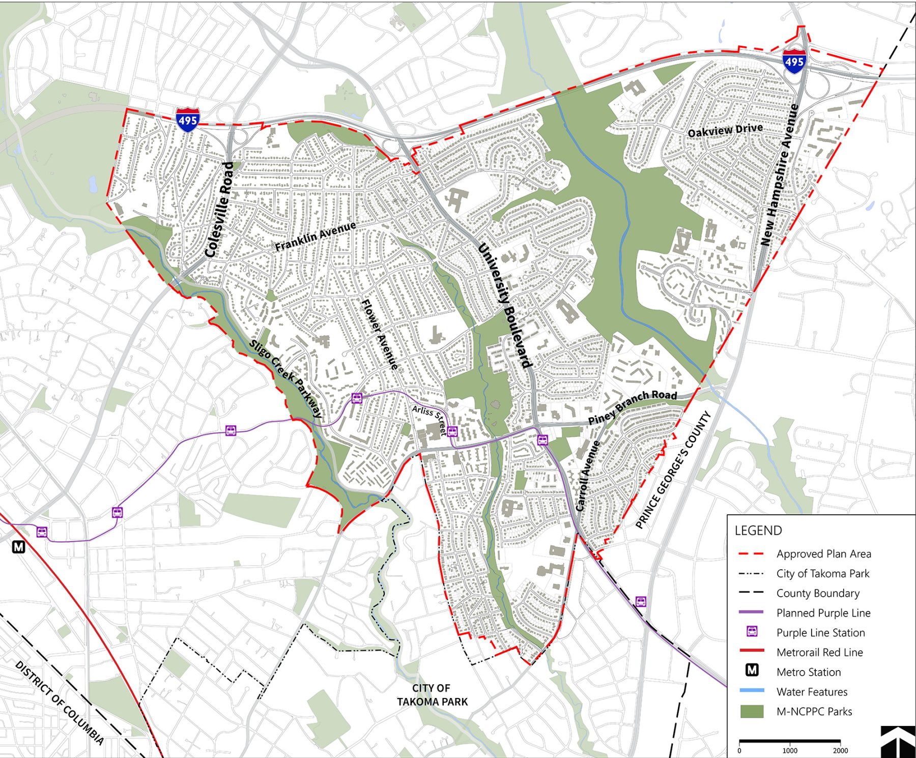
What is the Plan Area?
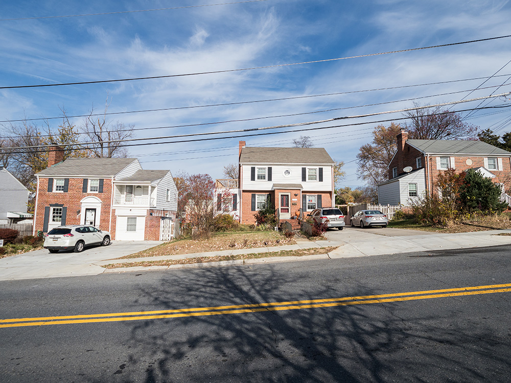
To help the planning team and community focus their work, the Montgomery County Planning Board approves a “Plan Area”, a defined geographic area legally required for each master plan. A master plan recommends new zoning and other changes for properties and streets included within the Plan Area. On May 16, 2024, the Planning Board approved the Plan Area outlined in dashed red in the map above. The Plan Area includes sections of three Growth Corridors identified by the county’s updated General Plan, Thrive Montgomery 2050 – Colesville Road, University Boulevard, and New Hampshire Avenue – and includes single-family and multi-family residential, commercial, and institutional properties, as well as the Long Branch, Northwest Branch, and Sligo Creek Stream Valley parks.
Frequently asked questions
The Eastern Silver Spring Communities Plan is an opportunity to establish a vision and recommendations for communities that are poised to experience change with the Purple Line light rail beginning service in 2027 and plans for Bus Rapid Transit on University Boulevard and New Hampshire Avenue. The Plan responds to these changes by recommending ways to maintain affordability, add more types of housing, support small businesses, and improve transportation safety.
Since 2023, over 1,200 people shared what they value, what challenges they face and where they want to see improvements. We heard from people at community meetings, community events, door-knocking, online surveys, and focus groups. To learn more, check out our community engagement page. This helpful input, along with data analysis, best planning practices and county policies, informed the plan’s preliminary recommendations. Did we get it right? Let us know on our survey.
The Plan’s preliminary recommendations encourage investment from both the private and public sectors to create more opportunities in the Plan area, while providing recommendations that prioritize the community’s needs, to ensure that residents today benefit from recent investment and future growth. These recommendations include creating spaces to gather, building safer sidewalks, incentivizing new developments to retain locally-owned businesses, and striving for no net loss of affordable housing.
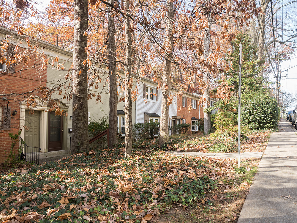
- Community members told us they value diversity—of people, cultures, and housing types. Today, this area includes many kinds of homes: single family houses, duplexes, condos, townhouses, and small and large apartment buildings. Allowing a wider range of housing types helps ensure the community helps maintain this diversity by providing housing options that meet different need
- It gives families more options. For example, a homeowner could create a home where multiple generations—grandparents, parents, and adult children—live close together, but in separate units.
- It creates more affordable places to live. Many residents told us they’re worried about rising housing costs and want ways to stay in the area. Townhomes, duplexes, triplexes, and quadplexes tend to cost less than single family homes in Montgomery County and create more opportunities for homeownership.
The Eastern Silver Spring Communities Plan area was largely developed before modern stormwater management practices existed. As a result, many of the impervious surfaces—streets, roofs, driveways, and parking lots—were not designed to hold or slow down rainwater, allowing stormwater to flow quickly off these properties. With climate change bringing more intense and frequent storms, this runoff problem is becoming more severe.
Creating opportunities for redevelopment brings with it opportunities to add housing while also improving stormwater management, as required by county code. While runoff changes will differ from site to site, any redevelopment will improve stormwater management by adding new controls or upgrading older systems to meet today’s standards.
The number of homes on a lot doesn’t necessarily determine how much runoff is created. Duplexes, triplexes, quadplexes, townhouses and small apartment buildings are similar or slightly larger in size and design to single-family homes but contain multiple units, and do not inherently produce more runoff. What matters most is the amount of impervious surface and effectiveness of the stormwater controls on the property. County code requires an erosion and sediment control plan and a stormwater review when more than 5,000 square feet of land will be disturbed, ensuring that site-specific runoff impacts are addressed.
The preliminary recommendations also encourage using nature-based solutions when properties are developed or redeveloped. These include planting native trees and vegetation, adding bioretention areas and gardens, creating vegetated open spaces, and using permeable pavement or green roofs to help manage stormwater on-site.
In addition, the Montgomery County Department of Environmental Protection’s RainScapes program offers rebates to property owners who install stormwater friendly features such as rain gardens, water harvesting systems, green roofs, permeable pavement, or by removing unnecessary pavement.
Learn more about how Montgomery Planning helps plan for flooding caused by severe storms.
- There is not enough housing that people can afford. Housing prices are rising because there aren’t enough homes in the county. The recommendations would help create the possibility for more housing – especially in places that make sense, like near transit – so people have more options. For larger properties, we’ve also proposed recommendations to ensure that deeply affordable units are included in the event of new development.
- We heard that you want more amenities closer to where you live. Mixed-use zoning near Purple Line and most Bus Rapid Transit stations makes it possible to add these neighborhood-serving shops in the right locations.
- We heard that you want better parks, gathering spaces and neighborhood amenities. In mixed-use Commercial Residential Town (CRT) and Commercial Residential (CR) zones, new development over 10,000 square feet or 0.5 FAR (floor area ratio) has to provide public benefits. This can help bring new parks or plazas, neighborhood services, and improvements to the sidewalks to make them wider and safer.
This plan looks at displacement from several angles. If a property is redeveloped, the plan recommends giving eligible current residents the first opportunity to return once the new housing is built. Property owners should work closely with the County’s housing department (the Department of Housing and Community Affairs) and with tenants to reduce disruption, and to make sure residents get the support they need if they have to relocate temporarily.
The plan also includes strategies to make sure that new development adds to the supply of affordable housing. This includes creating deeply affordable homes for households earning less than half of the area median income, supporting the county’s Housing Opportunities Commission (HOC) and nonprofit groups in building more affordable housing, and encouraging affordable housing on public land—especially when paired with community facilities or other public uses.
All of these steps are meant to help current residents stay in their community and benefit from new investment, rather than being pushed out by it.
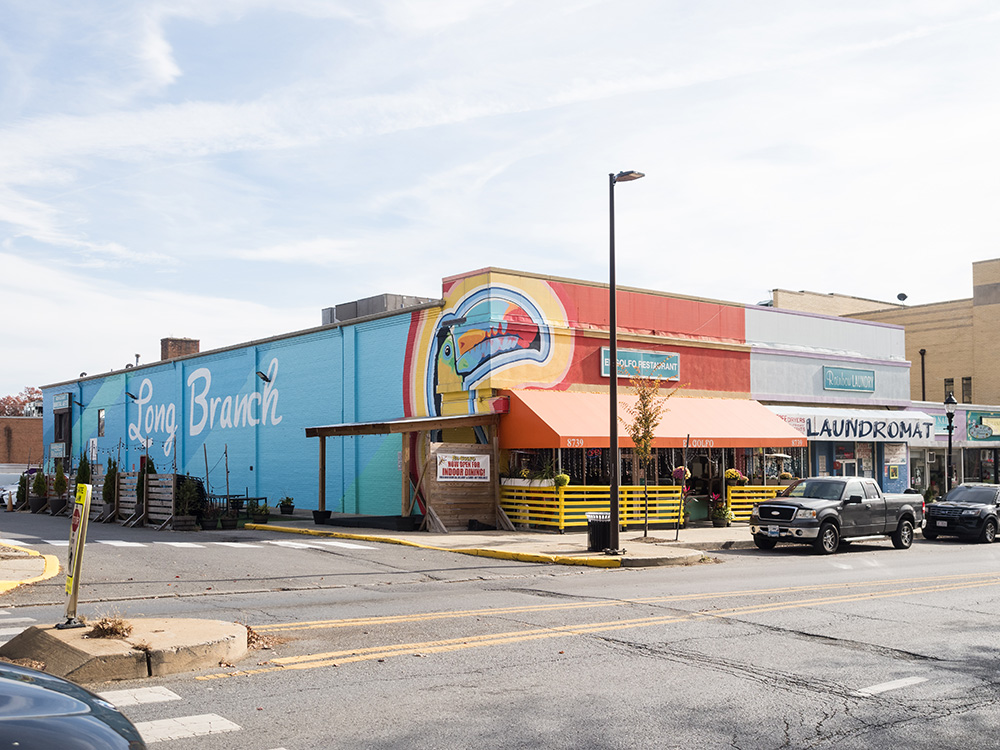
This plan focuses on helping existing small businesses stay in the community and supporting new locally owned businesses, while still allowing new development to move forward. It encourages developers to keep local businesses during redevelopment by offering comparable leases, relocation assistance when needed, and space for new local businesses. It also strengthens the Long Branch Business League so it can better support and advocate for business owners, explores creating a commercial land trust to help maintain affordable commercial spaces, and promotes local and international businesses through a program that highlights the area’s unique shops and restaurants.
The preliminary recommendations include several steps to make walking and biking safer near the Purple Line and along major roads. These include adding more visible crosswalks, building new sidewalks and widening existing ones, shortening crossing distances, stopping traffic on wide roads at crossings so people can cross more safely, adding protected pedestrian crossings, and improving lighting so people can see and be seen.
These are the plan’s preliminary recommendations, which reflect over two years of community input, research, and guidance from county policies and planning best practices. This step in the process is a chance for residents, community members, and the Planning Board to review the ideas and tell us what needs to be changed or improved before we write the full Working Draft of the plan, which is expected in Fall 2026. You can share your feedback by attending upcoming events or reaching out to the planning team at easternsilverspring@montgomeryplanning.org.
During the Scope of Work phase of the Communities Plan, staff found that temporary placemaking could help test ideas for future recommendations. Placemaking means improving shared spaces so they feel welcoming and useful to the people who spend time there.
This area is a strong fit for temporary placemaking that connects communities to local amenities and to one another, while celebrating its cultural diversity. Based on community input and in partnership with the Parks Department, staff identified four locations that would benefit from these improvements. These “gathering spots” received temporary features that encourage social and physical connection—such as seating, interactive signs, plantings, public art, and spaces for residents to learn and engage with their community.
These installations will test ideas before they become long‑term recommendations and create new opportunities for residents to share feedback and learn about local history. Three new temporary gathering spaces are now open across eastern Silver Spring at Franklin Knolls, Hastings Conservation Area, and the Northwest Branch Trail at Oakview Drive. The fourth gathering spot at Quebec Terrace will be installed in late May/early June. They will remain in place through October.
To follow updates on this initiative, please visit our Placemaking website.
Project timeline
-
Summer 2023 – Winter 2024Existing Conditions Analysis
-
Spring 2024
-
Fall 2024/Spring 2025Community Visioning: On February 27, 2025, the planning team briefed the Planning Board on the community engagement conducted since the approval of the Scope of Work in May 2024, including the initial stages of Community Visioning. Watch the February 27 recording and view the presentation (English | Español).
-
Winter 2026Preliminary Recommendations presented to Planning Board
March 5, Briefing #1 – Preliminary Recommendations Overview and Placemaking initiative. Watch the Briefing #1 recording or review the slides (English | Español)
March 19, Briefing #2 – Preliminary Zoning and District Recommendations. Watch the Briefing #2 recording or review the slides (English | Español)
March 19, Briefing #3 – Preliminary Plan-wide Recommendations. Watch the Briefing #3 recording or review the slides (English | Español) -
Summer 2026Over the summer, the planning team will be refining the plan’s preliminary recommendations based on community input and guidance from the Planning Board for the Working Draft.
-
Fall 2026Working Draft presented to Planning Board
-
Fall 2026-Spring 2027Planning Board Public Hearing, Work Sessions and Draft
-
Spring-Summer 2027County Executive Review, County Council Public Hearing, Review and Work Sessions
-
Fall 2027Commission Adoption of Plan and Sectional Map Amendment