View all recommendations or filter by category. Download the Planning Board draft of the plan.
Updated June 9, 2023
Build
Achieving Pedestrian Master Plan goals will require building new sidewalks, rehabilitating existing pathways, building more places to cross streets, improving lighting, and creating the type of places where walking is the preferred way to get around. This section lays out recommendations that will help the county build better, faster, safer, and more equitably by setting new standards, identifying barriers that need to be overcome, and reaching toward best practices.
B-1: Build more sidewalks faster.
The CSDG recommends sidewalks on both sides of the street with adequate buffers from traffic. However, the county’s busiest roads lack about 220 miles of sidewalk (on one or both sides of the road), about 54% of sidewalks do not meet the minimum widths (five feet), and about 22% lack a buffer from traffic. With the need for new and reconstructed sidewalks far exceeding the county’s capacity to build them, the following key actions help build more sidewalks faster.
Only 44% of residents report that they are satisfied with the number of sidewalks along their walking routes: 44% are satisfied with the width of sidewalks, and 31% are satisfied with the buffer between the road and sidewalks.Key Actions:
B-1a: Pivot the Annual Sidewalk Program from a reactive, request-driven process to an equitable, data-driven process.
An approach to sidewalk construction that relies on community requests does not necessarily address those locations with the greatest need. Using a data-driven approach to allocating the limited resources of the Annual Sidewalk Program will ensure that the highest-priority connections are made and that resources are expended equitably. Requested sidewalk projects that have already begun the public engagement, design, and construction process should proceed to implementation. Requested sidewalks that have not begun this process and existing sidewalk gaps that have not been requested for improvement should be prioritized for construction in a data-driven way, and the highest scoring projects should be constructed first. Related Effort: Vision Zero Action PlanGoals: Comfortable/Connected Pedestrian Network, Pedestrian Safety, Equitable and Just Pedestrian Network
Lead: MCDOT
B-1b: Reimagine public engagement for sidewalk construction to ensure that community members can share valuable local perspectives while pedestrian safety and connectivity improvements are not delayed.
Public engagement is essential to understanding the unique local context that may require changes in the design of a sidewalk project. Today, public engagement around sidewalk projects tends to be centered around whether a sidewalk project should be constructed, and some important projects do not advance due to public concerns. The public process around sidewalk construction should be reframed to focus on how the sidewalks in question can best be constructed, not whether they should be constructed at all. This approach will lead to a more efficient engagement process that uses staff time and funding more effectively, ultimately resulting in more sidewalks being built.Goals: Comfortable/Connected Pedestrian Network, Pedestrian Safety
Lead: MCDOT
B-1c: Require all new public buildings, as well as major renovations, to design and construct bikeways and walkways along their frontage as recommended in master plans and the CSDG, as well as to dedicate right-of-way where required.
Public projects, such as schools and libraries, should provide frontage improvements identified in master plans or other regulations, just like private development projects do. Public agencies should coordinate with the Planning Department early in the project design to help identify the master-planned frontage improvements so they can be accommodated in the project budget.Goals: Walking Rates, Comfortable/Connected Pedestrian Network
Leads: MCDGS, MCPS
Support: Montgomery Planning
B-1d: Require that new and reconstructed sidewalks achieve at least a “somewhat comfortable” rating using the Pedestrian Level of Comfort (PLOC) tool.
Currently, 41% of pedestrian pathway mileage in the county is rated as “uncomfortable” or “undesirable,” based on Montgomery Planning’s PLOC metric. To improve the comfort of walking, this recommendation establishes a minimum comfort standard of “somewhat comfortable” for new and reconstructed sidewalks as part of capital improvement and private development projects. This ensures that future sidewalks and pedestrian pathways are designed and constructed to be navigable and comfortable. Note that sidewalk reconstruction does not include maintenance projects to eliminate tripping hazards.Goal: Comfortable/Connected Pedestrian Network
Leads: MCDOT, Montgomery Planning
B-1e: Explore use of temporary materials to create dedicated pedestrian spaces where sidewalks are not feasible.
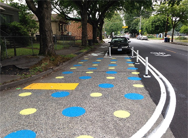
Where there is limited available right-of-way or environmental or other limitations, use flex posts, jersey barriers, or other materials to create pedestrian space within the roadway.
Precedents: Seattle has created temporary walkways in the roadway to preserve trees and other environmental features. In Washington, D.C.’s Georgetown neighborhood, the sidewalk on M Street is widened seasonally into the street using semi-permanent materials to accommodate more pedestrians.
Related Effort: Vision Zero Action Plan
Goal: Comfortable/Connected Pedestrian Network
Lead: MCDOT
B-1f: Amend Montgomery County’s Residential Permit Parking Guidelines to allow MCDOT to remove residential permit parking areas in support of another transportation purpose.
Executive Regulation 24-16 allows for the creation of residential permit parking areas within 4,000 feet of light rail or Metrorail stations. Often, right-of-way currently dedicated to on-street parking in these locations is needed to improve safety for pedestrians and bicyclists. As the regulation is written, without support from a majority of residents along the block face, the residential permit parking zone cannot be removed, leading to more expensive capital projects because right-of-way purchases or utility relocation may be required to get the project done.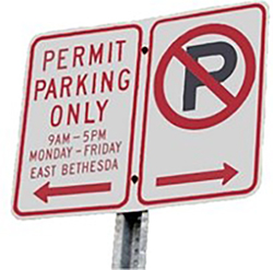
Goal: Comfortable/Connected Pedestrian Network
Lead: County Executive
B-1g: Affirm that the county can remove curbside electric vehicle (EV) charging to allow a transportation facility to be constructed.
The county’s Department of Permitting Services has a policy for the installation of EV charging infrastructure for residential use in the public right-of-way. The policy currently states that the right-of-way permit can be revoked in specific instances. The policy should be updated to reflect that an EV charging station can be removed to construct a transportation facility like a sidewalk or bikeway. Residents should be provided with information about whether their property abuts a master-planned transportation facility before they pursue an EV charging station construction project.Goal: Comfortable/Connected Pedestrian Network
Lead: MCDPS
B-1h: Document deviations from Complete Streets Design Guide streetscape default widths where applicable.
The Complete Streets Design Guide identifies preferred, default, and minimum widths of different roadway elements, from travel lanes to sidewalks and landscape buffers. These widths were agreed upon through a collaborative process between Montgomery Planning, MCDOT, and MCDPS. Where public or private projects do not provide the default widths, Planning Department and MCDOT staff must document the reasons that prevent the project from achieving the CSDG dimensions, as part of regulatory staff reports.Goal: Comfortable/Connected Pedestrian Network
Leads: Montgomery Planning, MCDOT, MCDPS
B-1i: Update state curb height standards to 6” in areas with pedestrian activity.
Curb ramps allow people using wheelchairs and other wheeled vehicles to transition between the road surface and the sidewalk. By law, the running slope of the curb ramp (from the street to the sidewalk) cannot exceed 8.33 percent for new sidewalks or 10 percent for sidewalks built before the ADA went into effect. A taller curb that maintains the same running slope will require a longer curb ramp. This additional space requirement often requires adjustments to the slope of adjacent sidewalks, which can have a negative effect on accessibility. Lowering the state’s 8” standard curb height to the county’s 6” standard will allow shorter ramps and more accessible sidewalks.Goal: Equitable and Just Pedestrian Network
Lead: MDOT SHA
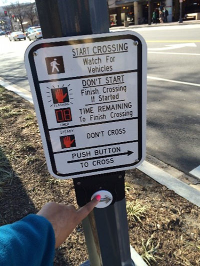
B-2: Eliminate the need to press a button to cross the street.
Key Actions:
B-2a: Make pedestrian recall the default configuration for signalized intersections in Downtowns and Town Centers and adjacent to rail and bus rapid transit stations, schools, parks, major trail crossings, and community centers.
Goals(s): Comfortable/Connected Pedestrian Network, Equitable and Just Pedestrian Network
Leads: MCDOT, MDOT SHA, County Municipalities
B-2b: Continue to evaluate passive detection to eliminate the need for pedestrians to press a button to safely cross the street in areas where pedestrian recall is not desirable.
In Suburban and Country areas of the county where providing a pedestrian crossing phase via pedestrian recall in every signal cycle may have detrimental effects on traffic flow, passive detection provides an option that eliminates the need to push a button while minimizing impacts to traffic. Using sensors, the signal detects an approaching pedestrian and adds a phase to the signal cycle so that pedestrian can safely cross the street.Precedent: The PUFFIN passive detection approach is used in the United Kingdom.
Goals(s): Comfortable/Connected Pedestrian Network, Equitable and Just Pedestrian Network
Leads: MCDOT, MDOT SHA
B-2c: Develop criteria for “Barnes Dance” pedestrian signalization.
A “Barnes Dance” is a traffic signal phase when no motor vehicle traffic can proceed, but pedestrians and bicyclists can travel in any direction through an intersection. The county should consider adopting and publishing implementation criteria about this signalization approach.Goals(s): Comfortable/Connected Pedestrian Network
Lead: MCDOT
B-2d: Reduce the number of intersections with permissive left turns along Major Highways, Downtown Boulevards, Downtown Streets, Town Center Boulevards, Town Center Streets, and Boulevards to improve safety, in line with findings from the Predictive Safety Analysis.
Left turns can be configured in two main ways: permissive or protected. A permissive left turn is when a left-turning driver must wait for a break in oncoming traffic to execute a left turn. A protected left turn is when a left-turning driver waits for a left turn signal—where oncoming traffic is stopped—to execute a left turn. Permissive left turns can be dangerous for pedestrians because drivers looking to turn left are focused on finding a gap in oncoming traffic and may not be paying attention to pedestrians crossing the street. Protected left turns separate turning vehicles from through traffic and crossing pedestrians, eliminating these conflicts.Goals(s): Comfortable/Connected Pedestrian Network, Pedestrian Safety
Leads: MCDOT, MDOT SHA
B-3: Create direct and accessible street crossings
Key Actions:
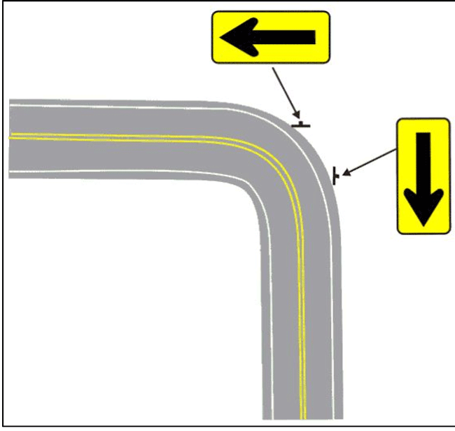
B-3a: Update state and county design standards to reflect a preference for perpendicular curb ramps aligned with the crosswalk.

Goals(s): Equitable and Just Pedestrian Network, Pedestrian Safety
Leads: MCDOT, MDOT SHA
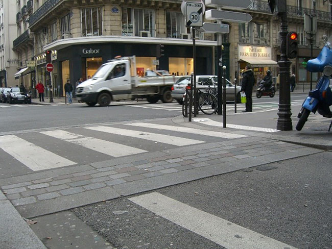
B-3b: Update the CSDG to establish ladder-style, high-visibility crosswalks as the default crosswalk design in Montgomery County.
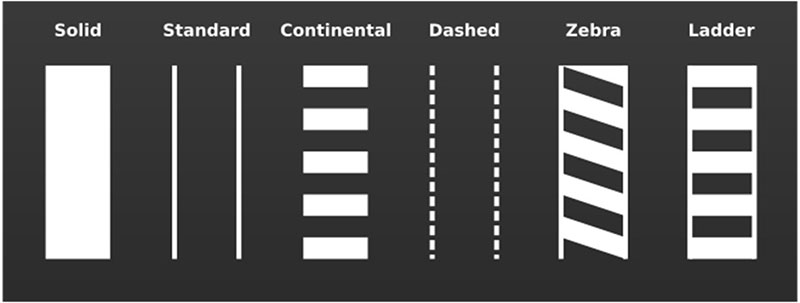
Precedent: This is the predominant crosswalk marking treatment in Washington, D.C.
Goals(s): Equitable and Just Pedestrian Network, Pedestrian Safety
Lead: MCDOT
B-3c: Construct raised crossings across all driveways and at intersections between residential street types (Neighborhood Streets and Neighborhood Yield Streets) and higher classification streets through capital projects and as a requirement for private development.
Goals: Equitable and Just Pedestrian Network, Pedestrian Safety
Leads: MCDOT, MDOT SHA, County Municipalities
Support: Montgomery Planning
B-3d: Provide marked crosswalks and Accessible Pedestrian Signals at all legs of an intersection where there are connecting sidewalks or comfortable streets.
Goals: Equitable and Just Pedestrian Network, Comfortable/Connected Pedestrian Network, Pedestrian Safety
Leads: MCDOT, MDOT SHA, County Municipalities
B-3e: Pursue a modification of Maryland Code §21-502 to indicate that the driver of a vehicle must stop for pedestrians waiting to cross the street, not just those already in the crosswalk.
Currently, state law requires pedestrians to enter the street at a crosswalk at an uncontrolled intersection to gain the right-of-way and cause drivers to stop. In practice, this creates situations where drivers maintain elevated speeds through marked and unmarked crosswalks, frightening pedestrians into waiting until there is a gap in traffic before taking the opportunity to cross the street. To support improved driver yielding, additional signage in advance of crosswalks should be installed across the county, particularly at locations where there may be sight distance issues.Precedent: Virginia law requires drivers to yield to pedestrians “at” a crosswalk, not “in” a crosswalk.
Goals: Equitable and Just Pedestrian Network, Comfortable/Connected Pedestrian Network, Pedestrian Safety
Lead: State Delegation
B-3f: Crosswalk markings and associated curb ramps should be at least as wide as the sidewalks and trails they connect on either side.
Pedestrian facilities like sidewalks and crosswalks should be designed to comfortably accommodate the anticipated number of users. In commercial areas, near schools, and where major trail crossings are present, wider crosswalk markings are necessary to maintain the pedestrian experience across the intersection and inform drivers that the crossing has significant pedestrian activity.Goals: Walking Rates, Pedestrian Safety, Equitable and Just Pedestrian Network
Leads: MCDOT, MDOT SHA, County Municipalities
B-4: Build more walkable places.
Key Actions:
B-4a: Use master planning processes to focus growth in Downtowns, Town Centers, and along Growth Corridors to expand walkable places in the county.
To increase walking, plans need to encourage situations where walking is preferable. Creating dense mixed-use clusters and adding density to existing mixed-use clusters is the most effective way to achieve this goal. Thrive Montgomery 2050 strongly emphasizes this approach. Making it easier to walk to more destinations within the same distance will encourage more people to choose walking over other travel modes, which will reduce vehicle miles traveled and transportation emissions in the county.Goals: Walking Rates, Comfortable/Connected Pedestrian Network
Lead: Montgomery Planning, County Municipalities
B-4b: Locate schools and other public buildings to prioritize providing safe and direct pedestrian access.
The placement and design of pedestrian pathways strongly influences whether walking is the preferred transportation mode for accessing public buildings like schools, community centers, and libraries. To make public buildings as pedestrian friendly as possible, they should be placed adjacent to nearby sidewalks; avoid directing pedestrians through parking lots; provide a welcoming, prominent pedestrian entrance; and incorporate other best practices for safe pedestrian access.Goal: Walking Rates
Leads: MCDGS, MCPS
Support: Montgomery Planning
B-4c: Encourage MCPS to revise minimum acreage requirements for school sites and consider co-location opportunities to facilitate smaller school footprints that are better integrated into adjacent communities.
Minimum acreage requirements can discourage the use of smaller sites and buildings that are embedded within walkable neighborhoods in favor of larger tracts at the edge of the community that are less conducive for walking. Revising minimum acreage requirements would allow more walkable infill parcels to be considered for schools, making it more likely that future students will walk to school. Increasing the likelihood that students will walk to school has numerous benefits, including operational savings from reduced busing and reduced transportation emissions.Goal: Walking Rates
Lead: MCPS
B-4d: Update the CSDG to include a Growth Corridor overlay to provide additional context-based guidance on crossings and target speeds.
Goals: Comfortable/Connected Pedestrian Network, Pedestrian Safety
Leads: MCDOT, Montgomery Planning
B-4e: Create a grid of streets and alleys along transit corridors with block sizes based on the protected crossing spacing standards in the CSDG.
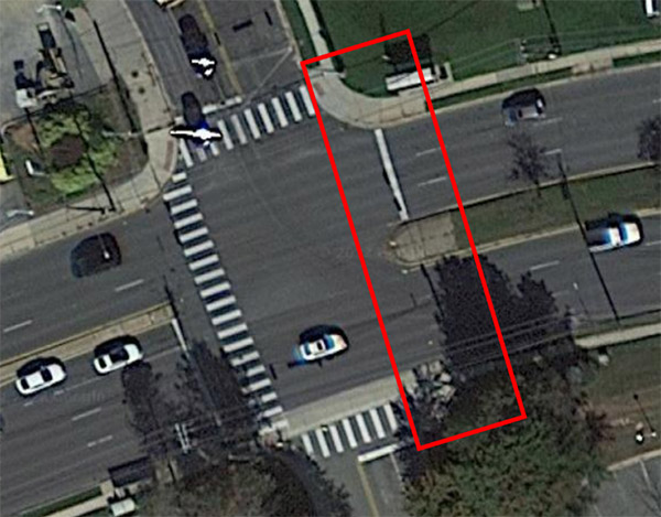
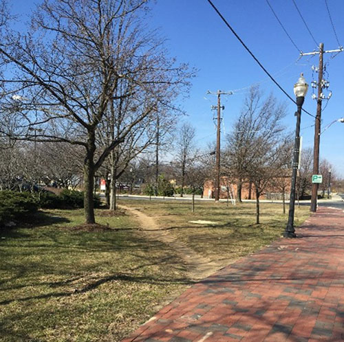
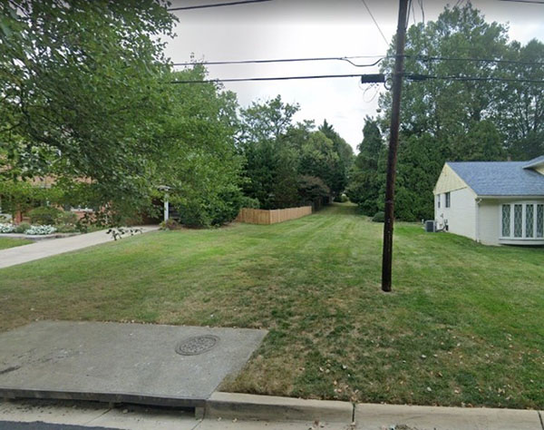
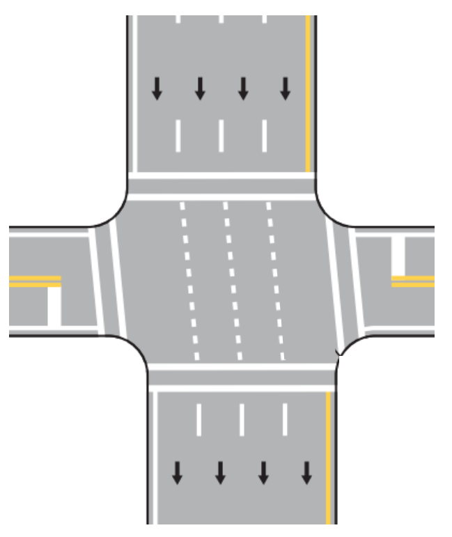
Many of Montgomery County’s rail and bus rapid transit corridors (outside of Downtowns and Town Centers) are characterized by long blocks and are lined with commercial and residential driveways (Figure 1). Longer block lengths limit routing options for pedestrians and encourage crossing streets at unsafe places because protected crossing locations are spaced too far apart. Driveways create conflict points between cars and pedestrians. Tools are needed to reduce the size of these blocks where appropriate by expanding the street grid through future redevelopment and capital projects, as well as to consolidate and relocate driveways to side streets and alleys.Goals: Comfortable/Connected Pedestrian Network, Pedestrian Safety
Leads: Montgomery Planning, MCDOT, MDOT SHA
B-4f: Develop and implement a comprehensive pedestrian wayfinding system for the county.
A comprehensive pedestrian wayfinding system—a network of signs providing distance and direction to destinations—will increase walking by helping residents, employees, and visitors understand what is accessible nearby on foot. A similar effort to develop bikeway wayfinding is under development by the Planning Department.Goal: Walking Rates
Leads: MCDOT, County Municipalities
Support: Montgomery Planning
B-4g: Make the Open Parkways that are currently operating along Beach Drive and Sligo Creek Parkway permanent.
Montgomery County should build on the success of the Open Streets program by tmaking steps to make itweekend and holiday Open Parkway days and times (including Fridays along Sligo Creek Parkway) permanent. The Rock Creek and Sligo Creek Parkway trails are some of the most popular in the county. Opening Beach Drive and Sligo Creek Parkway to active transportation permanently will provide more safe, comfortable, and direct spaces for walking and bicycling. Spillover effects to adjacent neighborhood streets should be studied, and any negative effects should be mitigated.Precedent: San Francisco recently made JFK Drive through Golden Gate Park car-free.
Goal: Comfortable/Connected Network
Lead: Montgomery Parks
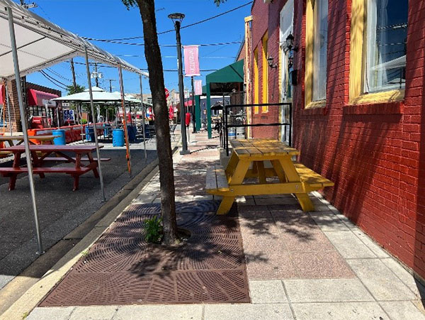
B-4h: Provide public seating, restrooms, and other pedestrian amenities in Downtowns, Town Centers, and priority park locations and along Boulevards.
Enjoyable walking often requires more than just a sidewalk and a place to safely cross the street. For example, not having a place to rest along a walking route may reduce walking for the elderly, people with disabilities, and others. Providing public seating in Downtowns and Town Centers and along Boulevards makes it easier for these individuals to walk in areas of the county with the greatest pedestrian activity. Benches and other seating can be provided along the sidewalk and also set back from the street in pocket parks and other small green spaces. Likewise, access to public restroom facilities is an equity issue that can be a determining factor for some when it comes to the decision about if and how to make a trip. Public restrooms should provide an adult changing table or family bathroom option. Public drinking fountains and trash receptacles make the pedestrian experience better for all by providing hydration (including for four-legged friends) and making it easier for people to keep public spaces clean. All of these amenities should be built as part of public and private projects that interact with the streetscape. Priority park locations are areas within parkland that were determined by Montgomery Parks to be good candidates for these amenities.Goals: Walking Rates, Comfortable/Connected Pedestrian Network, Equitable and Just Pedestrian Network
Leads: MCDOT, Montgomery Planning, Urban Districts, Montgomery Parks, County Municipalities
B-4i: Update horizontal alignment standards in Chapter 50 of the County Code.
Goals: Walking Rates, Comfortable/Connected Pedestrian Network, Pedestrian Safety
Leads: MCDOT, Montgomery Planning
B-5: Lighting for Roadways, Intersections, and Pedestrian and Bike Facilities
B-6: Reduce pedestrian pathway temperatures.
B-7: Create more pedestrian connections and formalize pedestrian shortcuts.
Key Actions:
B-7a: Increase funding for the Annual Sidewalk Program and other related Capital Improvement Program efforts, including the Bus Stop Improvement capital funding program, to address missing, broken, or substandard sidewalks and other infrastructure.
Additional funding is needed to address the large demand for sidewalk projects. Goal: Comfortable/Connected Pedestrian Network Leads: County Executive, County CouncilB-7b: Create a new Capital Improvement Program (CIP) project to build, reconstruct, and resurface master-planned pedestrian shortcuts, Neighborhood Connector pedestrian/bike paths, and other pedestrian connections.
B-7c: Create a new Capital Improvement Program (CIP) project to build pedestrian and bicycle connections to park land.
Montgomery Parks will identify additional access points and other opportunities on park property to increase pedestrian and bicycle connections (Key Action B-8a). This CIP project would provide dedicated funding to complete projects that connect from park land to the existing pedestrian and bicycle network. Goal: Comfortable/Connected Pedestrian Network Leads: County Executive, County CouncilB-7d: Preserve paper streets and other rights-of-way if they could potentially provide future pedestrian connectivity benefits, like pedestrian shortcuts.
B-7e: Update development standards to require or incentivize new developments to connect to nearby sidewalks and trails that exist or may be built in the future.
New development projects must fully connect to existing and future land uses on their periphery by providing a fine-grained pedestrian network. This network, including valuable interparcel connections, makes pedestrian trips easier, safer, and more direct. Without these connections, pedestrian trips are likely to become motor vehicle trips or end up not happening at all. Goal: Comfortable/Connected Pedestrian Network Leads: Montgomery Planning, MCDOT, County MunicipalitiesB-7f: Offer monetary support to Homeowners Associations, Condominium Associations, and commercial properties for providing pedestrian connections through their property and reconfiguring existing parking lots to be more pedestrian friendly.
Many residential communities and commercial areas were constructed at a time when pedestrians were not prioritized. While today, pedestrians are a larger priority and Montgomery Planning and county agencies work with those pursuing private development projects on pedestrian-friendly site and frontage design, there are not many opportunities currently to encourage property owners who are not pursing redevelopment to make pedestrian-friendly changes. This key action would provide a sum of money annually to support two types of important projects:- The provision of pedestrian shortcut connections and through-block connections across common areas of Homeowners Association and Condominium Association property—where these connections would improve pedestrian access to local businesses, transit, and community destinations.
- The reconfiguration of parking lots to be more pedestrian friendly—reducing the number and severity of conflicts between motor vehicles and pedestrians
B-7g: Fund off-site pedestrian and bicycle access improvements to transit stations as part of the main capital project or through a parallel effort.
Non-motorized access to transit stations should be an essential component of their construction. These investments can provide substantial public benefits, including reduced transportation emissions and increased economic development, but poor pedestrian and bicycle connectivity in the surrounding area makes it difficult for these projects to reach their full potential ridership. Non-motorized access should be a higher priority than motorized access.Related Effort: Vision Zero Action Plan
Goals: Comfortable/Connected Pedestrian Network, Walking Rates
Leads: MCDOT, MDOT SHA
B-8: Reduce natural barriers to walking and rolling
Key Actions:
B-8a: Develop a park access master planstudy to identify new pedestrian connections to and through parkland.
Direct and accessible pedestrian connections to and through parks are limited in some locations. This study will increase hard surface park access points so neighboring communities can more directly access park resources and travel through parkland to connect to local destinations. Key Action B-7c recommends funding in the capital budget to construct these connections.
Goals: Comfortable/Connected Pedestrian Network, Walking Rates
Lead: Montgomery Parks
Support: Montgomery Planning
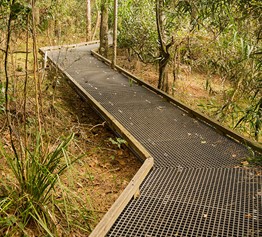
B-8b: Use environmentally sensitive trail materials and construction approaches to provide pedestrian connections through parkland.
Goals: Walking Rates, Comfortable/Connected Pedestrian Network
Lead: Montgomery Parks
B-8c: Write Forest Conservation Plans to allow accessible pedestrian pathways to make important connections and rewrite existing Forest Conservation Plans to allow pathways where it would be beneficial for pedestrian connectivity.
Forest conservation areas and their restrictions on disturbance can act as barriers to pedestrian connectivity, leading to more circuitous pedestrian trips or pedestrian trips that become car trips — to the detriment of public safety and the environment. Ensuring accessible pedestrian travel through forest conservation areas is one way to improve pedestrian connectivity. Discussions should occur early on when Forest Conservation Plans are being developed to identify pathway locations and codify their inclusion in the ultimate plan. Montgomery Planning staff should also work to revise existing Forest Conservation Plans where appropriate to allow for accessible pedestrian connections.Goals: Comfortable/Connected Pedestrian Network, Walking Rates
Leads: Montgomery Planning, MD DNR
B-8d: Study lowering impervious surface caps in relevant Special Protection Areas (and other areas with impervious surface restrictions) to account for the perviousness of planned pedestrian pathways and bikeways.
In Special Protection Areas and other areas with impervious regulations, sidewalks and other pedestrian amenities along public streets often cannot be constructed without removing impervious surfaces from other locations in the same general area. Sometimes, this tradeoff cannot feasibly be made, so the pedestrian amenities are not constructed. As a result, pedestrian connectivity in these areas suffers. The Planning Department should conduct a study with MCDOT to understand the total impervious impact of planned pedestrian and bicycle infrastructure and adjust the relevant impervious caps to take these pathways and bikeways into account—allowing them to be built in these areas, while maintaining water quality.Goal: Comfortable/Connected Pedestrian Network
Leads: Montgomery Planning, MCDOT, County Council
B-8e: Prioritize construction of all required sidewalks and bikeways to standard dimensions for development projects in areas with impervious surface caps or other similar limitations.
Certain parts of the county have limits on the amount of impervious surface that can be built to maintain local and regional water quality. In these parts of the county, development projects have moved forward with internal sidewalk networks on only one side of streets to stay under the area’s respective impervious surface cap. This makes it more difficult for pedestrians to travel through these communities and encourages driving for walkable trips, increasing the county’s transportation emissions and the climate impact of development. Pedestrian pathways and bikeways required by applicable master plans, the CSDG, the Zoning Code, and county regulations need to be prioritized in all communities.Goal: Comfortable/Connected Pedestrian Network
Leads: Montgomery Planning, MCDOT
B-9: Make traffic calming easier to implement.
B-10: Assume county control of state highways.
B-11: Address curbside management to prioritize pedestrian safety and rethink how curb space is used.
Maintain
The pedestrian experience in Montgomery County can vary greatly based on how diligently vegetation is trimmed, snow is shoveled, and sidewalks are kept smooth and level. It is not enough to invest in building more pedestrian spaces. This section lays out recommendations that clarify existing regulations and propose changes to how the county and private property owners care for sidewalks, pathways, and other pedestrian spaces so that these investments can provide a high quality of service for everyone for years to come.
MA-1: Fix sidewalks proactively.
MA-2: Keep sidewalks and curb ramps clear.
MA-4: Minimize streetlight repair time.
Protect
Montgomery County has adopted Vision Zero, a commitment to eliminate severe injuries and fatalities in the transportation system by 2030. While the recommendations related to construction and maintenance of pedestrian spaces highlighted above will also improve safety, the recommendations that follow are systemic policy changes and programming that will speed proactive Vision Zero implementation and ensure pedestrians are safe while traveling through Montgomery County.
P-1: Reduce impacts of vehicle design and operation on pedestrian safety.
Key Actions:
P-1a: Install speed governors or intelligent speed control devices in county and public agency vehicles to ensure their drivers adhere to the speed limit.
The county and public agencies should set an example when it comes to driving safely by setting an upper limit for how fast vehicles can go using speed governor technologies. Emergency vehicles should be exempt from this policy.Related Effort: Vision Zero Action Plan
Goal: Pedestrian Safety
Leads: County Executive, Montgomery Parks, MCPS
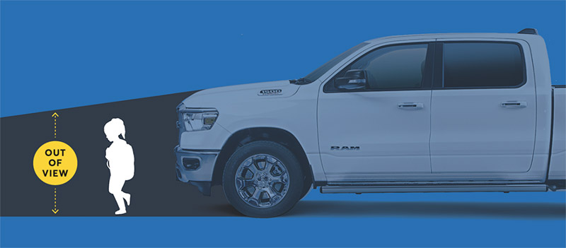
P-1b: Develop a strategy to purchase emergency vehicles that can navigate narrower streets and tighter curb radii while maintaining appropriate performance standards.
The size and design of fire and emergency vehicles often dictates street design to the detriment of pedestrian safety and comfort; these vehicles require wider streets and larger curb radii dimensions than other vehicles. Wider streets increase pedestrians’ exposure to traffic when crossing the street, and larger curb radii enable vehicles to make faster turns which results in less-convenient and less-direct curb ramp placement and reduces motorists’ ability to see pedestrians crossing the street. Other communities across the country and around the world have created fleets of emergency vehicles that can operate on narrower streets and make tighter turns than Montgomery County’s fleet.Precedents: The Los Angeles Fire Department purchased their first electric fire truck—the Rosenbauer RTX—in 2022. It is quieter, narrower, and has a tighter turning radius than other fire trucks. San Francisco has been purchasing smaller fire trucks to support pedestrian safety efforts since 2017.
Goal: Pedestrian Safety
Lead: Fire & Rescue Service
P-1c: Develop legislation to create a new class of commercial driver’s license required to operate vehicles with identified pedestrian safety and visibility issues.
Goal: Pedestrian Safety
Lead: State Delegation
P-1d: Develop legislation to improve pedestrian and bicycle safety by implementing a knowledge test requirement as part of the driver’s license renewal process.
Over time, rules and regulations governing the transportation system change, and new roadway striping, signage, facilities, and signalization approaches are implemented. However, unless a Maryland driver’s license has expired for a year or more, there is no requirement to retake either the driving skills or knowledge tests upon license renewal. A knowledge testing requirement, with the option to retake as many times as necessary to pass, would provide an opportunity to bring drivers up to date on changes to the transportation system and relevant laws and regulations since their last license renewal between five and eight years earlier. This would result in better driving and increased safety for all road users. Efforts should be taken to ensure this new requirement does not place an undue burden on the Motor Vehicle Administration. Additionally, each year the county should notify all county households identifying changes to traffic rules and regulations that have taken effect over the past year.Goal: Pedestrian Safety
Lead: State Delegation
P-1e: Develop legislation to improve pedestrian and bicycle safety by implementing a knowledge test requirement as part of the driver’s license renewal process.
Pedestrian detection systems are becoming increasingly common in new motor vehicles. These systems inform drivers about pedestrians in their vicinity and may perform automatic braking to avert a pedestrian crash. The county should study whether requiring or incentivizing the use of these technologies would be a cost-effective approach to reducing pedestrian injuries and fatalities.Goal: Pedestrian Safety
Lead: County Executive, County Council
P-2: Improve and expand protected crossings.
Key Actions:
P-2a: Develop a methodology for identifying and prioritizing implementation of new protected crossings at mid-block or uncontrolled locations based on roadway characteristics, motor vehicle speeds and volumes, proximity to bus stops, proximity to pedestrian attractors including parks and schools, pedestrian crash history, and other relevant criteria.
In many parts of the county, the distance between protected crossing locations exceeds the recommended spacing identified in the CSDG. Indeed, Table 24 in the Existing Conditions chapter highlights that 16% of severe and fatal pedestrian crashes take place at uncontrolled intersections and 37% of severe and fatal pedestrian crashes take place midblock. Integrating protected intersection design features consistent with the CSDG can greatly improve pedestrian safety across the county, but with crossings needed in so many places, there is a need to prioritize which locations should be addressed first.Related Effort: Vision Zero Action Plan
Goals: Pedestrian Safety, Comfortable/Connected Pedestrian Network
Leads: MCDOT, MDOT SHA
P-2b: Establish standards for the distance between bus stops and the nearest protected crossing to encourage pedestrians to cross the street at safe locations.
When either boarding a bus or alighting from one, typically passengers must cross a street. Locating bus stops within a short distance of protected crossings will encourage pedestrians to cross the street at safer locations. Generally, these standards should lead to more protected crossings being constructed (with some exceptions where bus stop consolidation may make sense for operational purposes).Related Effort: Vision Zero Action Plan
Goals: Pedestrian Safety, Comfortable/Connected Pedestrian Network
Leads: MCDOT, MDOT SHA, WMATA
P-2c: Make No Turn on Red (NTOR) the default in Downtowns and Town Centers and evaluated elsewhere on a case-by-case basis. Enforce NTOR using automated enforcement approaches and additional traffic control devices as needed.
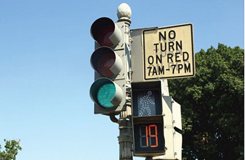
Precedent: Washington, D.C., ended Right Turn on Red at 100 locations in 2019.
Goal: Pedestrian Safety
Leads: MCDOT, MDOT SHA, County Municipalities
P-2d: Prioritize pedestrian crossings using Leading Pedestrian Intervals (LPIs) (or Leading Through Intervals) at signalized intersections along Downtown Boulevards, Downtown Streets, Town Center Boulevards, and Town Center Streets. Everywhere else, implement LPIs within a certain distance of schools, parks, and community centers along those roadways. Ensure that Accessible Pedestrian Signals at locations with LPIs provide an audible signal to indicate when the pedestrian phase has commenced.
Precedents: More than 30% of Seattle traffic signals have an LPI. They recently identified a 50% reduction in pedestrian turning collisions and 35% reduction in serious and fatal injury collisions at locations with LPIs. LPIs are also a common treatment in Washington, D.C.
Goal: Pedestrian Safety
Leads: MCDOT, MDOT SHA
P-2e: Reduce pedestrian wait times by developing a policy on target and maximum traffic signal cycle lengths by street type.
Longer signal cycle lengths result in increased pedestrian delay and non-compliance with signals and make pedestrian travel less convenient. As a result, satisfaction with pedestrian signal wait time is 44% countywide. Establishing target signal cycle lengths by street function and land-use context will more safely and efficiently accommodate pedestrians. Note: Key Action P-2e and Key Action EA-3a may somewhat work at cross purposes, as providing more time for pedestrians to cross the street may require a longer signal cycle length. There may not be an opportunity to implement both key actions at the same intersection.Precedents: Seattle established maximum and target signal cycle lengths for different types of streets. London is actively working to shorten signal cycles to reduce pedestrian delay with a goal of “pedestrian time saved.”
Goals: Comfortable/Connected Pedestrian Network, Pedestrian Safety
Lead: MCDOT
P-2f: Update the CSDG and Executive Regulations to make pedestrian median refuges a high priority for intersections with six or more lanes, including through lanes, turning lanes, and auxiliary lanes.
Only 16% of pedestrian crossings across six or more lanes in the county have a median refuge—a place to safely stand between directions of traffic—and as a result, satisfaction with places to stop partway while crossing a street is 33% countywide. Installing more refuges would improve safety by allowing pedestrians to negotiate crossing only one direction of traffic at a time.Goals: Pedestrian Safety, Comfortable/Connected Pedestrian Network
Lead: MCDOT
P-2g: Remove free-flow channelized right turn lanes where roadway geometry allows and improve their design where it does not.
Goals: Pedestrian Safety, Comfortable/Connected Pedestrian Network, Equitable and Just Pedestrian Network
Leads: MCDOT, MDOT SHA
P-3: Design pedestrian-safe parking lots.
P-4: Educate and encourage pedestrians of all ages to walk safely.
P-5: Make the walk to school safer and more direct.
Key Actions:
P-5a: Prioritize locations for additional school crossing guards and advocate for additional funding.
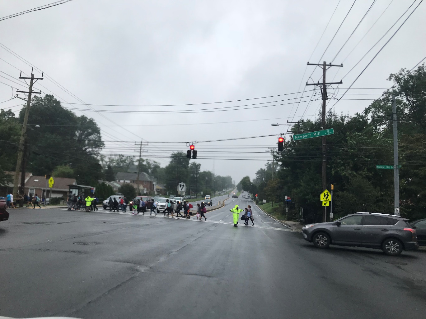
Goals: Pedestrian Safety, Walking Rates
Lead: MCPD
Support: MCPS
P-5b: Fund Walking School Buses to reduce the number of students being driven to school.
A walking school bus is a group of students walking to/from school with the guidance of adults. They help students get to school in the same way that school buses do, but in a more active, independent, and healthful way. Funding could be used to incentivize participation, provide promotional materials, and other general support. Reducing vehicular trips to schools lowers the likelihood of pedestrian crashes that involve students at arrival and dismissal and minimizes the transportation emissions associated with the public school system. The success of this effort would be measured by the number of students walking to school as part of Walking School Buses.Goal: Walking Rates
Lead: MCPS
P-5c: Develop and implement School Streets—partial roadway closures immediately adjacent to schools during arrival and dismissal—at several schools as a pilot.
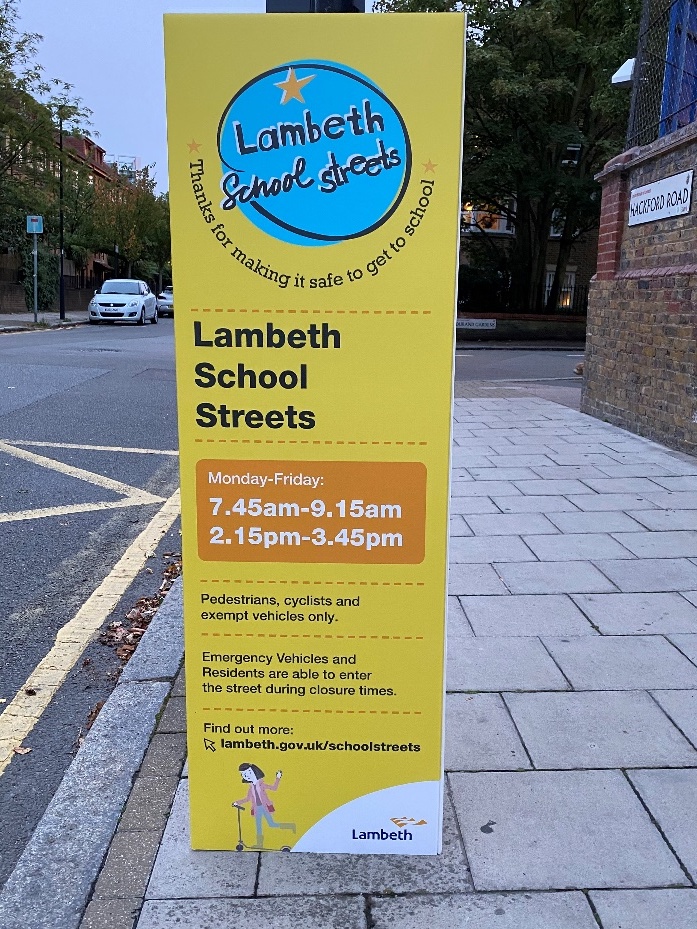
Precedent: School Streets are common in London and other parts of the United Kingdom.
Goals: Pedestrian Safety, Walking Rates
Leads: MCDOT, MCPS
P-5d: Develop and implement a countywide transportation demand management plan for schools addressing all school-related travel, including travel by students, parents, and staff members.
Concerns about school-related traffic can limit the county’s ability to expand existing schools or build new schools on sites in existing neighborhoods. One way to address these concerns is through the development and implementation of a transportation demand management plan that discourages travel in a private car and encourages the use of safer and more sustainable modes, including walking by all users of MCPS facilities, including teachers, administrators, staff, students, and local residents. Similar plans already exist for private schools. Reducing vehicular trips to schools lowers the likelihood of pedestrian crashes that involve students at arrival and dismissal and minimizes the transportation emissions associated with the public school system.Goal: Walking Rates
Lead: MCPS
P-5e: Identify walking and bicycling routes to school within each MCPS school catchment area and ensure all students within the area can safely walk and bicycle to school.
Walking and bicycling should be the preferred travel mode for students within one mile of elementary schools, one and a half miles of middle schools, and two miles of high schools. MCPS should coordinate with MCDOT to identify specific walking and bicycling routes for each school that allow all students living within these walk and bicycle boundaries to safely walk and bicycle to school using sidewalks, pathways, and crossings that are not worse than a PLOC score of Somewhat Comfortable. If a Somewhat Comfortable or Very Comfortable score cannot be achieved using the identified routes, MCPS should coordinate with MCDOT to provide new or improved connections that are more comfortable. Observed pedestrian demand, as discussed in Key Action B-9b, should not be a determining factor in where improvements are made.Related Effort: Vision Zero Action Plan
Goals: Walking Rates, Pedestrian Safety
Leads: MCPS, MCDOT
P-6: Address access management to reduce pedestrian/vehicle conflicts.
P-7: Ensure pavement markings and street furniture are installed in pedestrian-safe locations.
Key Actions:
P-7a: Paint lane markings to indicate the presence of minor streets along state highways in line with Maryland Manual on Uniform Traffic Control Devices (MdMUTCD) guidance.
Goal: Pedestrian Safety
Lead: MDOT SHA
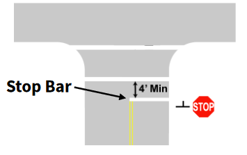
P-7b: Ensure vehicular stop bars are located at least four feet behind the crosswalk.
Goal: Pedestrian Safety
Leads: MCDOT, MDOT SHA
P-7c: Where guardrails are installed next to sidewalks or trails, ensure they are located between the pedestrian space and the roadway.
Goal: Pedestrian Safety
Leads: MCDOT, MDOT SHA
P-7d: Eliminate breakaway traffic signal and other poles in the immediate vicinity of transit stops and other areas of significant pedestrian activity.
Breakaway poles are installed along roadways to reduce the severity of motor vehicle crashes. When a car hits a breakaway pole, the pole snaps off and moves away from the car, absorbing its energy and lowering crash severity for its occupants. However, when hit, breakaway poles become projectiles, enhancing the risk of injury and fatality for pedestrians in the area, even those not struck by a motor vehicle. Additionally, when used for a pedestrian signal, the base of a breakaway pole can make it difficult for a wheelchair user to maneuver close enough to use the push button. In areas with pedestrian activity, breakaway poles should not be used.Goal: Pedestrian Safety
Leads: MCDOT, MDOT SHA
P-8: Increase traffic enforcement activities.
P-9: Comprehensively lower speed limits countywide.
Expand Access
The pedestrian environment has been constructed in a way that can make it difficult or impossible for some members of the community to walk or roll. Pedestrians with disabilities in Montgomery County are 10% less satisfied with the pedestrian experience than pedestrians overall. Pedestrians with disabilities outside of urban areas expressed an even greater dissatisfaction with the pedestrian experience. These recommendations aim to make the pedestrian system more accessible to all pedestrians, whether they walk or roll.
EA-1: Reduce tripping hazards.
Key Actions:
EA-1a: Prioritize the repair of brick sidewalks that have identified accessibility challenges. Require new or rehabilitated brick sidewalks to be constructed using non-slip materials and with patterns, spacing, and installation methods designed to minimize disturbance for wheeled vehicles.
Bricks and pavers are challenging surfaces to walk or roll on if they are poorly maintained. Addressing these accessibility issues by repairing these sidewalks with like material in line with best practices and then ensuring continued accessibility is essential to the ongoing use of brick and other non-concrete paving treatments.Goals: Equitable and Just Pedestrian Network, Walking Rates
Leads: Urban Districts, Montgomery Planning
EA-1b: Saw cut sidewalk joints to minimize vibrations for pedestrians using mobility devices or pushing strollers.
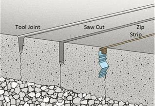
Precedent: Saw-cut contraction joints are required when a sidewalk is a designated or shared bicycle path in Portland, Oregon.
Goals: Equitable and Just Pedestrian Network, Walking Rates
Leads: MCDOT, MDOT SHA, MCDPS, County Municipalities
EA-1c: Strengthen existing regulations and the permitting process to ensure that utility cuts in sidewalks and legal crossings are quickly and appropriately repaired.
Goals: Equitable and Just Pedestrian Network, Comfortable/Connected Pedestrian Network
Leads: MCDOT, MCDPS
EA-1d: Construct the pedestrian clear zone using Portland cement concrete, in line with MCDOT’s Design Standards and Specifications.
Portland cement concrete is a superior sidewalk material, as it is more durable and results in fewer tripping hazards and slippage than bricks, pavers, and other materials. All future sidewalks should use this material in the pedestrian clear zone, which is a portion of the area within the streetscape’s active zone between the street buffer and the frontage zone. The pedestrian clear zone should be free of obstructions of any kind. Other paving materials may be used outside the pedestrian clear zone and in historic districts, as appropriate.Goals: Equitable and Just Pedestrian Network, Comfortable/Connected Pedestrian Network
Leads: MCDOT, MCDPS, Montgomery Planning
EA-2: Remove sidewalk obstructions.
Key Actions:
EA-2a: Identify and relocate permanent vertical obstructions (like utility poles) that result in pedestrian clear zone widths that are not ADA compliant.
Vertical obstructions present accessibility issues by narrowing sidewalks, limiting equal access to the transportation system. At the same time, these obstructions can be very expensive to move. To address this challenge, it is important to prioritize relocating vertical obstructions that present the greatest barrier to pedestrian travel, and then systematically move them over time. This can be accomplished in two ways: 1) create a capital improvement program project to address the highest priority locations, and 2) incentivize or require undergrounding or utility relocation as part of development applications by updating zoning regulations or using other tools.Goals: Equitable and Just Pedestrian Network, Pedestrian Safety
Leads: MCDOT, MDOT SHA, Utilities
Support: Montgomery Planning
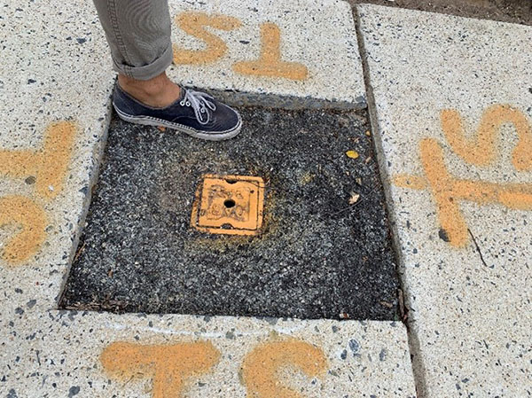
EA-2b: Move existing utility boxes and traffic signal control cabinets out of the sidewalk into the street buffer or underground. Ensure that new utility boxes and traffic signal control cabinets are not installed in the sidewalk.
Goals: Equitable and Just Pedestrian Network, Comfortable/Connected Pedestrian Network
Leads: MCDOT, MDOT SHA, Utilities
Support: Montgomery Planning
EA-2c: Provide additional on-street parking corrals for dockless vehicles in high-use areas and coordinate with operators to provide incentives to encourage their use.
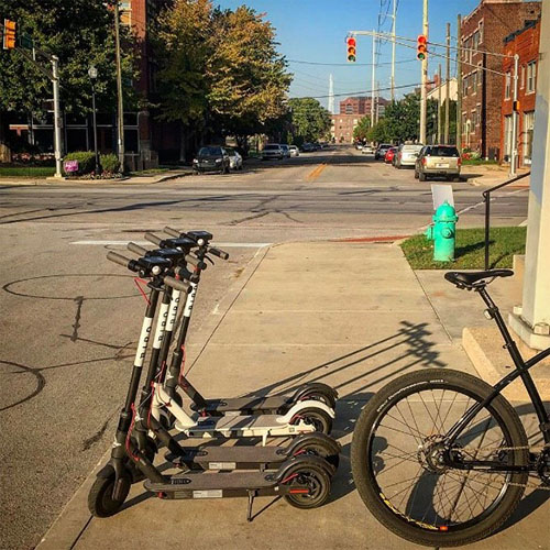
Related Effort: Vision Zero Action Plan
Goals: Pedestrian Safety, Equitable and Just Pedestrian Network
Lead: MCDOT, County Municipalities
EA-3: Provide pedestrians more time to cross the street.
EA-4: Make pedestrian signals more accessible.
Key Actions:
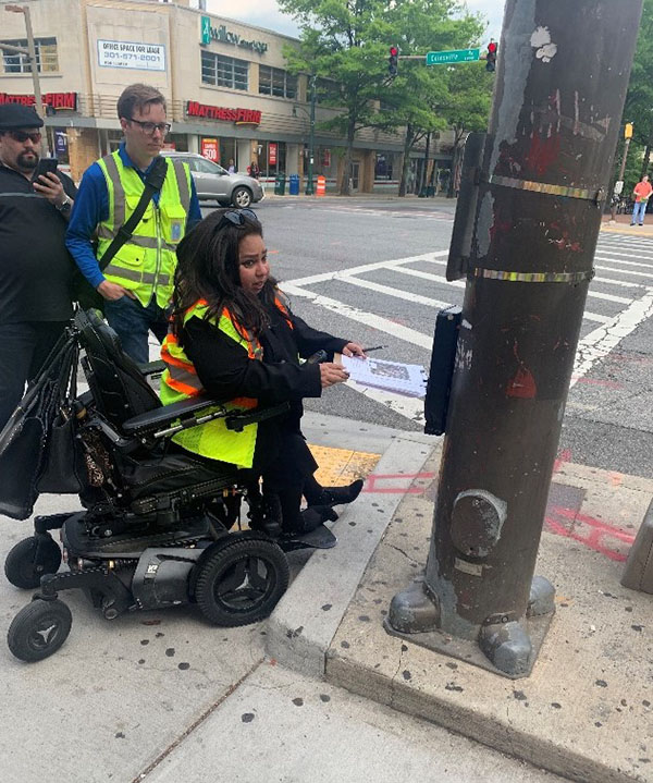
EA-4a: Identify and modify APS/Pedestrian Push Buttons in the county that are incorrectly installed or are inaccessible to wheelchair users.
Goal: Equitable and Just Pedestrian Network
Leads: MCDOT, MDOT SHA
EA-4b: Ensure that every pedestrian push button has a light that informs pedestrians when the pedestrian phase has been triggered.
Currently, many traffic signals in Montgomery County do not provide feedback to pedestrians that the push button has been actuated. Providing a confirmation light reduces confusion about whether pedestrians will have a crossing phase by confirming that a request for a pedestrian phase has been made, reducing the likelihood that pedestrians will cross the street without the pedestrian signal. Likewise, intersections with passive detection (Key Action B2-b) should also provide some form of notification that a walk signal has been triggered.Goal: Comfortable/Connected Pedestrian Network
Leads: MCDOT, MDOT SHA
EA-5: Improve guidance for pedestrians with low or no vision.
Key Actions:
EA-5a: Develop standards on the use of tactile walking surface indicators (TWSIs) in the pedestrian and transit networks.
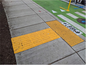
Precedents: Tactile treatments are standard in many parts of the world, including Australia, New Zealand, and Japan, among others. Montgomery County has used these treatments along and across separate bike lanes, but there are more opportunities for their use in other places in the pedestrian network.
Goal: Equitable and Just Pedestrian Network
Lead: MCDOT
Support: MDOT SHA, Montgomery Planning, WMATA
EA-5b: Provide subsidized orientation and mobility specialist and/or travel training sessions for those who may not be able to afford them.
Orientation and mobility and travel training assistance help people with disabilities learn how to navigate their environment so they can run daily errands and maintain their independence. Subsidized training is needed so that financial obstacles do not limit a person’s ability to learn how to move around their community.Goal: Equitable and Just Pedestrian Network
Lead: County Executive
EA-6: Provide more opportunities for accessible park experiences.
EA-7: Exceed existing accessibility requirements.
EA-8: Regulate shared spaces.
Key Actions:
EA-8a: Pursue a modification to the Maryland Code clarifying that drivers, bicyclists, and scooter riders are required to yield the right of way to pedestrians on shared streets and that drivers are also required to yield to bicyclists and scooter riders.
Related Effort: Vision Zero Action Plan
Goal: Pedestrian Safety
Lead: State Delegation
EA-8b: Develop streetery guidance that identifies appropriate locations, seating requirements, accessibility requirements, and other issues. Conduct periodic inspections to verify compliance with this guidance.
Goal: Equitable and Just Pedestrian Network
Leads: MCDOT, MCDPS
Support: Montgomery Planning
EA-9: Make work zones more accessible.
Fund
Achieving the Pedestrian Master Plan vision is going to require resources that exceed current spending on pedestrian and safety efforts. For decades, the county has invested heavily into expanding roads, but investments in pedestrian pathways and crossings have not kept pace. The following recommendations identify additional revenue sources to support the county’s commitment to improving pedestrian conditions.
F-1: Identify new revenue sources to fund pedestrian improvements.
Monitor
Monitoring recommendations track the county’s progress in achieving the Pedestrian Master Plan’s goals and objectives. These recommendations also identify opportunities to improve the quality of the data collected countywide so decisions on project prioritization and funding can be more equitable.