The M-NCPPC Pedestrian Audit Toolkit is intended for residents, community groups and other organizations to use to conduct the audits of their neighborhoods as it relates to pedestrian safety. This document is provided to the public by Montgomery Planning, a part of the Maryland-National Capital Park and Planning Commission, for informational purposes only, and any reliance on the same is at the discretion and liability of the user(s).
Introduction
What is a pedestrian audit?
A pedestrian audit is an in-person effort by a group of people to assess pedestrian safety, accessibility and comfort in a given area. The term “pedestrian” refers to people who walk and people who use wheelchairs and other assistive mobility devices.
What is the purpose of a pedestrian audit?
The purpose of a pedestrian audit is to identify issues that negatively impact pedestrian safety, comfort, and accessibility. The process of identifying these issues is the foundation for creating a more pedestrian-friendly community for all people, regardless of ability, age, gender, race, ethnicity, and other forms of human difference.
How can this toolkit improve pedestrian safety and accessibility in Montgomery County?
This toolkit was created to help community members identify and build consensus on issues affecting pedestrian safety, comfort, and accessibility. This includes involving representatives from appropriate groups, collecting accurate information, and holding discussions to determine priorities. Once you identify some of the top pedestrian needs for your community, this toolkit will help you relay that information to the appropriate agency division and elected officials in Montgomery County – the people best suited to addressing these issues. Your findings can help improve the pedestrian-friendliness of your community.
What does a pedestrian-friendly community look like?
A pedestrian-friendly community is a community where people feel safe and comfortable walking or rolling for any purpose at any time of day. Pedestrian-friendly communities promote health and foster a sense of connection among residents.
Here are some elements of a pedestrian-friendly community. Keep these in mind during your pedestrian audit.
- Wide, well-maintained, and connected pedestrian facilities
- Frequent opportunities to cross the street
- Connections to commercial and residential areas, as well as other destinations
- Connections to other transportation modes (transit, biking, etc.)
- Low motor vehicle speeds
- Well-maintained trees and landscaping
- Proper lighting, so that drivers and pedestrians can see each other and for pedestrian navigation and safety
- The ability to walk roll at all times of day and night without fear of crime, harassment, or racial profiling
What is in this toolkit?
This toolkit provides guidance and materials to plan and conduct a pedestrian audit in your community. You will also find information on how to share your conclusions to improve safety, comfort, and accessibility for pedestrians.
The materials provided include:
- List of people/groups with potential interest to invite, based on the type of pedestrian audit
- Stakeholder invitation template
- Agenda for the pre-pedestrian audit meeting
- Question prompts to help participants identify issues during the pedestrian audit, with accompanying photos
- Data collection form to record issues during the pedestrian audit
- Introduction to infrastructure and programmatic solutions to pedestrian issues
- Report template to summarize pedestrian audit findings
- Decision tree to determine the most appropriate government employees to contact
Planning the Pedestrian Audit
Step 1: Determine the type of pedestrian audit
The type of pedestrian audit you do will influence the study area, route, and relevant stakeholders. Examples include pedestrian audits focused on:
- Schools
- Transit stops
- Pedestrian crash locations
- Neighborhoods
- Commercial areas
Step 2: Determine the goals of the pedestrian audit
Not all pedestrian audits have the same goals. Ask yourself what you are trying to achieve with the audit? Example goals include:
- Identify barriers to pedestrian travel
- Build consensus among community stakeholders about pedestrian needs
- Collect evidence to support a request for improvements
- Educate community members about pedestrian safety, comfort, and accessibility
- Understand disparities in pedestrian conditions between different neighborhoods
Step 3: Determine relevant stakeholders
The success of your pedestrian audit depends heavily on who is involved. Think about who lives, works, and plays in the study area. Think about who has a say, or should have a say, in potential changes to how the streets in the area look, feel, and function. Gathering the appropriate group of people can both help you identify needs and advance recommendations that come out of the pedestrian audit process.
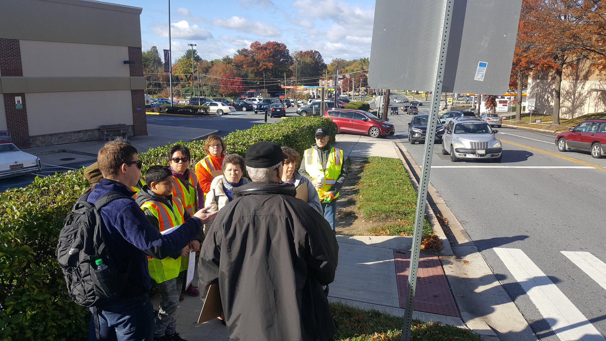
Focus on a limited number of key people. Try and limit the number of people evaluating one route to less than 15 people. Larger groups can split up and assess an adjacent street/area. Each separate group will need its own leader.
The following groups or organizations may be useful to invite. For a list of relevant stakeholders for different types of pedestrian audits, see the Stakeholder List by Pedestrian Audit Type.
- Neighbors
- Pedestrian or active transportation advocacy groups
- Disability advocacy groups
- Community and civic groups
- Local businesses or developers
- Homeowner/neighborhood associations
- Health and safety groups
- Faith organizations
- Safe Routes to School coordinators
- School staff
- Parents, PTAs, or PTOs
- Crossing guards
- Local institutions (libraries, schools, recreation centers)
- Representatives from state and local agencies (Planning Department, Department of Transportation, State Highway Administration, Montgomery County Public Schools, Police Department)
- Elected officials (County Council members, State Delegates)
It can be extremely valuable to bring together a group that includes people with different backgrounds and experiences, including people with different genders, ages, abilities, races, and ethnicities. Otherwise important issues can be missed. For example, barriers to accessibility for people with disabilities can be missed if the group does not include people familiar with these barriers.
If there is a large non-English speaking population in the area, consider inviting someone who can translate.
Step 4: Determine the pedestrian audit study area
Establish boundaries for your study area. When in doubt, keep the study area small. You may only need 15 minutes to walk or roll the study area on your own, but doing it with a group of people can take a lot more time.
Your study area may be:
- A single block or a few blocks along a corridor
- A quarter-mile or half-mile radius around a pedestrian destination, such as a transit stop, school, place of worship, shopping center, etc.
- A small area with known pedestrian issues, such as past pedestrian crashes, safety concerns, or missing sidewalks and crossings
- A route between common destinations, such as between a school and a playground, a transit stop and a shopping center, etc.
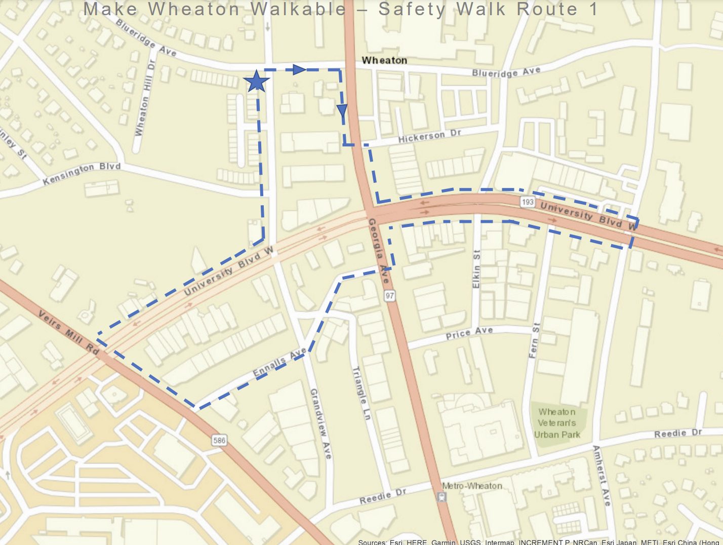
Step 5: Determine the route
Once you have determined your study area, you must determine your pedestrian audit route. Pedestrian audit routes are commonly 0.5 – 1 mile. The route should start at a logical location, such as your meeting venue, parking lot, transit stop, or park. Ideally, your route should end at the same location.
Before conducting the pedestrian audit, determine locations along the route where it may be important to stop as a group and discuss. Make sure there is enough room for the group and that participants will be able to hear each other. Pedestrians not affiliated with the pedestrian audit should be able to safely pass the group.
Draw on a paper map or a screenshot of Google Maps to share the route with participants. This map may also include the meeting place and nearby destinations.
Step 6: Select the day, time, and meeting venue
Day and Time
Most pedestrian audits consist of a pre-pedestrian audit meeting, the pedestrian audit, and a post-pedestrian audit meeting. Set aside 1.5-2 hours for the entire process. For the audit itself, plan to take 30 minutes per half mile. It takes longer to survey the route than to simply walk or roll it.
Consider the following when determining the date and time:
- What will the weather be like?
- Will your participants be available?
- Will your meeting venue be available?
- Do you want to analyze conditions at a certain time of day, such as rush hour or school dismissal?
- Do you want to analyze conditions during the day or at night?
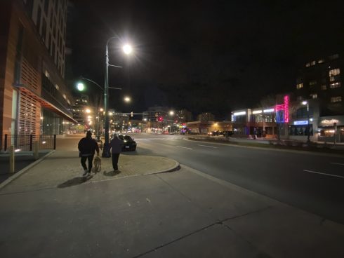
- Be careful of visibility later in the evening. Exercise extreme caution when working at dawn, dusk, or after daylight hours.
- Even if you’re conducting the pedestrian audit in the middle of the day, remember to think about how the streets function for pedestrians at night.
Meeting Venue
Next, pick a venue for your pre- and post-pedestrian audit meetings. The meeting space should be a short distance from the start/end point of the pedestrian audit. Rooms in Community Centers, Libraries, Senior Centers and other spaces can be reserved via Active Montgomery or Montgomery County Recreation. The venue should have enough room for all participants to comfortably gather. The venue should also be accessible to people with limited mobility. You may want to find a venue with a projector, so you can share images, data, or a page of this pedestrian audit toolkit.
Step 7: Invite stakeholders
Invite stakeholders via email, social media or phone as soon as possible. Be sure to communicate the purpose, meeting location, date/time, and the need to dress for the weather. This toolkit has a Stakeholder Invitation Template, which you can customize with the details of your pedestrian audit.
You can have a better idea of how many people are attending by using an online RSVP site like evite.com or free-rsvp.com.
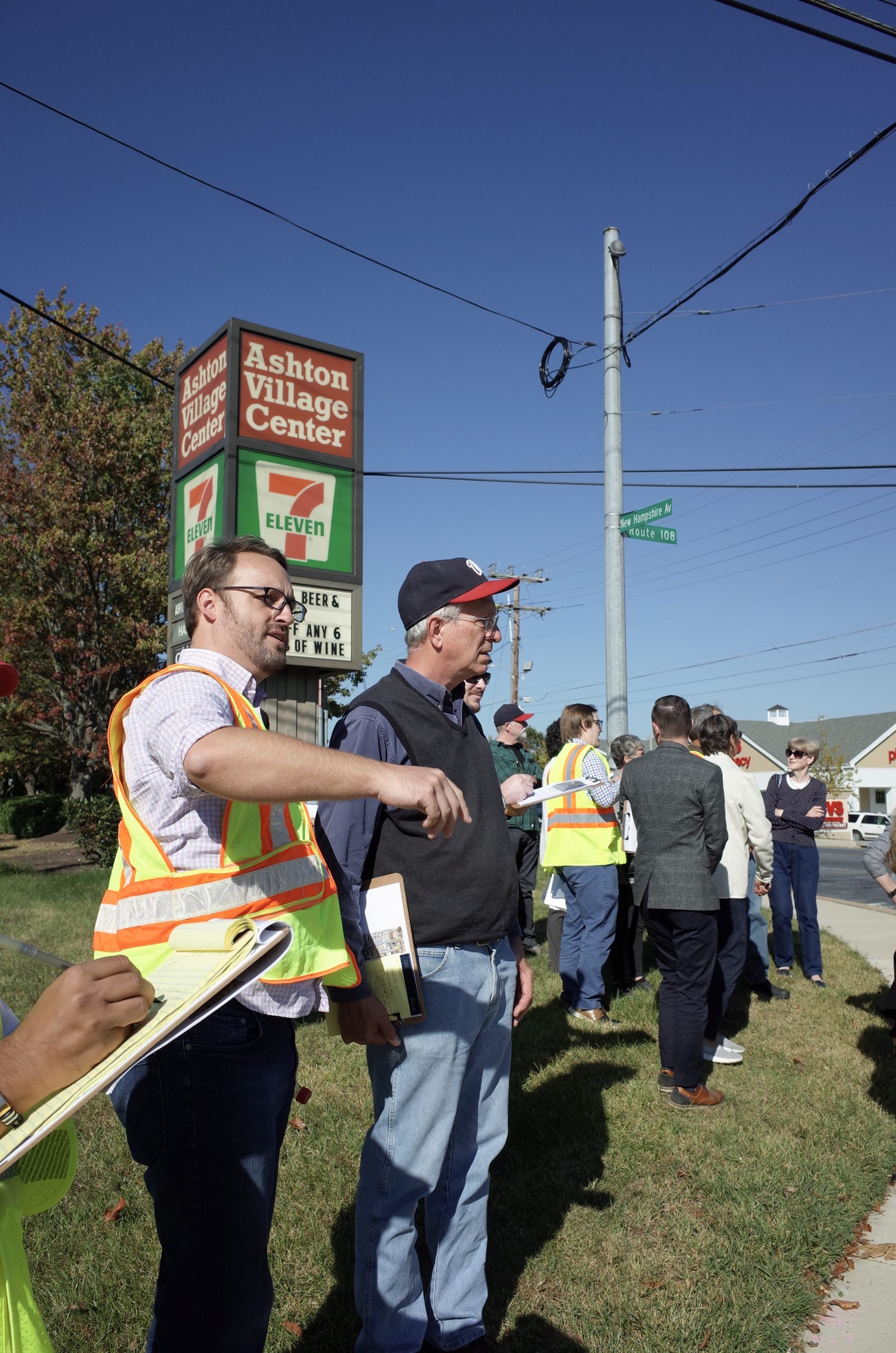
Step 8: Prepare for the pedestrian audit
To best lead the meeting before the pedestrian audit, it is important to prepare your talking points. You can create a short presentation to make sure all participants understand the pedestrian audit purpose and timeline.
You should have some awareness of pedestrian issues in the study area before walking or rolling it with the group. You can prepare by walking or rolling the route beforehand and/or doing a review on your computer using Google Street View or similar service.
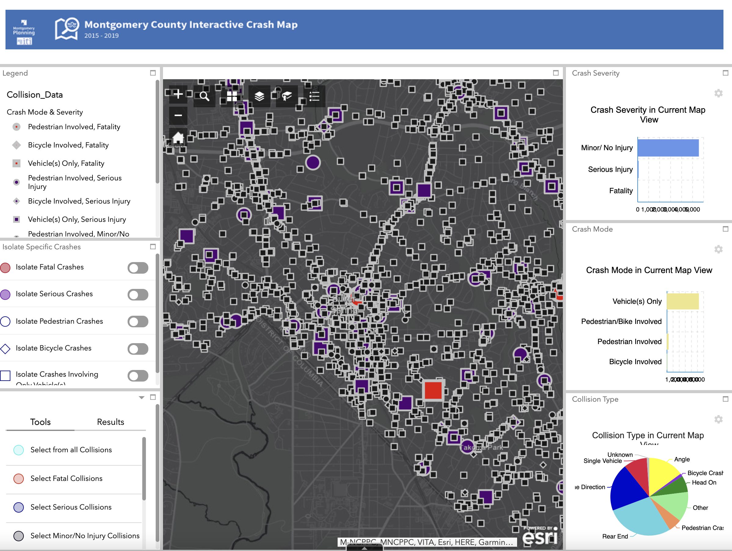
It may also be helpful to review data on crashes in the study area, especially crashes involving pedestrians. Montgomery Planning has a dataset with information on pedestrians involved in traffic collisions on county and local roadways. You can use this interactive map to find the number of recent pedestrian-related crashes and potential problem areas to investigate further during the pedestrian audit. Zoom to the location of your study area and use the toggles on the left side of the screen to isolate pedestrian crashes. You can click on each point to learn more about the details of the crash. The graphs on the right can be used to understand overall statistics for your study area and can be shared with other pedestrian audit participants.
Materials
Next, gather the materials needed for the audit. Examples include:
- Printed Data Collection Form for each participant. You must prepare the form by inserting a map of the pedestrian audit area on the left-hand side of slides 5-9. A map can be obtained by taking a screen shot on your computer of the study area in Google Maps or Google Earth.
- Clipboard
- Pens
- Name tags
- Reflective vests
- Camera or smartphone
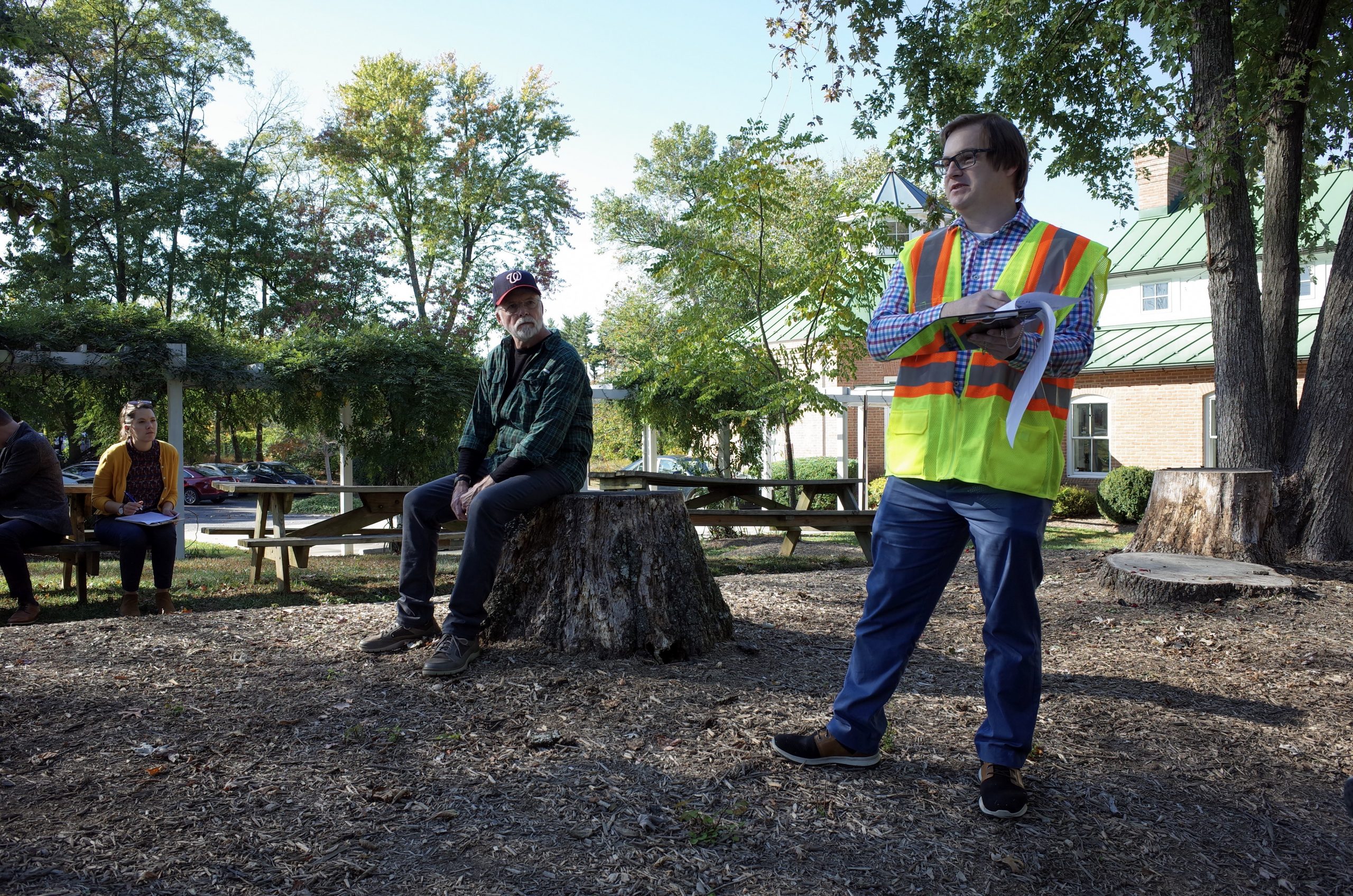
Conducting a Pre-Pedestrian Audit Meeting
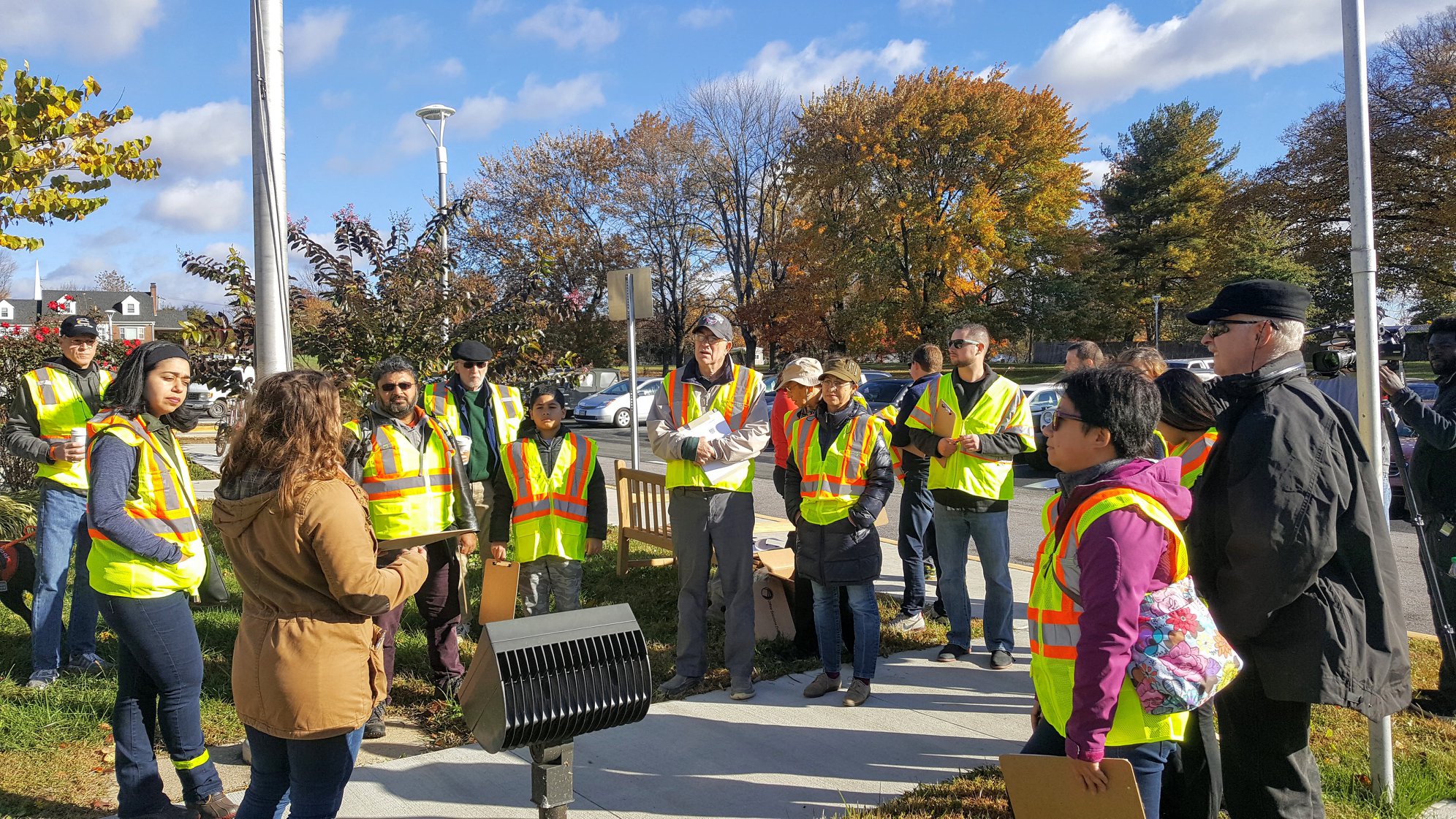
Use the pre-pedestrian audit meeting to inform participants of their role and establish the group as a team with common goals. Make sure to cover the following items.
- Participant introductions
- Pedestrian audit study area and route
- Known safety conditions
- What to look for during the pedestrian audit. Reference the Key Pedestrian Safety Issues
- How to use the data collection form
Throughout the meeting, encourage participants to think about all types of road users, including children, people using wheelchairs, people with visual or hearing disabilities, and transit riders. Though you may be performing the pedestrian audit during the day, remind participants to also think about safety and accessibility for pedestrians at night or in darker conditions.
You may want to assign participants to certain roles:
- Multiple participants to record observations using the Data Collection Form
- Someone to take photos/videos
- Someone to walk or roll behind the rest of the group to make sure no one is left behind.
If you are planning to host a larger group, the group can split up into small groups each assigned to a specific route or section within the study area. Each small group will need a leader.
Conducting a Pre-Pedestrian Audit Safety Training
Pedestrian audits require participants to do multiple things at the same time. Distracted walking or rolling can be risky, especially on a road with high traffic. It is important to hold a brief safety training to remind participants of these risks and basic safety rules as a pedestrian.
Participants should not take risks to collect data during the pedestrian audit. Remind participants that they are responsible for their own safety.
Basic pedestrian safety:
- Always use common sense and follow pedestrian and traffic laws.
- Always be aware of sight lines and visual obstructions (e.g. curves, parked cars)
- Cross at marked and/or signalized crosswalks. Refrain from using crossings that are unmarked.
- Do not enter the street from between parked cars.
- No cell phone use, texting, or headphones while walking or rolling.
- Do not block the sidewalk. Other pedestrians need to use it, too.
Conducting the Pedestrian Audit
Begin walking and/or rolling the established route. Use information in the Key Pedestrian Safety Issues to understand what to look for. Stop periodically to point out features and allow time to record notes and observations on the map handout. Lead the group at a reasonable pace and return to the debriefing venue at the pre-determined time.
Recording observations using the Data Collection Form
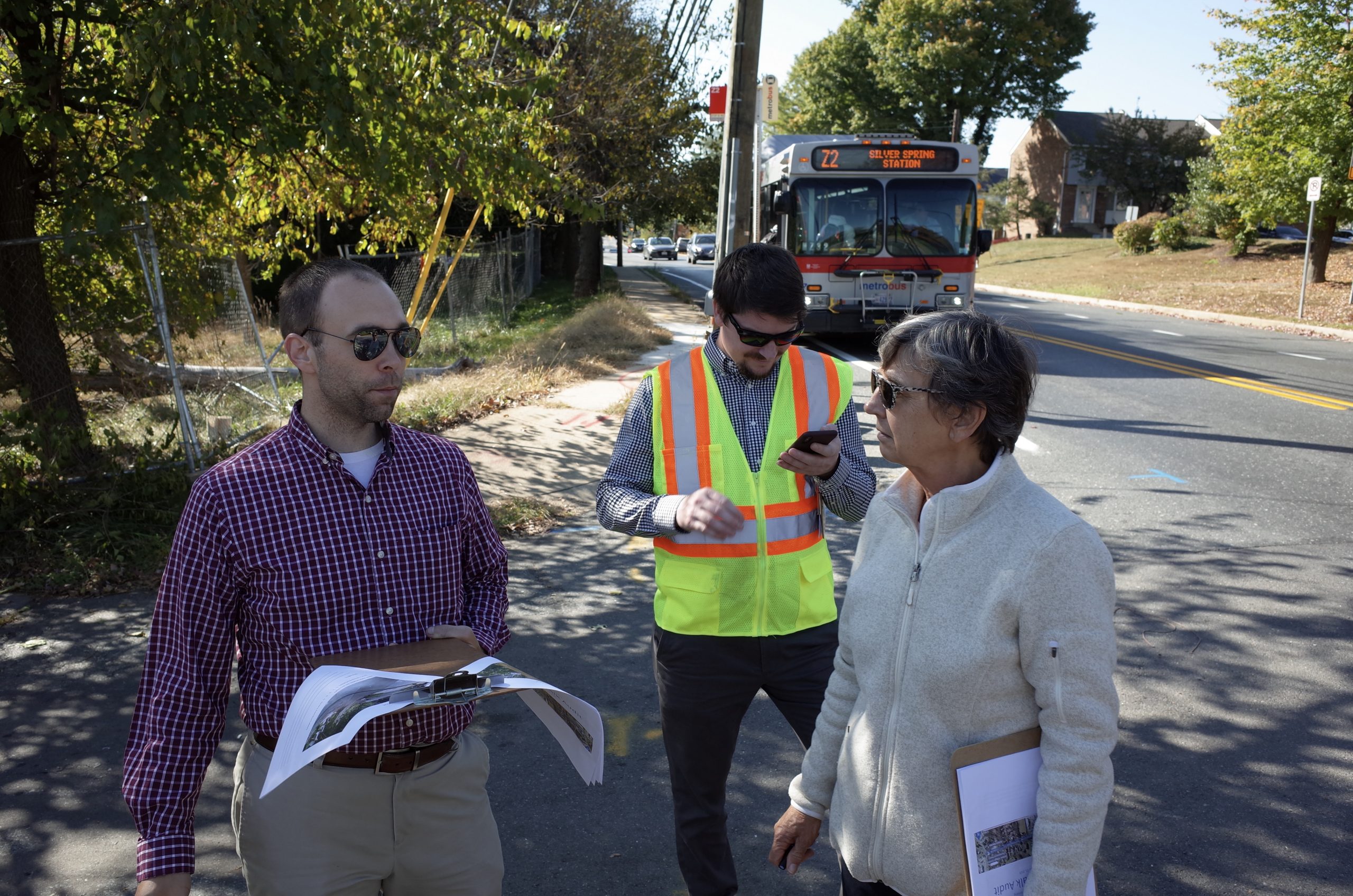
The Data Collection Form should be used to record pedestrian issues during the pedestrian audit. Remind participants to document both the physical deficiencies of the pedestrian environment and the behaviors of people walking, rolling, and driving.
The Data Collection Form has space to record the date, time, and weather. The form also has five pages that correspond to the five pedestrian issue categories. Each page has a space for the Pedestrian Audit leader to insert a map on the left and a box for participants to write observations on the right. Participants may fill out all of the pages themselves. If you have enough participants, the Data Collection Form may be split up and completed by five different people – one pedestrian issue category per person.
To use the Data Collection Form during the pedestrian audit:
- Find the page with the topic relevant to the observed issue (Sidewalks, Intersections/Crossings, etc).
- Mark the issue on the map.
- For an issue at one location, use a dot, star, or other shape to mark that point. Add a number to correspond to your written description.
- For an issue along part or all of a street block, use a line to mark that segment. Add a number to correspond to your written description.
- Write a brief description of the issue in the box on the right. There is room for additional notes on the back of each map.
Download the Data Collection Form.
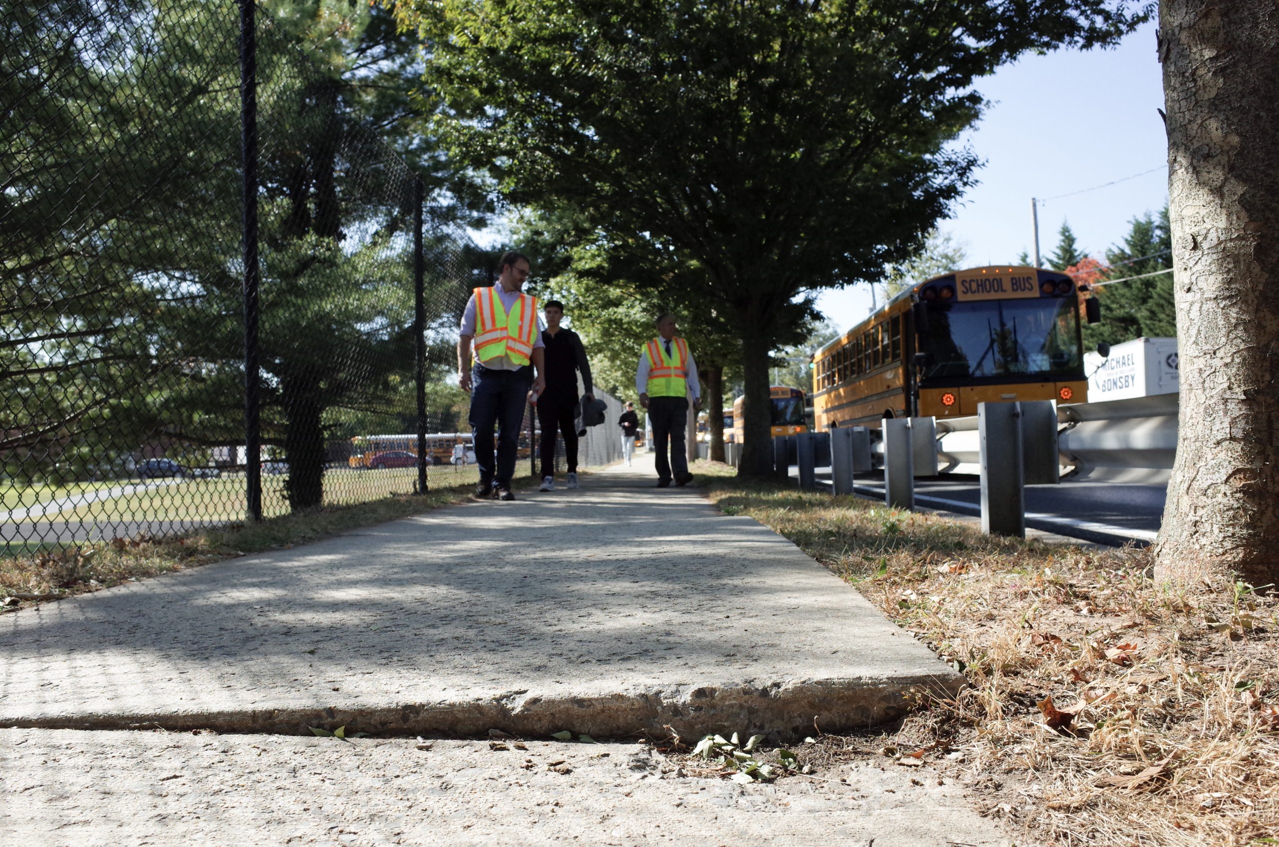
Recording observations using photos/videos
In addition to recording observations on the Data Collection Form, photos and videos are easy ways to document existing conditions. Photos and videos record a lot of information in a short amount of time. They are also useful if you are not aware of technical terms but still know something is an issue.
Photos and videos can be especially compelling if they tell a story. Avoid close-ups of one detail – instead, show the context of the issue by capturing the background. You can use a video to pan around and show the whole street or intersection.
Here are some potential photo/video subjects:
- Important or incorrect signs
- Gaps in sidewalks
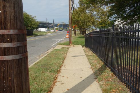
- Broken or cracked sidewalk
- Curb ramps that are obstructed or out of alignment with crosswalk, or that orient pedestrians with impaired vision into the center of the intersection rather than across the street
- Pedestrian pushbuttons that are hard to reach or would be difficult for a person with a mobility or vision disability to use
- Trees or bushes that obstruct sight lines between pedestrians and drivers
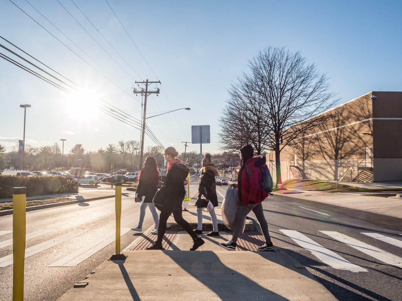
- Pedestrian audit participants navigating the route
- Participants with vision or mobility impairments navigating the route
- Video of driver behaviors
- Video of pedestrian behaviors
- Video depicting the challenges a pedestrian faces when traveling along a route
Conducting the Pedestrian Audit Debrief Meeting
At the end of the pedestrian audit, participants should regroup to share observations. This can be done as a quick discussion before participants disperse or as a more formal meeting. If you end your pedestrian audit near a busy street, find somewhere safe and quiet to discuss, or move indoors.
The post-pedestrian audit meeting is important for building consensus. Change is more likely to happen when pedestrian audit participants agree on priorities.
Ask the following questions and include topics from the Key Pedestrian Safety Issues section of this toolkit.
- What are the key pedestrian safety issues?
- Consider both traffic safety and personal security (crime, harassment, racial profiling).
- What are the key pedestrian accessibility issues?
- Consider the needs of people with different types of disabilities, such as people with mobility disabilities who use wheelchairs or other assistive devices and people with vision and hearing disabilities.
- What other key issues discourage pedestrian travel?
As a group, determine priority issues and next steps to address these issues. Determine who is responsible for pursuing the next steps. Ask participants to email or text their photos from the pedestrian audit, along with related text describing each picture, to a designated person. Refer to the Contact the County Decision Tree to understand the best way to report issues and concerns to the appropriate government agencies. Remember to take notes.
Post Pedestrian Audit Steps
Summarize findings
Summarize your findings in a report using the provided Pedestrian Audit Report Template. Be sure to include photos of the event and existing conditions. Your findings should focus on the priority issues and next steps determined in the debriefing meeting.
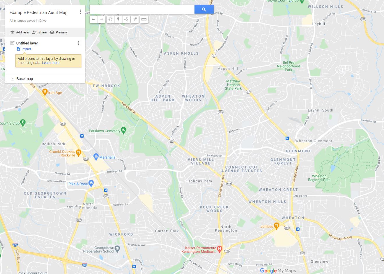
You can also summarize your findings in an online map. Online maps are a valuable tool for recording and communicating existing pedestrian conditions, safety concerns, and other details from your pedestrian audit, such as the study area and pedestrian audit route. You can create an online map using Google My Maps or other similar services. A link to the online map can also be added to a written report.
Instructions for Using Google My Maps
- Login to Google Maps using your free Google/Gmail account (necessary for creating maps)
- Click the three-line menu button in the upper left corner.
- Select “Your places”.
- Select “MAPS”.
- Select “CREATE MAP” at the bottom of the page.
- Zoom to the pedestrian audit’s location.
- Using the “add line” tool to mark lines showing linear features, such as sidewalk gaps, streets known for speeding, etc. You can edit the color and width of these lines after marking them on the map. Label each line.
- Using “add marker” tool to mark spot locations, such as any destinations, a missing crosswalk at an intersection, commercial driveway, sidewalk obstruction, or other barriers to walking and rolling. You can edit the color and style of these points after marking them on the map. Label each point.
- Save your map. Select the “Share” link.
- If you plan to share your map on a website, click on the menu next to the “Share” link and set your Privacy setting to “Public.” You will then have a link to your map to share.
Build community support
Consider sharing your pedestrian audit findings with other community members to get their input, identify opportunities, and build support for change. Sharing options include social media, community listservs, and regularly scheduled meetings within the community, such as neighborhood association and PTA meetings. You can also request to speak at a Pedestrian, Bicycle, and Traffic Safety Advisory Committee (PBTSAC) meeting.
When building community support, focus on the priority issues and invite others to get involved.
Report findings to government agencies and elected officials
You are encouraged share your findings with Montgomery County, the State of Maryland, and your elected officials. There are three primary ways you can do this.
- MC 311 Customer Service Center is the County’s source for non-emergency information and services. You can contact 311 by calling 311 or 240-777-0311. You can also submit service requests online. 311 is the best reporting avenue when there is an issue with a straightforward solution. For example, if a pedestrian signal at a crosswalk needs to be repaired, there is a webpage to submit a repair request.
- Emails to County and State agencies.
- Emails/calls to elected officials
- You can find your County Councilmember at https://mcgov-gis.maps.arcgis.com/apps/instant/lookup/index.html?appid=b57d3f11b2b847c5a7342e73f5079e98 by typing your address in the upper left. A popup window will provide the appropriate names and contact information.
- You can also determine the appropriate state delegation by typing your address and zip code at https://mgaleg.maryland.gov/mgawebsite/Members/District.
Use the Contact the County Decision Tree to determine the best reporting method based on the issues your audit has brought to light.
Pedestrian Safety Issues and Countermeasures
Now that you understand the process of a pedestrian audit, Part II introduces you to pedestrian safety issues you will need to observe during the pedestrian audit. The second part of this section introduces you to countermeasures, which are changes to infrastructure or other strategies to improve comfort and safety. This information will help you complete a successful pedestrian audit.
Key Pedestrian Safety Issues
This section of the toolkit uses guiding questions to help pedestrian audit participants analyze the pedestrian environment. Review these questions and accompanying images to better understand what to look for during the pedestrian audit. Sidewalks, intersections, crossings, driver behaviors, personal security, and access to transit are covered in this section.
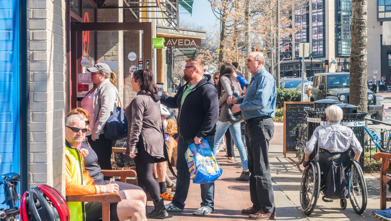
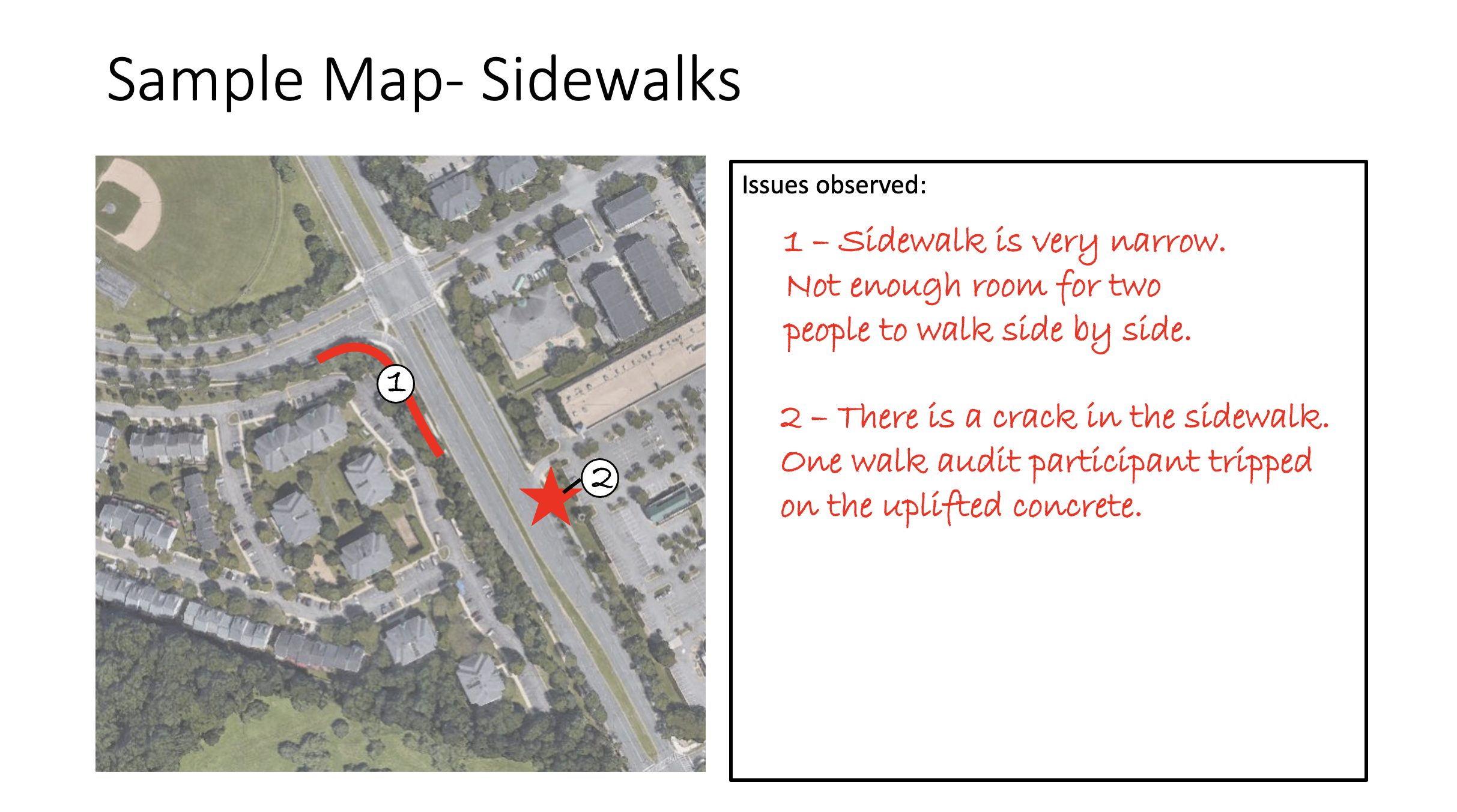
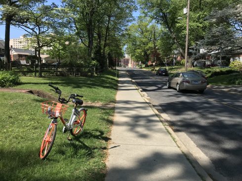
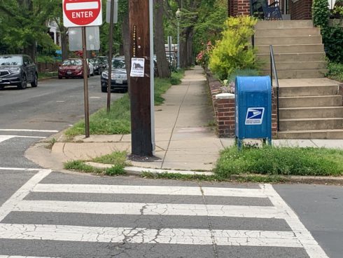
Sidewalks
Missing sidewalks: Are there sidewalks on both sides of the street? Does the sidewalk continue along the entire block? Are there gaps?
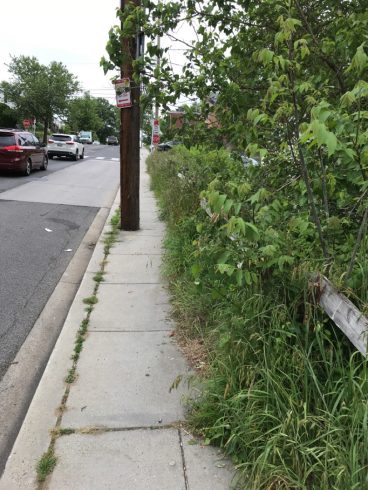
Narrow sidewalks: Is the sidewalk wide enough for two people to walk side by side? Minimum width needed is 5 feet.
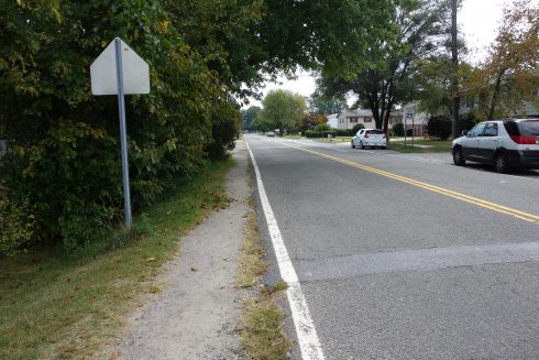
Driveways/alleys: Is the sidewalk frequently interrupted by driveways or alleys?
Sidewalk slope: Does the sidewalk feel sloped in any direction? Sidewalks with significant cross slopes can be difficult for people using wheelchairs to navigate.
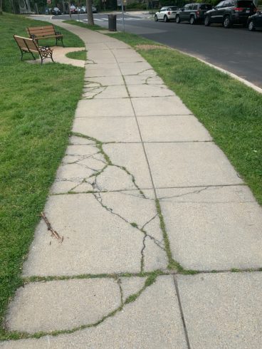
Sidewalk maintenance: Is the sidewalk well maintained? Are there cracks, broken areas, or other tripping hazards?
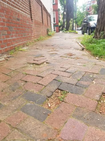
Physical barriers: Is there anything blocking the sidewalk, including trees/bushes, telephone pole, sign pole, garbage or recycling cans, bikes, or scooters?
Sidewalk buffer: Is there a buffer between the sidewalk and moving traffic, such as a landscaped strip, a bicycle lane, or a motor vehicle parking lane? Buffers can create a more pleasant pedestrian environment. Landscaped buffers also provide a space for shade trees, utilities, and snow storage.
Intersections/Crossings
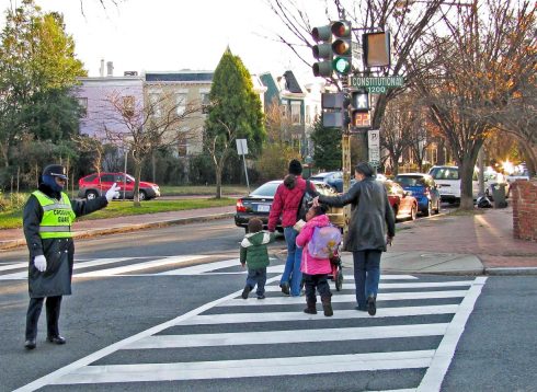
Marked crosswalks: Are there marked crosswalks?
- What type of crosswalk?
- Are the crosswalk markings easy to see, or are they worn away?
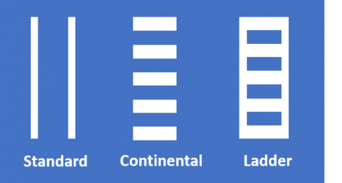
Continental and ladder-style crosswalks are considered high visibility crosswalks. They are easier for drivers to see and also more visible to pedestrians with low vision. Continental crosswalks are preferred by Montgomery County.
Traffic control: How is traffic controlled at the intersection? Stop sign or traffic signal?
Pedestrian signals: If there is a traffic signal, are there pedestrian signals?
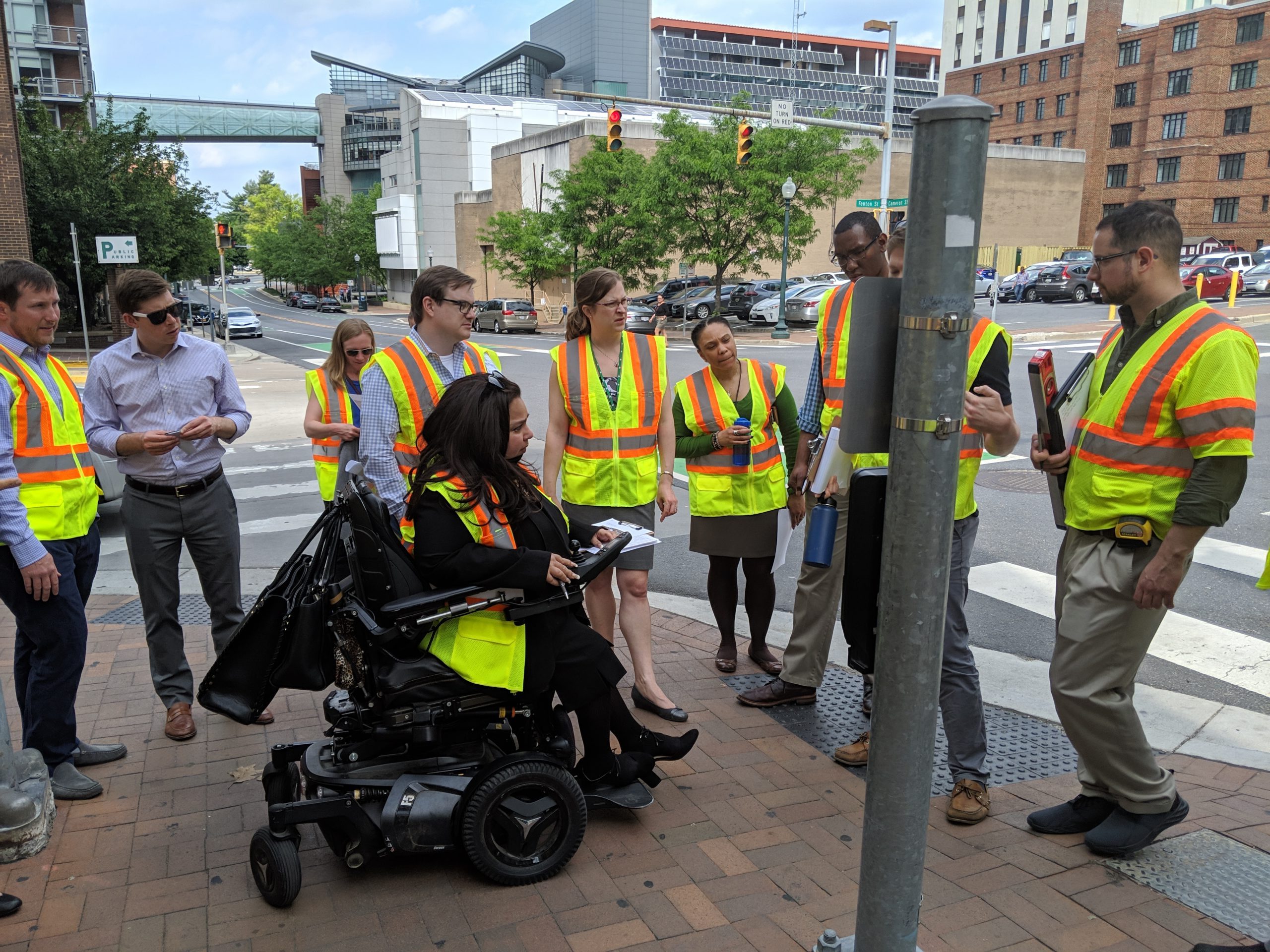
- Is there a pedestrian pushbutton? Is it located in an accessible location near the top of the curb ramp? Would a person in a wheelchair be able to get to it?
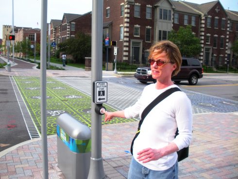
Pedestrians use the pushbutton to indicate they are waiting to cross. The pushbutton should be easy to reach. 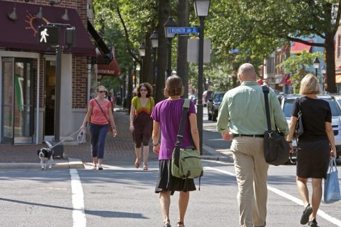
Pedestrian signals indicate to pedestrians when it is their turn to cross. - Is there an “accessible pedestrian signal”? Accessible pedestrian signals use audible tones and vibrating surfaces to let pedestrians with vision disabilities know it’s their turn to cross.
Detectable warning surfaces are textured bumps on curb ramps. They warn people that they are entering the roadway. - Do pedestrians have to wait a long time at the crosswalk before the signal changes? Long signal times can encourage risk-taking.
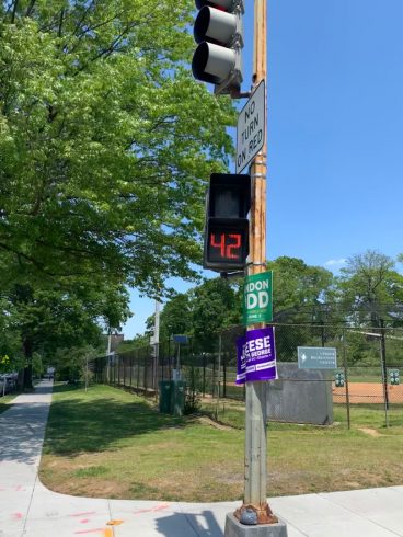
Pedestrian signals indicate to pedestrians when it is their turn to cross. - Does the signal provide pedestrians with enough time to cross? Would an older adult or a person with a disability be able to cross in the time given?
Continental and ladder-style crosswalks are considered high visibility crosswalks. They are easier for drivers to see and also more visible to pedestrians with low vision. Continental crosswalks are preferred by Montgomery County.
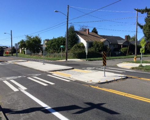
Crossing distances: Do pedestrians have to cross a wide road (more than four traffic lanes)? Is there a median or island in the middle? These are a helpful stopping point for pedestrians if they have to cross a wide road.
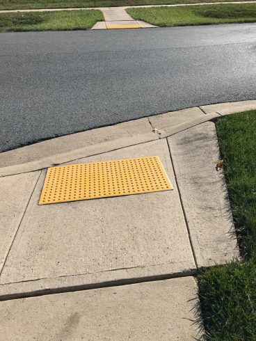
Curb ramps: Are there curb ramps? Curb ramps transition pedestrians from the sidewalk to the street. There should be two curb ramps for each crosswalk.
- Are there detectable warning surfaces on the curb ramps?
- Is the curb ramp aligned with the crosswalk?
- Is the curb ramp obstructed?
- Is there adequate space at the top and the bottom of the ramp for a person in a wheelchair to turn?
- Is the curb ramp perpendicular to the curb so visually-impaired users are oriented across the street and not into the center of the intersection?
The lack of a curb ramp makes crossing difficult for people using wheelchairs, walkers, and strollers.
Visual barriers: Is there anything blocking your view of oncoming traffic or preventing you from seeing when it is safe to cross?
Crossing frequency: Are there enough crossing opportunities? People who have to walk or roll more than 300 ft (about a football field) may be more likely to cross outside of a dedicated crossing.
Driver speeds: What is the speed limit? How much traffic is there? Higher motor vehicle speeds and traffic volumes can make walking or rolling uncomfortable.
Risky driver behaviors: Check for all behaviors:
- Drivers do not stop at stop signs.
- Drivers do not obey traffic signals.
- Drivers appear to be speeding.
- Drivers are turning at a high speed
- Drivers don’t yield to pedestrians at crosswalks.
- Drivers don’t yield to pedestrians at driveways.
- Drivers are distracted (using cell phones, etc.).
-
Personal Security/Comfort
Wayfinding: Are there wayfinding signs? Are they easy to read and understand?
Landscaping: Are there trees, grass, or flowers?
- Does existing landscaping need maintenance?
- Do the trees provide enough shade?
Street trees provide shade and create a welcoming atmosphere for pedestrians.
Benches/seats: Are there benches or other places for people to rest?
Lighting: (Nighttime) Does lighting illuminate the pedestrian path?
Dogs: Are there unleashed dogs?
Litter: Is there trash or litter? Are there trash cans?
Personal security: Are there other situations that made you uncomfortable or could potentially make someone else uncomfortable?
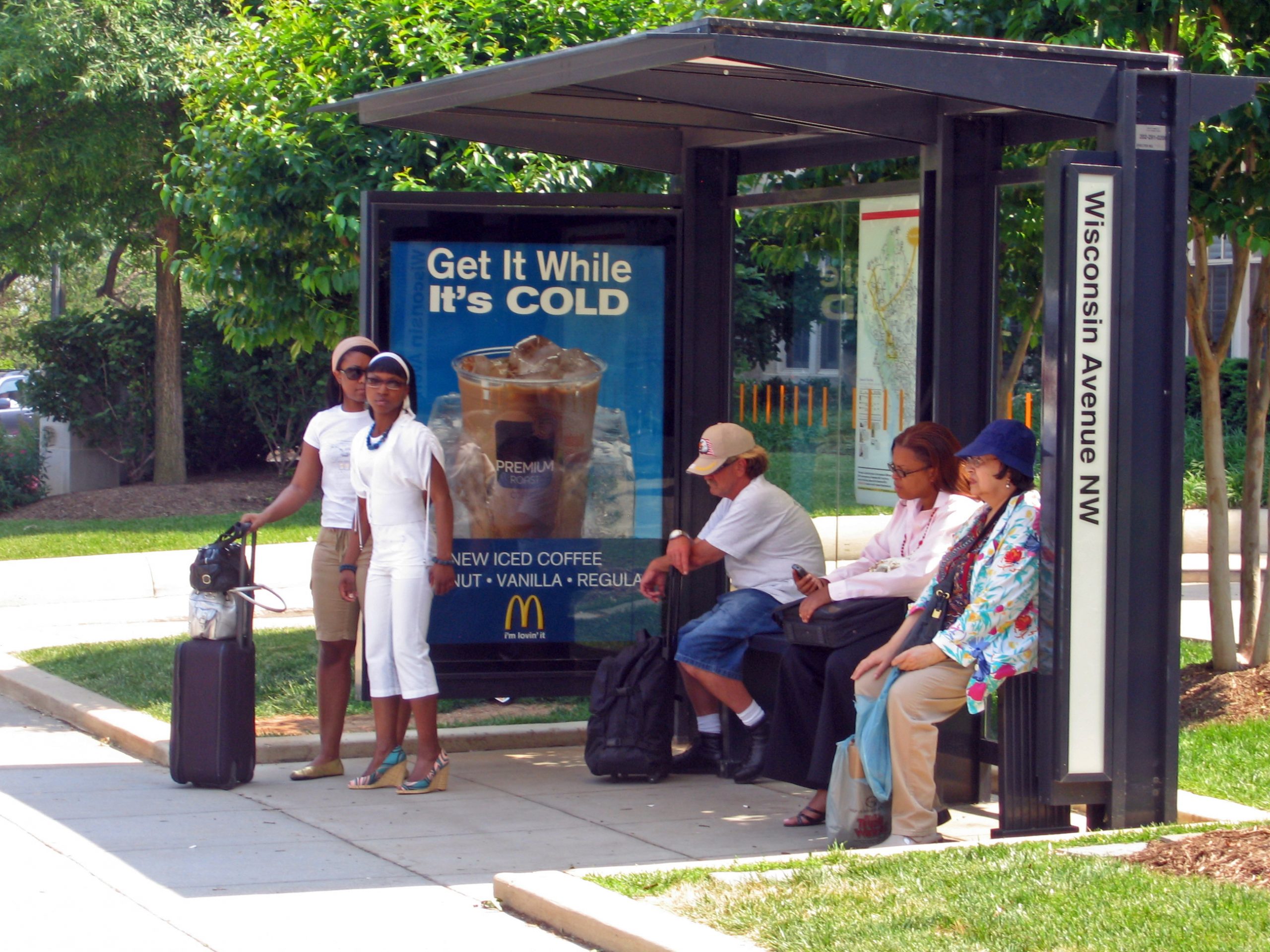
Connection to Transit
- Bus stop presence–Is there a bus stop on the street?
- Shelter—Does the bus stop have a shelter?
- Shelter condition–Is the shelter in good condition?
- Bus stop accessibility–Is the bus stop accessible by sidewalk? Could a person in a wheelchair get to the bus stop?
- Nearby crossings–Is there a marked crosswalk nearby?
-
Introduction to Pedestrian Safety Countermeasures
Pedestrian safety countermeasures include infrastructure changes and other strategies aimed at creating safer conditions for pedestrians. The table below provides a list of pedestrian safety issues along with the infrastructure countermeasures that may be considered to address the issue. Each countermeasure is linked to either the Planning Department’s Vision Zero Community Toolkit or the Federal Highway Administration’s PedSafe website to provide you with more information.
Pedestrian Safety Issues and Countermeasures
| Issue | Countermeasure |
| Inappropriate Motor Vehicle Speed/Speeding | |
| Drivers not yielding to pedestrians | |
| Long pedestrian crossing distance | |
| Conflicts between pedestrians and turning vehicles | |
| Poor visibility between drivers and pedestrians | |
| Poor accessibility for people with disabilities | |
| Pedestrians not crossing with traffic light |