Montgomery County’s recently approved General Plan, Thrive Montgomery 2050 (Thrive), aspires for compact growth supported by transit and a safe, comfortable, and appealing network for walking, biking, and rolling within the county’s centers and along our major corridors. The major corridors identified in Thrive span a diverse set of urban, suburban, and rural geographies and currently face conditions that include underutilized commercial uses and inadequate infrastructure to walk, bike, or roll. Decades of plans have recommended the preservation and protection of single-family uses along the major corridors and prioritized vehicular throughput and ease of driving. We now know that such practices lead to inequity, are bad for the environment, and make places economically uncompetitive in the long run. To implement Thrive and advance corridor-focused growth, Montgomery Planning developed center and corridor typologies as well as urban design, transportation, and sustainability characteristics associated with each. These centers range from large centers to villages, and segment typologies range from transformational growth to no growth.
Corridors are more than their asphalt. At their best, they:
- Facilitate multimodal travel, welcoming pedestrians, cyclists, and transit riders.
- Connect key activity centers, schools, parks, and cultural sites.
- Offer mixed-use development—housing, dining, retail, and jobs all within reach.
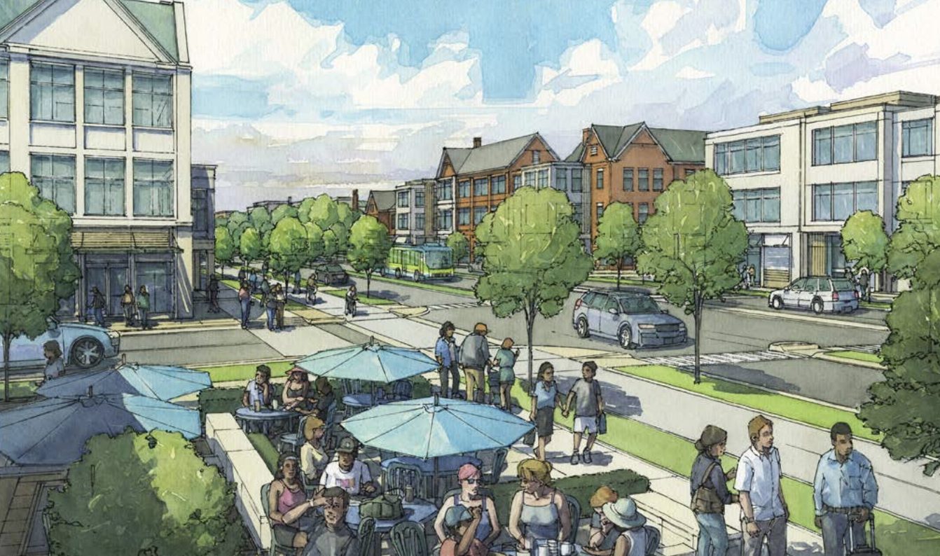
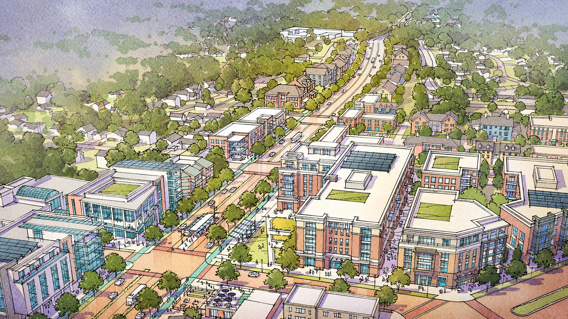

Corridors are the connective tissue of the county and its communities, linking geographic centers with a safe, comfortable, and appealing network for traveling, commuting, and commerce. A major part of the county’s Growth Map is built on corridors and their existing or planned ability to connect residents to jobs, services, and other destinations in the county and region.
That’s why new and revitalized corridors are key to the Thrive Montgomery 2050 vision of a more accessible, equitably developed county, with future growth centered around transit stations and along mixed-use corridors that are walkable, bikeable, and transit accessible and that connect residents, employees, and visitors to each other and the region.
Corridors are also central to transitioning the county’s growth toward a more efficient and sustainable future, by focusing growth in transit-oriented, walkable locations. They also enable better connectivity, such that centers of activity can coexist and complement each other for the benefit of everyone living, working, and traveling in the county.
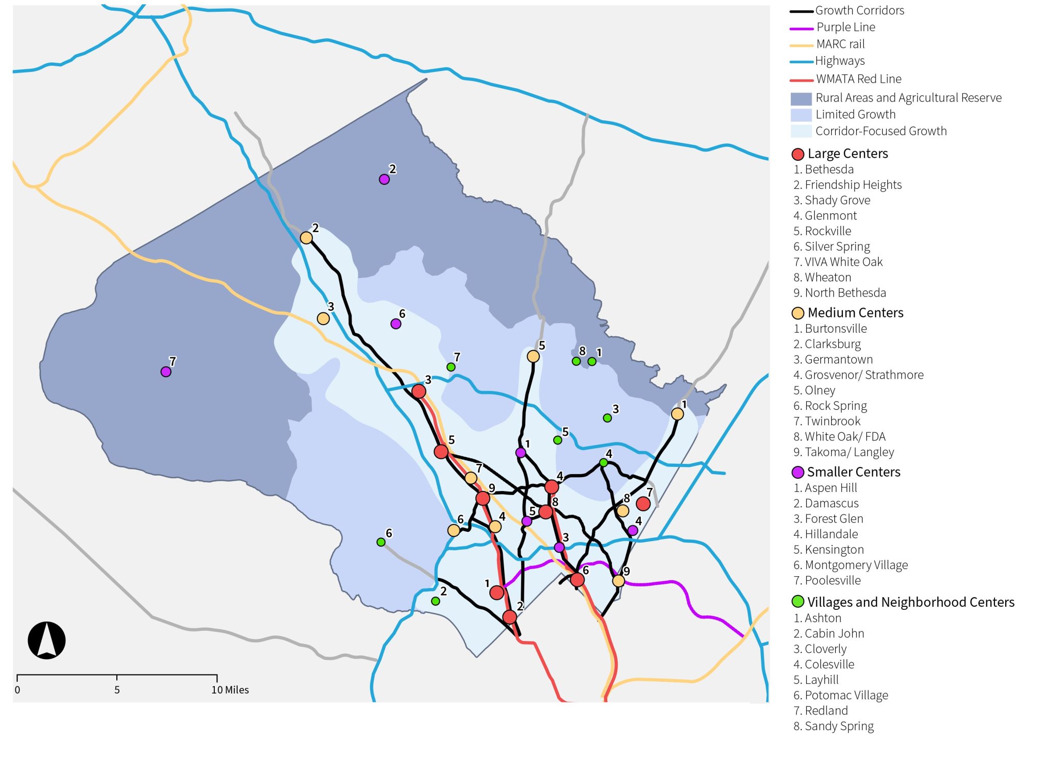
The Growth Map should be considered in the context of the Compact Growth and Complete Communities chapters of Thrive Montgomery 2050. The centers of activity shown are not exhaustive of all existing or potential centers. Some of the centers listed on the growth map are not subject to Montgomery County zoning authority.
Typology
Montgomery County is deeply diverse by almost any measure, and the various types of neighborhood centers—with small, medium, and large populations served by various residential and commercial densities—thus require different types of corridors to effectively connect them. The corridor types align county centers of activity with the degrees of anticipated growth illustrated on the map above while expanding opportunities for residents to live lives less dependent on cars.
We’ve identified three corridor types to guide planning and investment:
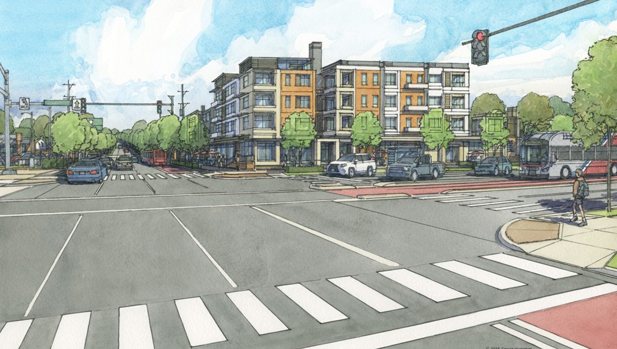
- Typology 1 – Transformational Growth: High-density, mixed-use design with frequent protected crossings.
- Typology 2 – Moderate Mixed-Use Growth: Primarily residential with strategic activity nodes.
- Typology 3 – Connector Corridors: Limited frontage development that serves as a travel link between major hubs.
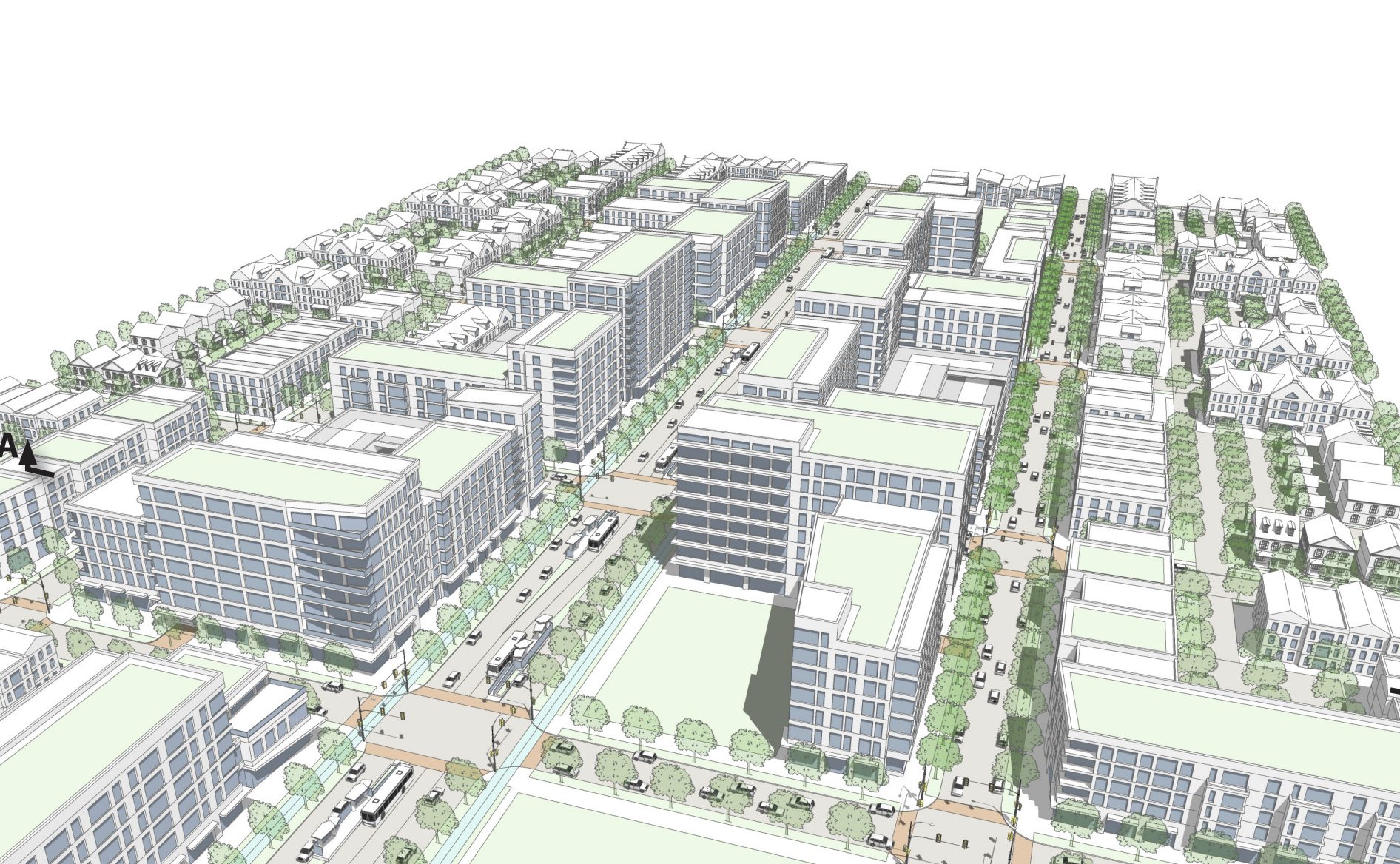
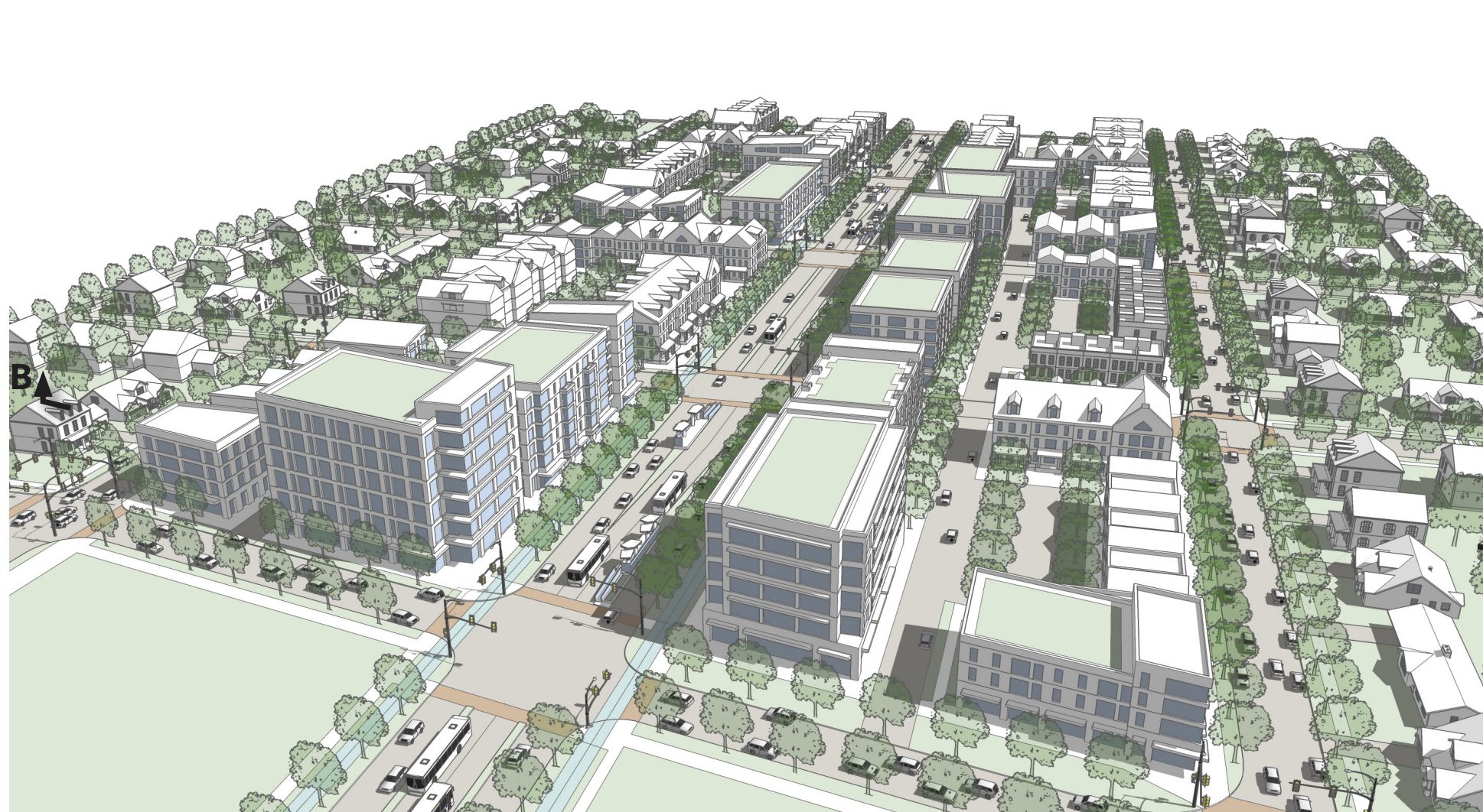
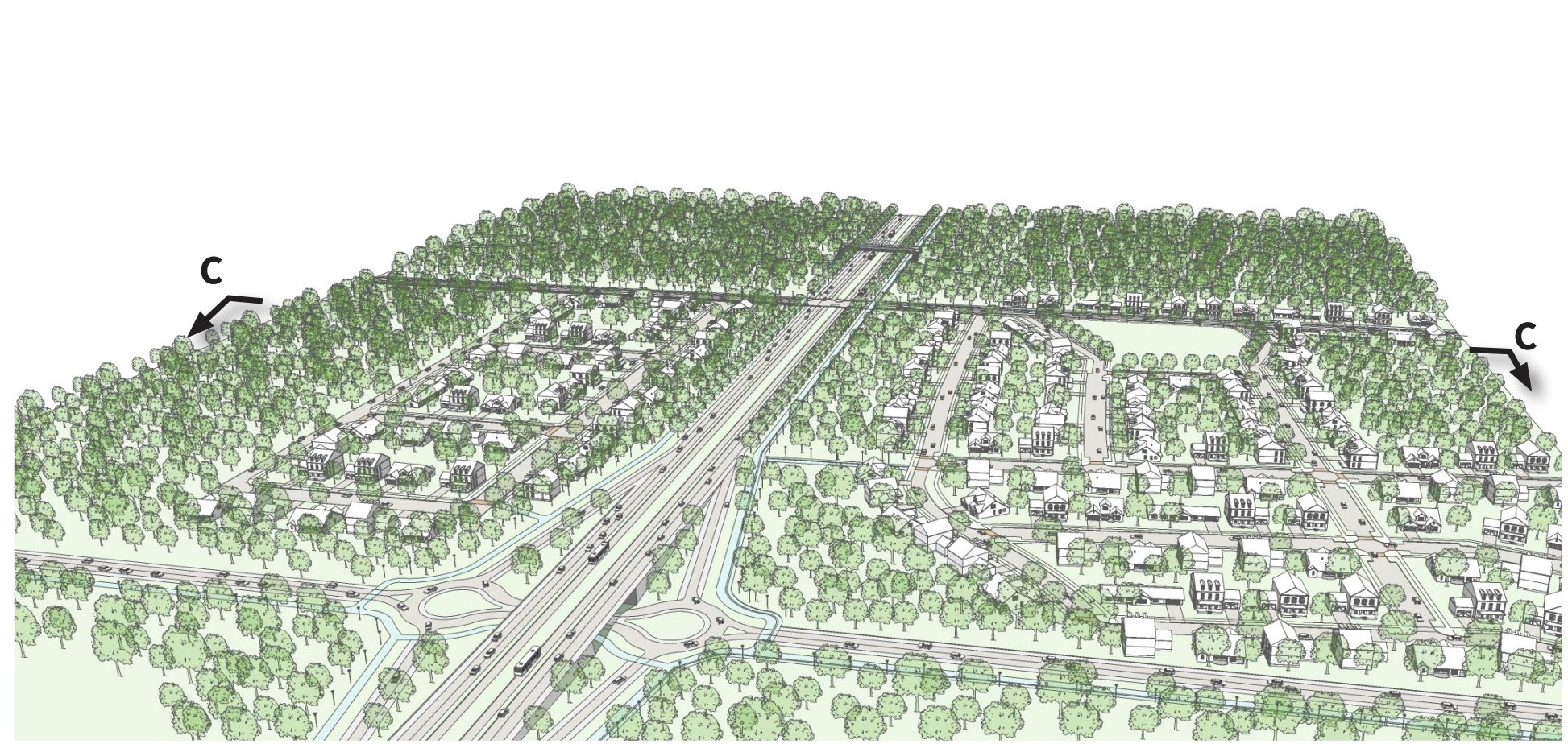
Centers and Corridors Segment Typologies
For more detail on the segment typology, including transportation and urban design characteristics, check out the complete Centers and Corridors Segment Typologies staff report.
These segment typologies are intended to provide Montgomery Planning a foundation in the development of a vision and recommendations for future corridor plans. While each corridor plan will be unique, and could include a combination of the segment typologies, the typologies and associated characteristics provide a point of commencement for developing corridor plans in consultation with community members and stakeholders and ensure that future corridor plans are initiated and pursued from a collective understanding of compact, corridor-focused growth.
Corridors Past, Present, and Future
Though central to our future, corridors have actually occupied a significant place in county planning since the 1964 Wedges and Corridors Plan. The 2013 Countywide Transit Corridors Functional Master Plan later enhanced transit opportunities along many corridors to support Montgomery County’s economic development and mobility goals in an environmentally sustainable way. Similarly, other plans have addressed major roadways and the centers along these corridors, such as the Veirs Mill Corridor Master Plan and the White Flint Sector Plan.
Looking ahead, Thrive Montgomery 2050 highlights the importance of several existing and evolving corridors, including Rockville Pike/MD 355, Columbia Pike/US 29, Fairland and Briggs Chaney, and University Boulevard. The University Boulevard Corridor Plan is expected to be one of the first to follow that vision.
As we envision what the future of Montgomery County could look like when we come together to realize an equitable vision that works for all of us, Montgomery Planning anticipates an increasing focus on the county’s corridors and expanding bus rapid transit along them. That direction ensures we can provide better access to wide-ranging destinations while remaining on track with our climate, racial equity, and social justice, and Vision Zero goals.