Damascus Master Plan (1982/1985)
Approved & Adopted 1982 – Amended 1985
The 1982 Damascus Master Plan was amended in 1985, 1993, and with the Rustic Roads Functional Master Plan in 2004.. Part of the plan area was again amended with a new master plan in 2006.
View the Damascus Master Plan (1982/1985) (pdf, 7 MB)
The complete document is represented by the index below:
- Table of Contents

- Amendment
- Plan Highlights
- Plan Introduction
- Environmental Concerns
- Land and Use Recommendations
- Transportation
- Damascus Business Area Plan
- Residential Land Use Plan
- Agricultural and Open Space Preservation
- Community Facilities
- Implementation
- Appendices
- Maps & Figures
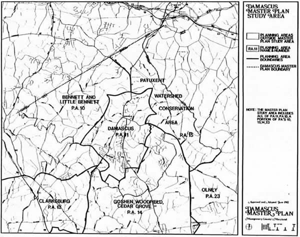
- Damascus Master Plan Study Area
- Drainage Basins
- Soils Which Pose Septic System Limitations
- Soil Limitations (for buildings with basements)
- 1966 Damascus Master Plan
- Land Use Plan
- Proposed Traffic Circulation and Rights-of-Way
- Proposed Business Area Road Improvements
- Damascus Business Area Development Constraints
- Damascus Business Area: Generalized Existing and Proposed Zoning
- Business Area Land Use Plan
- Transition Area
- Ridge Top Development Pattern
- TDR Receiving Areas
- Agriculture and Open Space
- Proposed Agriculture Reserve Area
- Parkland Map
- Magruder Branch Stream Valley Park Design Concept
- Historic Sites
- Generalized Existing Zoning
- Zoning and Highway Plan
- Proposed Sewer and Water Service Areas
- Bypass Alternatives
- Damascus Master Plan Study Area