This piece was originally published on brookings.edu on February 16, 2022.
By Jesse Cohn McGowan (Transportation Planner Coordinator), Lauren Pepe (Senior Planning Associate), and Juan Jose Castro Cerdes (Senior Planning Associate), Montgomery County Planning Department
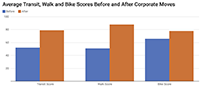
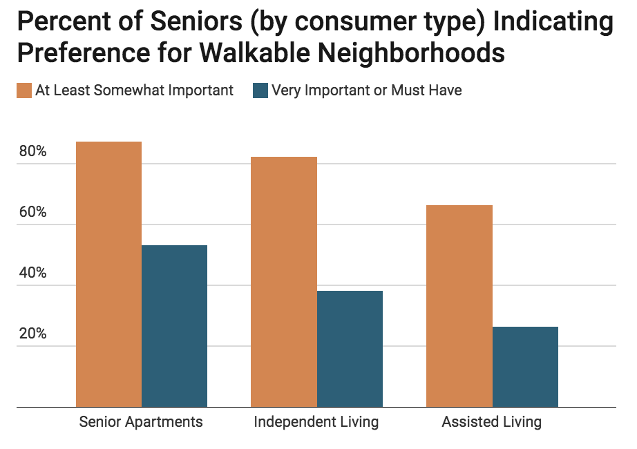
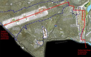
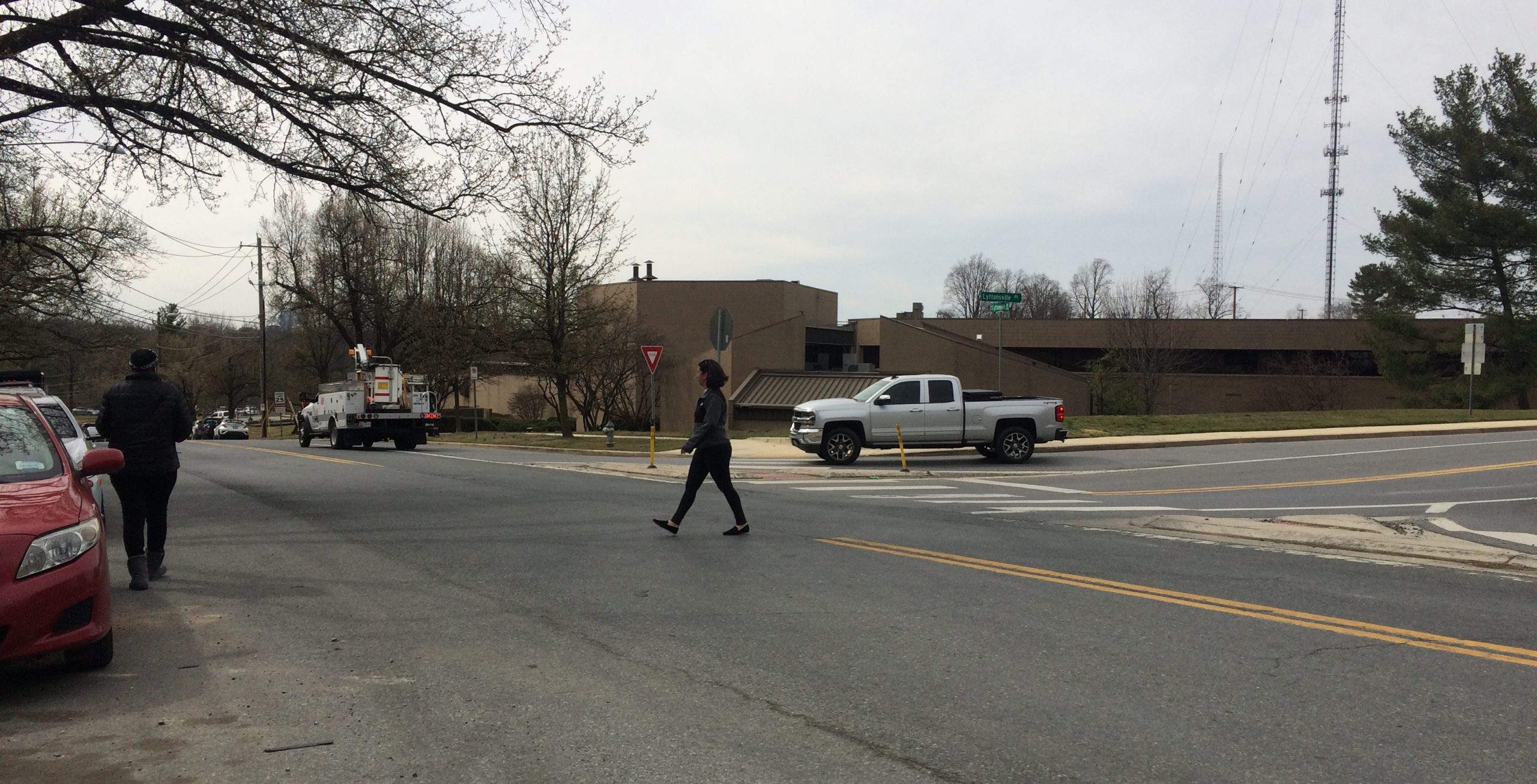
Transit has the potential to connect people to places in a sustainable, affordable manner—but only if riders can access it. Transportation planning must take into account not only where transit services are located, but how people traverse the built environment to access such services. Lower-income, majority-minority neighborhoods often lack the basic infrastructure for walking (such as sidewalks and crosswalks) and are more likely to have had their neighborhoods cut off by highways—resulting in disproportionate numbers of pedestrian crashes, injuries, and fatalities in these areas … Continue reading