Wheaton Central Business District and Vicinity Sector Plan
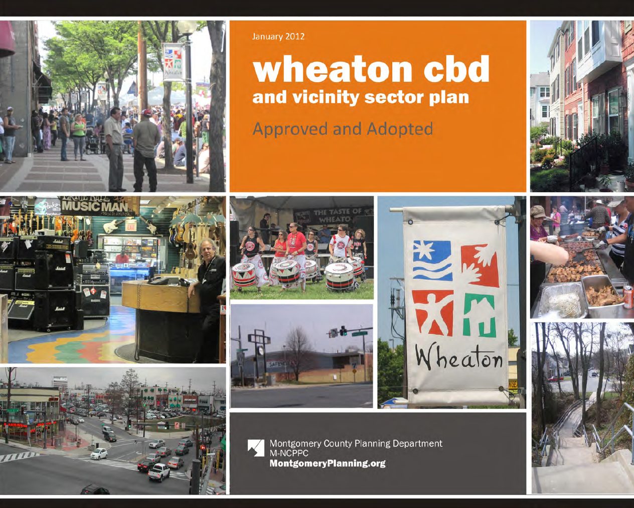
- Download the Wheaton CBD and Vicinity Sector Plan, which was approved in January 2012.
- Download the plan appendix
- The Wheaton Central Business District Design Guidelines provide guidance on how future development should enhance the public realm
- View the 2023 Wheaton Streetscape Standards.
Background
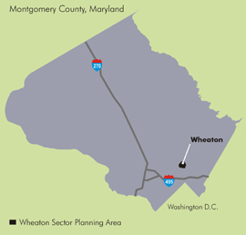
The Wheaton CBD and Vicinity Sector Plan covers approximately 484 acres surrounding the Wheaton Metro station. The plan focuses on encouraging great urban design, efficient transportation, pedestrian links to the Wheaton Metro station, environmental sustainability and more.
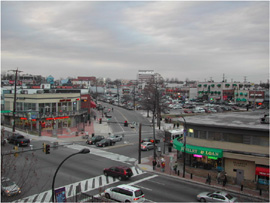
Home to the Wheaton Westfield Mall, Wheaton draws customers and workers from throughout the county and serves locals with a core of small stores, restaurants and other businesses.
The Plan looks at Wheaton’s future and how to build on its strengths. Planners, with input from the community and property owners, proposed a development pattern that best meets the needs and goals of Wheaton as a highly livable, unique place in the county. The plan’s goals are as follows:
- Focus new development and revitalization efforts near Metro’s Red Line
- Reinvigorate Wheaton’s downtown by creating a walkable community with a distinct identity
- Create a vibrant mix of jobs and housing
- Preserve Wheaton’s ethnic diversity
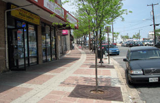
- Design quality public spaces inviting to pedestrians
- Foster an environmentally sustainable community
Learn More
View video clip on the Wheaton Sector Plan excerpted from our Montgomery Plans cable show.
Community Outreach
The Wheaton Sector Plan outreach strategy engaged two advisory committees associated with the Mid-County Regional Services Center — the Wheaton Redevelopment Advisory Committee (WRAC), as the lead organizing committee and the Wheaton Urban District Advisory Committee (WUDAC). During the planning process, WRAC and WUDAC formed a Wheaton Sector Plan Joint Advisory Ad Hoc Work Group. The Wheaton Civic Coalition, other interested organizations and community members also participated in the work group as non-voting members.
Past Sector Plan Meetings
- January 2012: The full Commission approved the Wheaton Sector Plan
- November 27, 2011: The County Council approved its version of the Wheaton Sector Plan
- November 15, 2011: County Council worksession
View planner presentation [PDF] (5.4 MB) to the County Council - March 31, 2011: The Planning Board directed staff to format the Planning Board draft and transmit to the County Council
- February 24, 2011:
Planning Board worksession #6: The Board reviewed the remaining property-specific issues and urban design guidelines. - January 6, 2011:
Planning Board worksession #5: Presentation from GreenWheaton on environmental concepts that support the goal of the draft plan to make Wheaton a unique and sustainable community, economically, environmentally and socially. - December 9, 2010: Planning Board worksession #4 on land use, zoning and circulation recommendations for districts and specific properties. View the staff presentation [PDF]. (pdf, 9MB)
- November 18, 2010: Planning Board worksession #3. View the staff presentation [PDF]. (pdf, 11.5MB)
- November 17, 2010: Downtown Wheaton Redevelopment meeting
- October 28, 2010: Planning Board worksession #2. View the staff presentation [PDF].
- October 7, 2010: Planning Board worksession #1. View the staff presentation [PDF] (pdf, 3.7MB).
- July 29, 2010: Planning Board public hearing. Download the public hearing draft [PDF] (pdf, 14MB)
- June 3, 2010: Staff Draft Sector Plan presented to the Planning Board
- May 19, 2010: Staff Draft recommendations presented by staff to residents, property owners, and developers. View the handout [PDF] and presentation [PDF].
- February 2010: Staff presented a summary [PDF] of the Wheaton Sector Plan Status Report to property owners and community groups.
- December 3, 2009: Public Hearing: Preliminary Recommendations [PDF] and PowerPoint [PDF]presented to the Planning Board.
- October 5, 2009: View the transportation presentation [PDF] to the Wheaton Redevelopment Advisory Committee’s (WRAC) Sector Plan Work Group.
- September 21, 2009: Community Meeting to discuss the draft preliminary recommendations [PDF]. View the presentation [PDF] and comment [PDF] session.
- June 11, 2009: Planners gave a status report and a presentation [PDF] (pdf, 20 MB) to the Planning Board. The following short video by Nick Whitaker, “Paint a Parking Lot, Put Up a Paradise” was shown to the Planning Board.
- September 4, 2008: Staff presented the Scope of Work [PDF] to the Planning Board.
- September 24, 2008: Community Visioning Workshop.
- April 30, 2008: Community meeting. View the presentation. [PDF]
The Sector Plan Process
Planners develop master and sector plans to create a framework for each community designed to last 15 to 20 years. Those visions help planners and policy-makers – such as the Planning Board and County Council – make policy and decide on proposed development. Each sector plan includes an inventory of land uses and an analysis of zoning, transportation, community facilities, environmental assets, and historic structures, among many other elements.
Created nearly 40 years ago, Montgomery County’s General Plan defined the land use concept Wedges and Corridors, a regional plan that envisioned growth corridors radiating from Washington, D.C., like the spokes of a wheel. In between each spoke, wedges of open space, farmland, and residential areas prevail. Metro station areas – such as Wheaton – provide opportunities for vibrant, compact, and walkable communities.
Appendix
- Appendix 1: Demographics (pdf, 1.2MB)
A review of population and household characteristics - Appendix 2: Housing (pdf, 1.5MB)
A review of assessments, sales, foreclosures, rentals, senior and special needs housing, and affordable housing - Appendix 3: Transportation Analysis (pdf, 3.8MB)
Recommendations, including techniques such as travel demand management, an analysis of the balance between land use and transportation, and ongoing transportation studies in the Wheaton area - Appendix 4: Park, Trail, and Recreation Facilities (pdf, 1.2MB)
Existing facilities, park and trail policies, trends in urban parks, and recommendations for Wheaton - Appendix 5: Community Facilities (pdf, 400KB)
Existing conditions and an estimate of future needs for schools; libraries; fire, rescue, and emergency medical services; the regional services center; and public safety - Appendix 6: Historic Preservation (pdf, 1.1MB)
Wheaton’s historic context, the County’s preservation program, and historic resources in Wheaton - Appendix 7: Environmental Conditions (pdf, 600KB)
A discussion of sustainability in Wheaton, including impervious land cover, carbon emissions, and water and sewer service - Appendix 8: Economic Analyses (pdf, 7.7MB)
Studies by International Downtown, the Urban Land Institute, BAE, and the M-NCPPC Research & Technology Center