Data to understand crash trends in order to achieve Vision Zero goals
Background
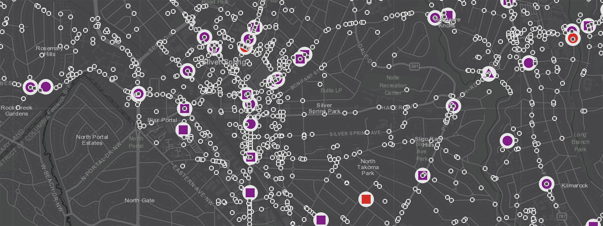
The Montgomery County Interactive Crash Map was developed by the Montgomery Planning Countywide Policy and Planning Vision Zero team. The map displays Montgomery County crashes to allow users to understand crash trends by neighborhood. The data begins in 2015 and is updated weekly.
Montgomery Planning has a strong commitment to supporting Montgomery County’s Vision Zero commitment – which seeks to eliminate transportation fatalities and serious injuries by 2030. To achieve this ambitious goal, it’s important to first understand the county’s crash history and conditions that lead to incidents on our roadways. The crash data has informed Montgomery County’s Vision Zero priorities. This map visualizes and provides justification for Montgomery Planning safety priorities.
The map’s data is from the Montgomery County Vision Zero crash data and has been modified by Montgomery Planning staff to more accurately depict crash locations and to simplify and consolidate some of the crash attributes.
View the Interactive Crash Map
How to use the Map
- The map is best viewed in Google Chrome and should be viewed on a desktop (rather than a mobile device).
- Watch the short map tutorial video to see features of the map.
- After launching the map, users can pan or zoom to their area of interest. The three panels to the right of the map update based on the map view.
- Users can isolate specific crash types using the middle panel to the left of the map.
- Applying the tool in the bottom panel to the left of the map. users can select and download the attributes and locations of crashes of interest.
- A serious injury is defined as severe lacerations, a broken leg or arm, significant burns, suspected internal injuries, unconsciousness, or paralysis.
Key Findings
- Most serious injuries and fatalities are located along the county’s arterials, such as Georgia Avenue, Old Georgetown Road, and Veirs Mill Road.
- While bicycle and pedestrian crashes are less frequent than motor vehicle crashes, they are more likely to result in a serious injury or fatality.