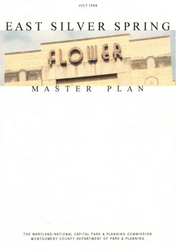
Approved and Adopted 2000
View the East Silver Spring Master Plan (2000) [pdf, 5 MB]

The complete document is represented by the index below:
- Table of Contents
- Plan Highlights
- Overview
- Community Preservation, Stability, and Character
- Commercial Centers
- Community Facilities, Parks, and Environmental Resources
- Neighborhood-Friendly Circulation
- Overview
- Plan Introduction
- Planning Context
- The Role of a Master Plan
- The Master Planning Process
- Relationship to Other Plans
- Outreach Program
- Overarching Issues
- Next Steps
- Plan Recommendations
- Introduction to Plan Recommendations
- Community Preservation, Stability, and Character
- Introduction to the Theme
- Land Use and Neighborhood Preservation
- Land Use and Zoning
- Revitalization and Diversity
- Neighborhood Protection
- Flower Avenue Neighborhood in East Silver Spring
- Fenton Street Village Neighborhood
- Piney Branch Road Site
- Historic Resources
- Commercial Centers – Character and Vitality
- Introduction to the Theme
- Commercial Revitalization
- Flower Village Center
- Clifton Park Crossroads Center
- New Hampshire Estates
- Northeast Clifton Park
- Community Facilities, Parks, and Environmental Resources
- Introduction to the Theme
- Community Facilities
- Parks and Open Space
- Stream Valley Parks
- Existing Parks
- Future Parks
- Environmental Resources
- Air Quality
- Noise
- Community Water and Sewer
- Trees and Forest Conservation
- Water Quality/Stormwater Management
- Neighborhood-Friendly Circulation Systems
- Introduction to the Theme
- Traffic Circulation
- Pedestrian System
- Master Plan Area Sidewalks and Trails
- Streetscape Treatments
- Bikeway System
- Public Transportation
- Plan Implementation
- Zoning
- Sectional Map Amendment
- Zoning Ordinance Text Amendments
- Interjurisdictional Coordination
- Historic Preservation
- Annual Growth Policy
- Framework for Action
- Zoning
Appendices
- Existing Land Use*
- Zoning*
- Selected Terminology
- Historic Resources Designation*
- Historic Preservation Designation Criteria
- Implementation of the Master Plan for Historic Preservation
- History of East Silver Spring
- Environmental Discussion of Policies and Regulations*
- Trees and Forest Conservation
- Water Quality and Stormwater Management
- Bikeway Plan – Detailed Recommendations*
- Silver Spring/Takoma Park Transportation and Circulation Report, M-NCPPC, August 1999
- County Council Resolution to Approve Plan
- M-NCPPC Resolution to Adopt Plan
*These actions are incorporated by reference in the Master Plan.
Background Supplements
- Glossary of Planning Terms, M-NCPPC, 1994
- Purpose and Outreach Strategy Report, East Silver Spring Master Plan, M-NCPPC, July 1998
- Commercial Economic Health Assessment, Takoma Park and East Silver Spring, M-NCPPC, May 1998
- An Assessment of Housing and Resident Population in East Silver Spring and Takoma Park, M-NCPPC, February 1999
- Proposed Urban Park and Open Space Concept for Silver Spring and Takoma Park, M-NCPPC, 1997
- Countywide Park Trails Plan, July 1998
- Pedestrian Routes and Bikeways Supplement to East Silver Spring and Takoma Park Master Plans, Preliminary Study, 2001Introduction
Background Supplements are offered separately from the information section by The Maryland-National Capital Park and Planning Commission at 8787 Georgia Avenue, Silver Spring, Maryland
Maps (incorporated into their respective sections)
- Overall Master Plan Concept
- Areas Recommended for Zoning Changes
- Silver Spring/Takoma Park Master Plan Area
- East Silver Spring Land Use
- East Silver Spring Zoning
Community Preservation, Stability, and Character
- Community Preservation, Stability, and Character
- Location of Multifamily Properties
Commercial Centers
- Commercial and Institutional Centers
- Flower Village and Clifton Park Crossroads Centers
Community Facilities, Parks, and Open Space
- Community Facilities and Parks
- Existing Community Facilities
- Existing Parkland
- Urban Forestry Concept
Neighborhood-Friendly Circulation
- Neighborhood-Friendly Circulation
- Road Classifications
- Forecast Intersection Congestion
- Pedestrian System-Framework
- Bikeway System-Framework
- Fenton Street and Metropolitan Branch Trail Alignment at Montgomery College
- Existing and Potential Transit Routes
Appendix A – Land Use
- Existing Land Use – Area A
- Existing Land Use – Area B
- Existing Land Use – Area C
- Existing Land Use – Area D
- Existing Land Use – Area E
- Existing Land Use – Area F
- Existing Land Use – Area G
- Existing Land Use – Area H
- Existing Land Use – Area I
- Existing Land Use – Area J
- Existing Land Use – Area K
- Existing Land Use – Area L
- Existing Land Use – Area M
- Existing Land Use – Area N
Appendix B – Zoning
- Existing Zoning – Area A
- Existing Zoning – Area B
- Existing Zoning – Area C
- Existing Zoning – Area D
- Existing Zoning – Area E
- Existing Zoning – Area F
- Existing Zoning – Area G
- Existing Zoning – Area H
- Existing Zoning – Area I
- Proposed Zoning – Area I
- Existing Zoning – Area J
- Proposed Zoning – Area J
- Existing Zoning – Area K
- Existing Zoning – Area L
- Existing Zoning – Area M
- Existing Zoning – Area N
Appendix F – Bikeway Plan
- Bikeway System – Framework – Types of Bikeways
- Bikeway System – Framework – Existing & Proposed
List of Figures (incorporated into their respective sections)
- The Master Plan Process in Brief
- Flower Village Center Illustrations of Street-Oriented Development along Flower Avenue
- University Boulevard and New Hampshire Avenue Streetscape Concept
- Piney Branch Road and Carroll Avenue Streetscape Concept
- Flower Avenue Streetscape Concept
- Arliss Street Section Concept
- Arliss Street-Flower Village Center