Biennial report shows an average commute time of 33 minutes, 17 miles of new bike facilities added, and over 200 Right Turn on Red prohibition signs installed in urban core areas
Wheaton, Md. – The Montgomery County Planning Department, part of The Maryland-National Capital Park and Planning Commission, presented the 2025 Travel Monitoring Report to the Montgomery County Planning Board at its meeting on December 4. The biennial report provides insight into how well the county is meeting its transportation goals, objectives, and metrics defined in Thrive Montgomery 2050, Montgomery County’s General Plan, and Functional Plans such as the Bicycle Master Plan and the Pedestrian Master Plan.
“The 2025 Travel Monitoring Report shows that Montgomery County residents are embracing more sustainable and people-centered ways of getting around,” said Montgomery Planning Director Jason Sartori. “As the county continues to invest in walking, biking, and transit infrastructure, and to pursue policies that make our roads safer for all users, we’re not just improving mobility, we’re advancing equity, public health, and environmental resilience.”
The report serves as a compilation of the Planning Department’s transportation monitoring efforts. This year’s report explores and leverages new transportation datasets and analytical tools as the county strives to create a more balanced, accessible and safer transportation system. The report also provides a platform for offering recommendations to address some of the challenges that have arisen since the approval of the various master plans along with guidance on how to proceed over the next few years.
Montgomery Planning staff collected and analyzed data from various sources including Maryland State Highway Administration, INRIX Probe Data Suite, Metropolitan Washington Council of Governments regional travel survey, and from the Department’s own Multimodal Geographic Information Systems database. Where available, data cover the period beginning on December 31, 2022, and ending on December 31, 2024.
Key Findings of the 2025 Travel Monitoring Report:
Travel & Commuting Trends
- There was a returned demand for auto travel in 2023 as residents drove an average of 6,901 miles per person, rebounding from a low of 6,172 miles per person in 2020. Still, travel remained below the pre-COVID-19 pandemic peak of 7,493 miles per person in 2019.
- The percentage of people who worked from home in 2023 was nearly 20% higher than in 2019, prior to the COVID-19 pandemic. The number of people traveling to work who use a mode other than driving alone increased by 11% over the same period.
- In 2023, the average commute time was 33 minutes one-way for all modes of transportation, including driving, carpooling, and public transit. This is a slight decline from an average of 35 minutes in 2019. The average delay for public transit via bus continues to be longer than that of cars by around 16 minutes, reaching 49 minutes per commute in 2023.
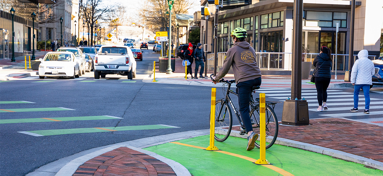
Bicycle Trends & Survey Results
- More than 17 miles of bike facilities were built or were under construction between 2022 and 2024. Projects included sidepaths, separated bike lanes (such as those on Old Georgetown Road), off-street trails (largely the Capital Crescent Trail) and neighborhood connectors.
- The 2024 Pedestrian and Bicycle Survey results show county residents are largely uncomfortable walking, rolling, or riding in their neighborhoods and expressed dissatisfaction with vehicle speed along a roadway (42%), drivers not stopping for pedestrians in a crosswalk (32%), and drivers cutting across a sidewalk while a pedestrian was in it (42%). The top concerns of cyclists included vehicle speed along bike routes (53%), the distance between cars and cyclists on busy streets (48%), and lack of quality bikeways on their route (48%). The survey ran from October to November 2024, and a total of 1,244 respondents completed the survey.
Pedestrian Safety & Comfort Trends
- As of September 2025, over 200 Right Turn on Red prohibition signs were installed in high-density downtown areas, including Bethesda, Friendship Heights, Silver Spring and Wheaton, as well as town centers in Germantown, Glenmont, Twinbrook and White Flint. In addition, Leading Pedestrian Intervals were established at County-controlled intersections in Downtowns and Town Centers to allow residents to begin crossing an intersection at least 3 seconds before the light switches for vehicle traffic.
- Sixty three percent of pathways, such as sidewalks or trails, provide a comfortable walking or rolling experience for pedestrians, according to an analysis of existing conditions in December 2024. This is an increase of 2% from December 2022. Locations where residents cross the road, including those with and without stop signs or traffic signals, received a 23% comfortable rating in 2023, increasing from 22% in 2022. The Pedestrian Level of Comfort methodology used to conduct this analysis is based on factors such as traffic speed and number of lanes and buffers between pathways and a street.
- In 2024, 65 pedestrians were severely injured or fatally struck by a vehicle, a decrease from 84 pedestrians in 2022.
The report is produced by Montgomery Planning’s Transportation Planning Division’s Travel Forecasting and Travel Monitoring Group. This group is tasked with providing technical support for planning efforts at all scales including countywide functional plans, area master plans, and development review. The group performs travel demand forecasting and monitoring of performance-related metrics defined and tracked by Montgomery Planning.