
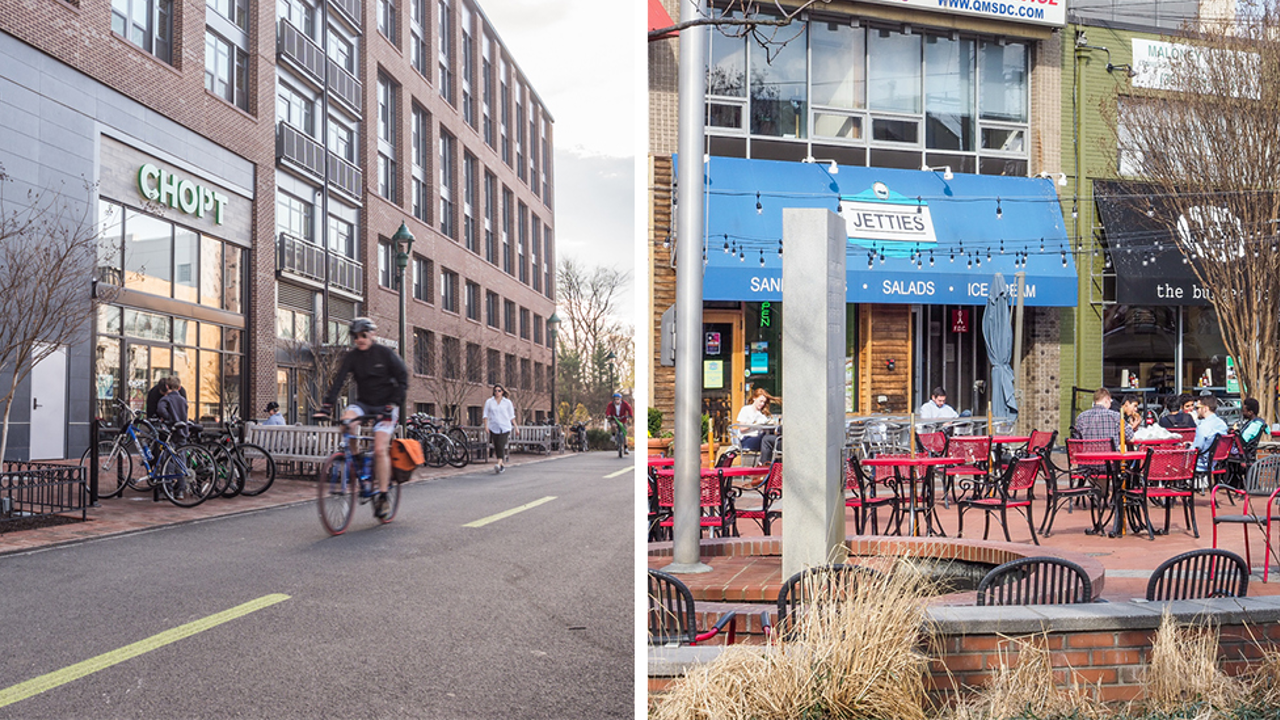
Background
The 2017 Approved and Adopted Bethesda Downtown Sector Plan is being implemented through focused coordination between public and private interests. The Plan’s vision stems from the goals and recommendations within this Sector Plan to enhance Downtown Bethesda over the next 20 years. The aim of the Plan is to achieve a truly sustainable downtown by focusing on components that will bolster the elements in most need of enhancement including increased Parks and Open Space, affordable housing, environmental innovation, economic competitiveness and design excellence. The Plan’s vision will be implemented through various actions, including zoning, a park impact payment, and annual monitoring and reporting.
The Sector Plan recommends the creation of the Bethesda Overlay Zone. The County Council, through Zoning Text Amendment 16-20, Ordinance No. 18-28, adopted the Bethesda Overlay Zone in July 2017 to implement the recommendations of the Bethesda Downtown Plan as it relates to density, building heights, affordable housing goals, parks and open space and design.
To better implement the recommendations of the Bethesda Downtown Sector Plan, Bethesda Overlay Zone and Design Guidelines, and to ensure transparency and accountability in the implementation of the Sector Plan, the Planning Department has been preparing numerous implementation tools, such as the Monitoring and Tracking Program, to aid applicants, the Planning Board, planning staff and the public in maintaining the objectives of the Sector Plan, Design Guidelines and the Bethesda Overlay Zone. Other resources will include; Implementation Guidelines and the Annual Monitoring Report that are currently under development.
2024 Update
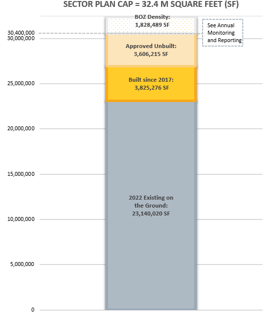
The Sector Plan states: “Once total development-including approvals reaches 30.4 million square feet, the County Council may require certain actions before additional development is permitted” (page 151). The Planning Board approved a Site Plan in September 2023 that increased total development above 30.4 million square feet. In response to this Sector Plan recommendation, the Planning Board may provide to the County Council comments and/or recommendations for next steps, based on Staff recommendations and public comment.
On September 28, 2023, Planning staff briefed the Planning Board on its assessment of the Sector Plan’s implementation and recommendations for next steps. On October 6, 2023, Planning staff met with the Bethesda Downtown Plan Implementation Advisory Committee (IAC) to hear their thoughts and concerns and discuss potential next steps. On October 12, 2023, the Planning Board heard testimony from representatives of the IAC, the Town of Chevy Chase, and the development and resident communities.
In consideration of the Planning staff briefing, public testimony and other feedback, the Planning Board has included in the Planning Department’s draft FY25 work program a Minor Master Plan Amendment for the Bethesda Downtown Plan to address implementation issues, and on January 18, 2024, recommended to the County Council to defer further action until its completion. The County Council will be taking up the Planning Department’s budget and work program this spring.
Monitoring and Tracking Program
Purpose

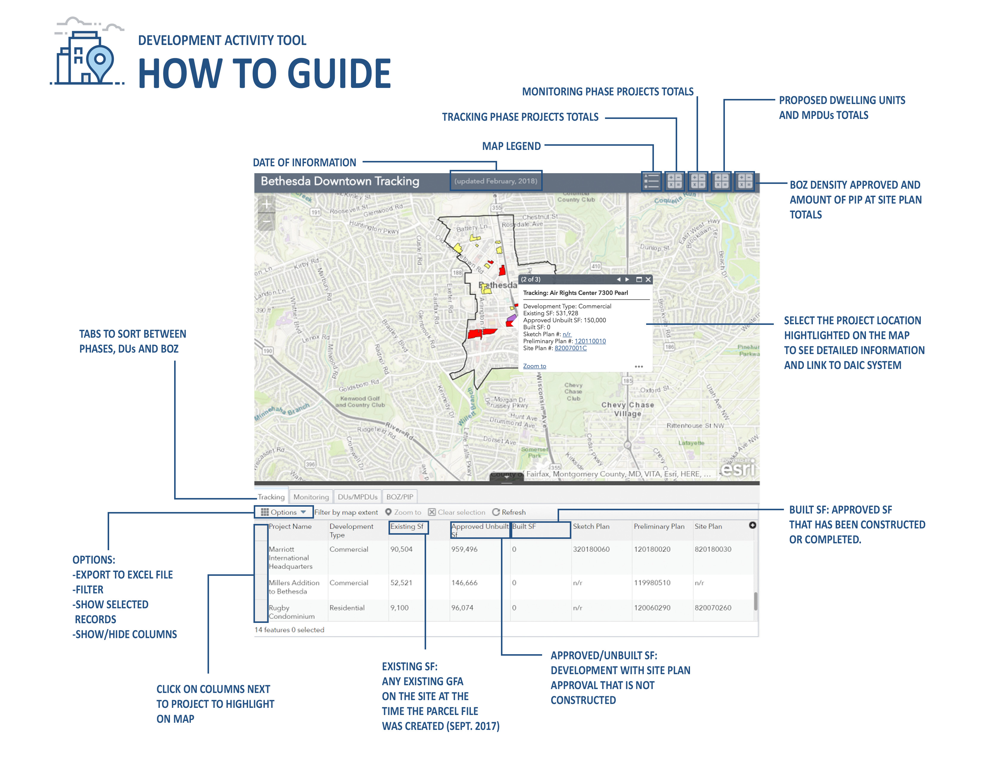
The Monitoring and Tracking Program is an online tool that will monitor proposed development and track the approved square footage (SF) in downtown Bethesda against the overall cap on development set forth in the Bethesda Overlay Zone. The information and data from this online tool will be used in reporting to the Planning Board and in developing the annual monitoring and reporting document. Scroll down to view the Monitoring and Tracking tool.
Learn more in the Bethesda Downtown Sector Plan Implementation Guidelines (Click here to view the latest Implementation Guidelines).
Definitions
Bethesda Overlay Zone (BOZ)
The BOZ is intended to implement the recommendations of the Bethesda Downtown Plan as it relates to density, building heights, affordable housing, parks and open space and design.
Cap (Maximum) on Development
The BOZ sets a cap on development to ensure that total density in the Plan Area, including existing, approved and new development (including affordable housing), does not exceed 32.4 million square feet of gross floor area.
Existing on the Ground Development
Existing on the ground development are buildings that are fully constructed and occupied. The existing on the ground development as of August 2017 is 23.3 million square feet. This includes approved projects from the February 2017 development pipeline that were under construction at the time of the analysis.
The updated parcel file methodology can be viewed here: Parcel File Methodology.
The parcel file web map can be viewed here: http://arcg.is/H8Hfb
The parcel file attribute table from the web map can be viewed here: Parcel file web map__AttributeTable
For questions regarding the parcel file web map please contact Lisa Govoni at 301-650-5624.
Approved Unbuilt Development
All development with a Site Plan or Preliminary Plan approval that is not constructed (development pipeline). Based on the February 2017 pipeline and reported quarterly. These projects are listed in the Tracking table below.
BOZ Density*
BOZ Density means the total square footage of gross floor area a project may cumulatively exceed the maximum square footage of gross floor area allowed under the mapped CR and CRT zones.
*This number may fluctuate based on projects that expire.
Park Impact Payment (PIP)
The Park Impact Payment (PIP) is a fund that will help to implement the Sector Plan’s recommendations for new Parks in Downtown Bethesda. The payment is at a rate of $12.49 per square foot of approved BOZ Density. If a project provides at least 25% MPDUs, a Park Impact Payment is not required for any residential gross floor area.
Development Activity
Development Activity includes two phases. Projects are either in the monitoring phase or the tracking phase as described below. Click here for a “How to Guide“ on using the interactive tables and map below.
Monitoring
Projects in the monitoring phase are those applications for development that have been submitted to and received by M-NCPPC/Planning Department for Concept or Sketch Plan review, and do not have a Preliminary or Site Plan approval, when subdivision staging is evaluated.
The overall density/development square footage that the project is requesting is being monitored but is not being counted against the overall Plan cap at this point.
Once applications for development have a final approval (Preliminary Plan and/or Site Plan), they move onto the development pipeline as approved projects (Tracking Phase).
Note: The monitoring chart below may include projects with previously approved development that was not built. These projects will have a preliminary and/or site plan approval for proposed development that predates the 2017 Bethesda Downtown Sector Plan. These projects may be amended under the current Sector Plan. The development square footage associated with any prior approval will be accounted for in the “Approved Unbuilt” column.
Tracking
Projects in the tracking phase are those applications for development that have a final Site Plan approval (if a Site Plan is not required, then Preliminary Plan or building permit).
These projects and the development square footage associated with them are tracked and reported against the overall Plan Cap ( See review Process).
Click here for the full-screen version
BOZ Density Tracking Tool
Regulatory Review Process
To ensure that the development cap (32.4 M SF) in downtown Bethesda is not exceeded, Planning staff will use this online tool to track and report the development data for each project to the Planning Board.
This includes specific data such as:
- Project base and proposed density
- Amount of BOZ Density requested by project
- Amount of Park Impact Payment (PIP) being paid
- Number of MPDUs (if applicable)
- Residential Square Footage and Number of Dwelling Units (if applicable)
- Total density allocated by the Planning Board at Site Plan
- Remaining density available based on Site Plan Allocations/approvals
For questions regarding the regulatory process and/or current development applications please contact Stephanie Dickel at 301-495-4527.
Annual Monitoring and Reporting
Schools
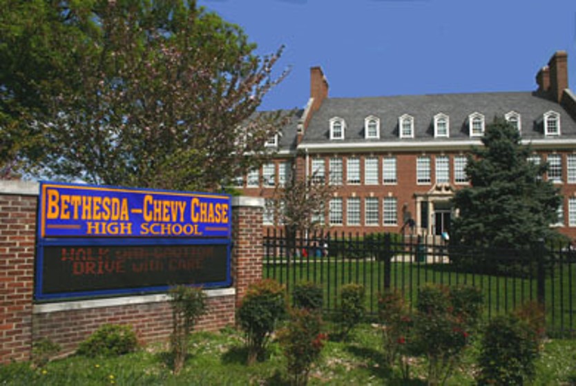
Appropriate solutions to the Plan’s potential enrollment impacts need to consider the potential full residential buildout of the Bethesda Downtown Plan as well as other sector plans on the B-CC Cluster. To provide timely information on the potential impacts, Planning staff will provide annual monitoring by updating the buildout enrollment forecast for the B-CC Cluster. This report will be provided to the Planning Board and County Council and will identify any concerns and potential solutions.
Parks
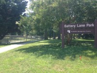
As part of the overarching goal of the Plan to include new civic greens, enhance and expand existing parks and open space and to increase the amount of new urban parks in the Downtown, Planning Staff will provide an annual report on the progress of implementing parks and open space recommended in the sector plan. This report will provide an inventory to monitor the implementation of new and expanded parks and open space and will be provided to the Planning Board and County Council for their review. The report will also track funds associated with the Park Impact Payment or any other funding source associated with Park acquisition and implementation.
Transportation

Planning staff will model and monitor critical intersections within the Downtown Bethesda vicinity, including the gateway intersections located in the Bethesda-Chevy Chase Master Plan area, as well as the Non-Auto Driver Mode Share (NADMS) for both employees and residents within the Downtown Bethesda area. Although transportation monitoring will be reported to the Planning Board on an annual basis, data would be collected in alternating years such that year one of the program analyzes intersection performance through the Highway Capacity Manual (HCM) methodology and year two analyzes Non-Auto Driver Mode Share.
- Annual Monitoring Report #1 – BDP Annual Monitoring Report May 2018
- Annual Monitoring Report #2 – BDP Annual Monitoring Report May 2019
- Annual Monitoring Report #3 – BDP Annual Monitoring Report May 2020
- Annual Monitoring Report #4 – BDP Annual Monitoring Report June 2021
- Annual Monitoring Report #5 – BDP Annual Monitoring Report July 2022
- Annual Monitoring Report #6 – BDP Annual Monitoring Report July 2023
Implementation Contact
Stephanie Dickel
301-495-4527
Email