This blog is also published as a Greater Greater Washington guest column.
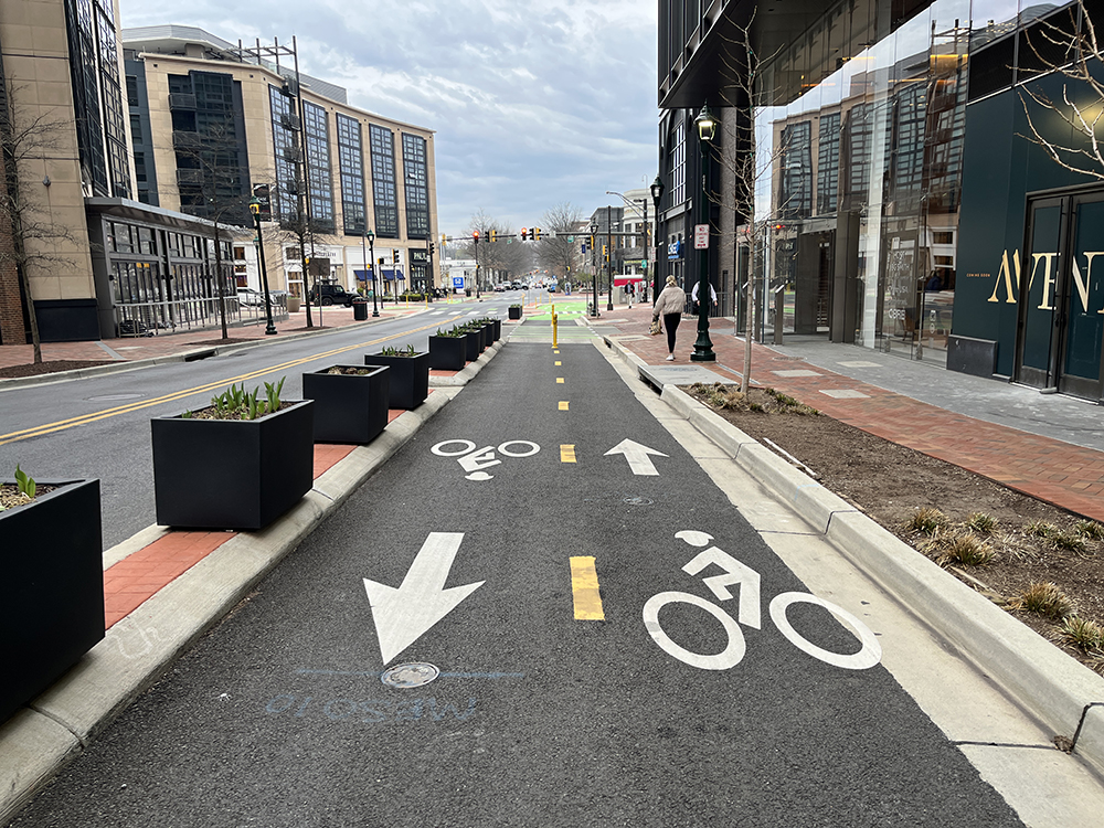
Protected bike lanes in downtown Bethesda and in many areas of Montgomery County reflect the growing demand for more transportation options in the 21st century.
Montgomery County has long been a great place to work, live, learn, and visit—and our transportation choices affect every aspect of our daily life.
As the 21st century unfolded, Montgomery County has seen a growing demand for diverse transportation options and a shift away from the low-density, car-centric development that followed World War II. Over the past 15 years, the county has refocused to prioritize mixed-use developments, pedestrian- and bicycle-friendly infrastructure, enhanced public transit, and creating vibrant, walkable communities.
Today, Montgomery Planning’s recommendations emphasize a multi-modal future where residents have a meaningful range of safe, convenient, and efficient transportation choices.
What we’ve done
2013’s Countywide Transit Corridors Functional Plan recommended adding over 100 miles of new bus transitways. Implementation has included the state’s converting existing lanes into dedicated bus lanes on several key corridors, and Phase 1 of the U.S. Route 29 Bus Rapid Transit (BRT) project opened in 2021. The county is also working with the Federal Transit Administration to add BRT to Veirs Mill Road and MD 355.
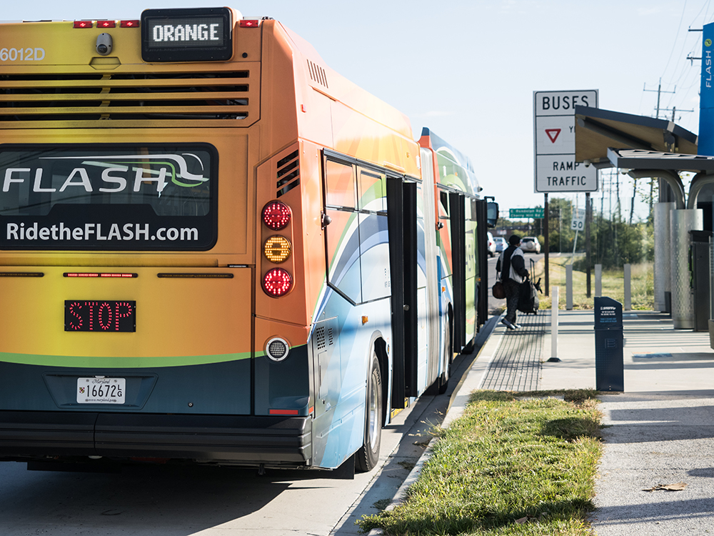
Phase 1 of the U.S. Route 29 FLASH bus rapid transit (BRT) line currently operates between Burtonsville and Silver Spring.
2014’s Bicycle and Pedestrian Priority Areas (BiPPA) program defined geographical areas for enhanced bicycle and pedestrian safety; the program has since funded more than $25 million of pedestrian and bicycle infrastructure around Metro stations and the Maryland Transit Administration’s Purple Line stations and along Bus Rapid Transit corridors.
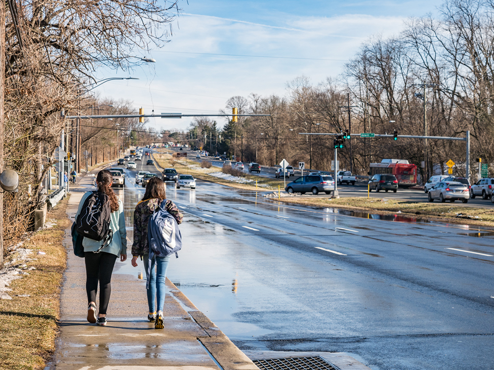
2016’s Vision Zero commitment made Montgomery County among the first in the nation to pledge to eliminate fatalities and severe injuries among pedestrians and bicyclists by 2030 by prioritizing changes to suburban arterial roads, which account for just 10% of the county’s roadway miles but 56% of serious incidents, which disproportionately affect Black and Hispanic victims.
2016’s Bicycle Level of Traffic Stress Map depicts road-by-road bicycling conditions to help planners and government decision-makers identify where to invest to reduce stressful bicycling trips. For instance, even dedicated bike lanes on an arterial road can prove high stress when located next to fast-moving vehicles or parked cars where someone inside could open a door without much warning.
2018’s Bicycle Master Plan recommended a countywide network of 1,200 miles of lower-stress bikeways, secure bicycle parking stations at transit stations, and other safety and access improvements for bicycling in the county. Since plan approval, almost 32 miles of new bikeways have been constructed.
2019’s Veirs Mill Corridor Master Plan, Montgomery Planning’s first applying a Vision Zero lens, calls for continuous sidewalks, additional protected crossings, reduced speeds, and the eventual transformation of this four-mile stretch into a multi-modal “complete street.”
2020’s Pedestrian Level of Comfort Map, like its bicycle counterpart, analyzes streets, sidewalks, and crossings to evaluate capital projects and to guide safety and mitigation requirements for development projects.
Georgia Avenue in Aspen Hill, Md.
2020’s Growth and Infrastructure Policy (GIP) update introduced requirements for development projects to comply with county targets for pedestrian and cyclist comfort levels—the first time Montgomery County required this from developers. The Montgomery County Planning Board has since approved 18 plans with more than $10 million in mitigations, including 8,000+ feet of sidewalks, 3,800 feet of protected bike lanes, 31 ADA-compliant curb ramps, and three traffic signals.
2021’s Complete Streets Design Guide organized county streets by land use and function to create an innovative framework for determining target speeds, rights of way, widths of lanes and sidewalks, intersection treatments, and more. Check out a series of videos that explains how the different street types are classified.
2022’s Thrive Montgomery 2050 is the county’s new General Plan, and its transportation policies prioritize concentrated growth in centers of activity and along corridors; development of a safe, comfortable and appealing network for walking, biking, and rolling; building of a frequent, fast, convenient, reliable, safe, and accessible transit system; and reducing reliance on cars.
2023’s Pedestrian Master Plan includes 100+ design, policy, and programming recommendations, including crossings that “eliminate the need to press a button”; pivoting the sidewalk maintenance program into an equitable, proactive, data-driven process; providing public seating, restrooms, and other pedestrian amenities in high-traffic areas; and developing street lighting standards. Implementation has included:
- The County Council’s Safe Streets Act requires the county to install leading pedestrian intervals and “No Right Turn on Red” signage in about 100 locations.
- MCDOT published its Accessible Design Guide in 2024, which centralized accessibility requirements, recommendations, and best practices to advance Pedestrian Master Plan
- Montgomery Planning and MCDOT updated the county’s streetlighting requirements to ensure that entire roadways are well-lit, and all users can see and be seen.
Looking ahead
Three overarching areas still need to be addressed when it comes to transportation:
Slow down: Suburban arterial roads—high-capacity roads that connect local roads to highways and other major roads—need posted speed limits below the typical 40–50 miles per hour, given that actual travel speeds trend higher.
Safe crossings, sidewalks, and lanes: Protected crossings for pedestrians and bicyclists need more frequent spacing on both sides of major roads, and sufficient separation will better protect pedestrians and bicyclists on sidewalks and in designated lanes.
Update corridor land uses: Reenvision land uses along transit corridors to support transit ridership and improve safety.
It took more than 50 years to create Montgomery County’s auto-centric transportation network, and it may take even longer to achieve our vision of a countywide multi-modal network—but we’ve laid a meaningful foundation for our emerging pedestrian, bicycle, and transit systems in just over a decade. That’s not by accident: Planning leadership, intragovernmental partnerships, high-quality data, strong community connections, and effective implementation by the county and state have made this transformation possible, and they will bolster its continuation.

About the author
David Anspacher is the Division Chief for Montgomery Planning’s Countywide Planning and Policy Division. In this role, he oversees transportation planning, historic preservation, growth policy, environmental resources, zoning and housing policy. David joined Montgomery Planning in 2009 and has led the development of the 2018 Bicycle Master Plan, was the co-project manager for the Complete Streets Design Guide and oversaw development of the 2023 Pedestrian Master Plan.
Laura Van Etten
Slow down: Suburban arterial roads—high-capacity roads that connect local roads to highways and other major roads—need posted speed limits below the typical 40–50 miles per hour, given that actual travel speeds trend higher.
Have you guys ever spoken to MCDOT about this? They follow federal guidelines which set road speeds at whatever 85 percent of the drivers are going. When they do a speed study that finds that drivers are exceeding the posted speed limit, they will not lower speeds because it will just cause more people to be breaking the law.