guest post by Larry Cole
On April 24, the Prince George’s County Council passed a law that requires developers to make improvements for pedestrians and bicyclists to ensure adequate public pedestrian and bikeway facilities in County Centers and Corridors.
The Washington Post article, “Prince George’s Backs Plan to ease the way of pedestrians and cyclists,” on this progressive measure, however, does not fully portray similar measures already in place in Montgomery County to improve the environment for pedestrians, bicyclists, transit riders and trail users. Montgomery County has had similar requirements for developers for almost a decade, and has moved on multiple fronts to further strengthen measures to achieve a pedestrian, bicyclist, and transit-friendly and accessible environment.
With each application considered by the Planning Board, developers must submit counts of vehicles, bicylists and pedestrians at each intersection in the affected area. The counts and the identification of deficiencies in the area may trigger a requirement that developers pay for substantial transportation improvements, such as sidewalks, bikeways and trails.

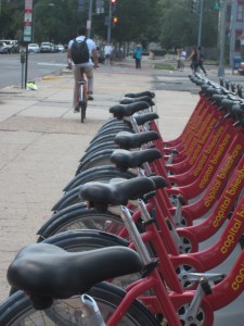
The developer of the Fenwick Station project also set aside land for Montgomery County’s first bike-sharing station, similar to the Capital Bikeshare stations in DC.
Other policies approved in the last decade also set the stage for enhanced pedestrian and cyclist use:
- In 2002, Montgomery County’s Blue Ribbon Panel on Pedestrian and Traffic Safety included a recommendation for a Pedestrian Impact Statement in its final report. Two years later, the County began requiring that Pedestrian Impact Statements be submitted as part of the traffic studies for development applications requiring Planning Board approval. The pedestrian impact reports were codified in the Local Area Transportation Review and Policy Area Mobility Review Guidelines that accompany each development application, as well as bicyclist accommodations.
- In 2007, the County required that the statement be submitted for all County-funded projects.
Montgomery County’s creation of the Pedestrian Impact Statement is cited by several organizations and publications as a contributor to improving public health:
- By the Active Living Network as a model practice on their website.
- In a technical report on public health by the Centers for Disease Control
- In a technical paper entitled “Trimming Maryland’s Waistline” that recommended that all Maryland counties follow Montgomery County’s lead and require developers to submit impact statements
- In the 2005 book Building Healthy Cities – Legal Frameworks and Considerations by Wendy C. Perdue
We’ve seen the payoff here in Montgomery County. Recent examples include the Montgomery General Hospital expansion project in Olney, Fenwick Station residential development in Silver Spring, Falkland North mixed-use development in Silver Spring, and Woodmont 7200 development in Bethesda. The developer of the Fenwick Station project set aside land for Montgomery County’s first bike-sharing station, similar to the Capital Bikeshare stations in DC. In addition, another developer will be contributing almost $200,000 toward the design and construction of the County’s first stand-alone bike station in Gene Lynch Urban Park, where bike owners will be able to leave their bikes in a secure facility adjacent to the Silver Spring Transit Center. The bike station may include additional amenities such as repair facilities.
Chapter 49 of the Montgomery County Code (the Road Code), which governs the classification, design, and construction of roads in the county, as well as use of the public right-of-way, was revised in 2007 to promote pedestrian and bicycle safety and accommodation and to make our roads more environmentally friendly. Executive Regulations were developed the following year to translate the law’s requirements into standards that would be used to design and construct these roads. This Complete Streets effort is continuing via a collaborative process between the Planning Department and County Executive agencies.
Last but not least, Montgomery County also has worked with the Maryland State Highway Administration (SHA) to ensure that those areas where we have the most pedestrians and bicyclists are designed to accommodate them safely. The White Flint Sector Plan area was approved by SHA on January 31, 2011 as Maryland’s first Bicycle-Pedestrian Priority Area (BPPA). This designation requires SHA to consider changes to the location, construction, geometrics, design, and maintenance of the State highway system to increase safety and access for bicycle and pedestrian traffic in the BPPA, and to consider the use of various traffic control devices to further those goals. SHA is already working on a plan of pedestrian and bicyclist improvements for this area and expects to complete this plan shortly.
In the last few weeks, Montgomery County has designated two additional areas as BPPAs – Takoma-Langley Crossroads and Wheaton – in the Sector Plans for those areas, which now await SHA approval.
We also will include many additional BPPAs around existing and proposed transit stations in the staff draft of the Countywide Transit Corridors Functional Master Plan, anticipated to be reviewed by the Planning Board later this year. The plans and guidelines that SHA prepares for BPPAs will be incorporated into the recommended pedestrian and bicyclist improvements required of developers who work in these areas.
We’re glad that Prince George’s County has taken this important step and look forward to working together to make sure our shared goal of improved accommodation and safety for bicyclists and pedestrians is achieved.
Cherian Eapen and Ed Axler contributed to this post.

Ian Cooper
I just hope that whatever ‘improvements’ that are installed don’t include bike lanes. Current law in MD requires cyclists to ride in bike lanes if they are present, and sadly, most transportation engineers seem to know nothing about cyclist safety, and as a result, bike lanes are painted in the most unsafe and stupid way. Let’s not forget that Montgomery County is host to what has been described as “The stupidest bike lane in America” – this bike lane was about ten feet long and led onto a curb. It was recently re-engineered so that it is longer and avoids the curb, but now it has a sharp turn that endangers cyclists and is in the door zone of parked cars along almost its entire length. Door zone bike lanes kill cyclists every year.
Until transportation engineers get a clue as to what is safe (and, more to the point, what is unsafe) for cyclists, and as long as we are forced by law to use their shoddy, half-baked and suicidal facilities, I cannot support bike infrastructure, and I urge other cyclists to adopt a similarly critical policy.
Bob
The people painting the lines don’t seem to know a whole lot about safety for drivers and people getting out of parked cars either. For example on westbound Spring Street between First and Second Avenues, the street has a grass median and then the travel lane is very wide and there is also a lane for parking. They painted a yellow line that attempts to make the median maybe 8 feet wider into the pavement and force drivers right next to the parked cars — where if someone opens a door to get out of a car there would be an accident and maybe a death. It makes riding a bicycle on Spring Street a lot less safe, too. Fortunately most drivers seem to realize that it is a lot safer to simply ignore the yellow line that that attempts to widen the median and move traffic to the right.