By James Lee and Benjamin Kraft
Latest data reflect county’s status as a populous, maturing suburb
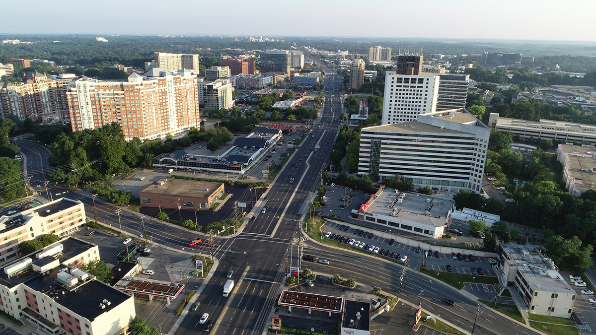
Aerial view of White Flint/North Bethesda in Montgomery County
Montgomery Planning’s Research and Strategic Projects (RSP) Division is responsible for developing Montgomery County’s long-range forecasts for employment, population, and households as part of the Metropolitan Washington Council of Government’s (MWCOG) Cooperative Forecast Program. The Round 10 forecast was recently completed, and new numbers show over the next 30 years the county is projected to experience growth in population, households, and jobs. The growth rate, however, is estimated to be at a slower pace than previous forecasts, reflecting the county’s status as a populous, maturing suburb. The forecast estimates the county will add 143,000 jobs (up from 493,600 in 2020 to 636,500 in 2050, a 29% increase), 189,000 residents (up from 1.06 million to 1.25 million, an 18% increase), and 88,000 households (up from 386,600 to 474,300, a 23% increase) (see Figure 1).
The Round 10 forecast covers the years 2020 through 2050 and is the first round completed since the COVID-19 pandemic. Governments, private sector, and other entities use these projections for a wide range of local and regional planning activities, such as transportation, water, and air quality modeling, analyzing the effects of growth and demand for public facilities, and development of policy responses to regional issues.
Figure 1. Round 10 Forecast Totals for Montgomery County
Where will growth take place in Montgomery County?
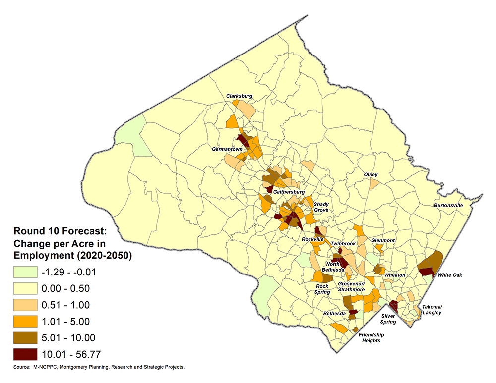
Figure 2 shows the forecasted growth in the number of jobs per acre from 2020 to 2050. (Figures are standardized on a per-acre basis as a more appropriate metric for comparing growth in different areas.) The areas forecasted to experience the most job growth are already major employment centers concentrated along major transportation corridors like the WMATA Red Line, Interstate 270, and U.S. 29. These areas include downtown Bethesda, downtown Silver Spring, White Flint/North Bethesda, the Great Seneca Science Corridor, White Oak, and Germantown, which are part of the Corridor-Focused Growth area and include large and medium activity centers as identified in the county’s General Plan, Thrive Montgomery 2050 (Thrive).
Figure 2: Round 10 Forecast Employment Growth by Traffic Analysis Zones (2020-2050)
Figures 3 and 4 show the forecasted growth in population and number of households per acre from 2020 to 2050. Areas that are forecasted to have the most growth include downtown Bethesda, downtown Silver Spring, White Flint/North Bethesda, and Grosvenor. Places with more growth in population and households also tend to coincide with many of the higher employment growth areas.
Figure 3: Round 10 Forecast Population Growth by Traffic Analysis Zones (2020-2050)
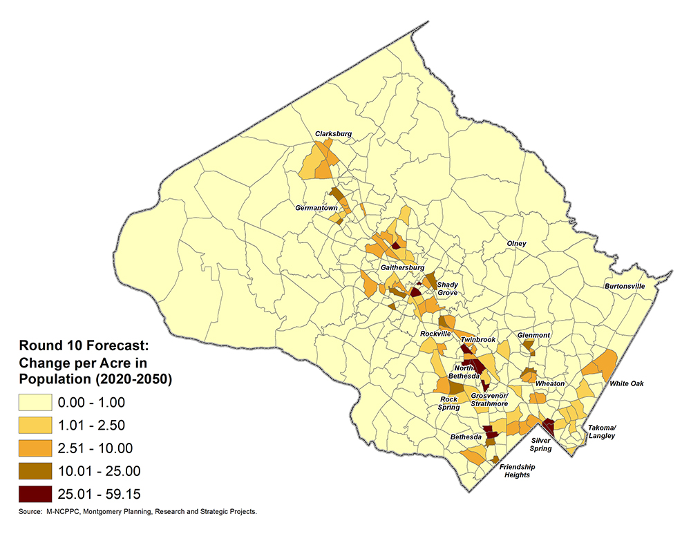
Figure 4: Round 10 Forecast Households Growth by Traffic Analysis Zones (2020-2050) 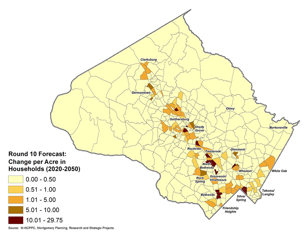
How might future growth occur in Montgomery County?
As the amount of undeveloped land available for new residential and commercial areas in Montgomery County continues to diminish, growth will increasingly come from more efficient uses of land through developing vacant parcels already served by public infrastructure (infill development) and converting existing built properties into other uses (redevelopment). Thrive directs future growth within activity centers and along our key corridors, setting the stage for more mass transit, bicycle, and pedestrian connectivity that will help support future residential growth and economic development in the county.
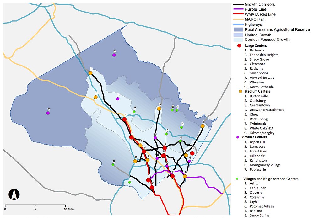
Thrive Montgomery 2050 Growth Map
However, redevelopment and growth will not happen automatically. Thrive is just one of many initiatives that provides county decision-makers with guidance on growth, re-envisions our main commercial corridors as vibrant centers for living, working, and playing, and fosters greater connectivity of workers to jobs in the county and across the metropolitan region. Transformative projects like the Purple Line and a regionwide recognition of the need to reactivate older employment centers and construct more affordable housing suggest that Montgomery County will continue to capture a sizeable share of future regional growth.
What are the regional growth expectations?

Aerial view of Montgomery County looking south to Northern Virginia.
Like the rest of the nation, the Washington, DC region’s economy suffered from the COVID-19 pandemic, which presented challenges and uncertainty for the forecasting process. However, local jurisdictions have seen jobs recover to near or above pre-pandemic levels and anticipate continued growth. From 2020 to 2050, DC-region employment is forecasted to grow by 31%, population by 25%, and households by 32%. The region’s outer suburbs (including Frederick County, Loudoun County, and Prince William County) and central jurisdictions (District of Columbia, Arlington County, and City of Alexandria) are expected to see higher growth rates (see Figure 5) than the inner suburbs, which includes Montgomery County. As the DC region continues to build out, each successive growth forecast generally shows a slower pace of growth. The MWCOG Board of Directors was briefed on the regional forecast numbers this spring and voted to adopted them in June.
Figure 5. Round 10 Forecast: Growth Rates for the Washington, DC Region, 2020-2050
More information about the forecast
Since 1975, local governments in metropolitan Washington have worked cooperatively to develop regionwide and neighborhood-level forecasts every four to five years. Interim adjustments are made as more information about demographic trends and economic conditions becomes available. In addition to developing Montgomery County’s long-range forecasts for employment, population, and households as part of MWCOG’s forecast program, Montgomery Planning works closely with the City of Gaithersburg and City of Rockville, which produce their own forecasts that are part of Montgomery County’s numbers.
For more information about the forecast numbers for Montgomery County, please visit the RSP Division’s forecasting webpage and Round 10 Forecast web map. Montgomery Planning staff provided a briefing on the Round 10 Forecast to the Planning Board on May 11, 2023 – the staff report and video for this briefing are available on the Montgomery County Planning Board’s website.
 About the authors
James Lee is the forecaster and demographic research specialist in Montgomery Planning’s Research and Strategic Projects Division. His areas of expertise include demographic analysis, census statistics, GIS data analysis, and immigration. James has a master’s degree in geography from University of Georgia and, prior to joining Montgomery Planning, was an immigration analyst for the federal government and a GIS analyst for Gwinnett County, Georgia’s planning department.

Ben Kraft is a research planner in Montgomery Planning’s Research and Strategic Projects Division. His research and planning work focuses on topics related to the economy and employment. Ben has a Ph.D. in city and regional planning from Georgia Tech and a master’s degree in urban planning from the University of Michigan.