I say brook, you say run: Waterway names vary regionally

Posted: by

Ever wondered how the names of waterways vary from state to state? An interesting map now shows the differences in waterway toponyms in the United States.

The patterns of settlement across the country give reason to the difference. From the brooks of New England and the kills of New Netherland York to the bayous of New France Louisiana and the rios of New Mexico, the variety of names adds flavor to a diverse nation.

The stark differences, especially in the Mid-Atlantic and New England show how varied the histories of those regions are, despite their size.

The map shows creeks and rivers in gray, since those names are so common nationwide. Though sometimes things get mixed up. Consider Philadelphia’s … Continue reading
Mapping Geotags: confirmation of our propensity to navel-gaze.

Posted: by

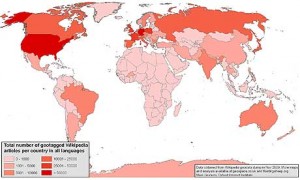
What would one notice if a map was created based on the geographical entries in Wikepedia? A confirmation that “we” [viz., the countries in dark red below] are more interested in ourselves than other places.

This may be obvious, and not necessarily self-serving, but it does point to our lack of knowledge of other places and peoples. In any event, the visualization of this information is a pointed reminder that much of the world isn’t even involved as part of the conversation on knowledge and information. If nothing else, we should remember this when we speak of “the greater good”.

More on Maps

Posted: by

One phrase in this Slate Magazine article about hand-drawn maps snagged on my brain–“ruthless editing.”

Sometimes planners love their stuff so much it’s hard to let it go. On a map about bike routes, do you need to show lot lines? Does the boundary line need to appear on every map?

We know we’ll hear what you think about our zoning recommendations, but check out our plans and tell us what you think about our maps.

Strange Maps

Posted: by

Here’s some inside baseball for you—planners love maps. Mention letraset and T-squares to older planners and they’ll start squirting tears for the good old days and bemoaning the cold computer line.

Maps, no matter how they’re made, have tremendous expressive potential and we planners argue long and hard about their content and style. Everyone has a different idea about land use colors, boundary lines, and north arrows.

Here’s someone else who cares about maps and I think two of them are of particular interest to planning in Montgomery County.

Entry 441 is a map of San Francisco’s privately-owned public open spaces (POPOS). Montgomery County has its share of these and master plans recommend more. Will these public amenities, negotiated … Continue reading