Private Project: Liberty Heights


Click thumbnails to see larger picture
Description
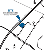
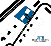
The applicant proposes to create two lots for the development of a total of two single-family detached homes. The entire 1.08-acre parcel is zoned R-200 for single-family residential development. The parcel is located on the northwest side of Liberty Heights Lane, approximately 650 feet northwest of Liberty Mill Road. The rear property line abuts Liberty Mill Road. The two subdivided single-family lots will each measure 20,000 square feet.
M-NCPPC Staff Contact
Catherine Conlon
301-495-4542
Catherine.Conlon@mncppc-mc.org
Applicant
Dung Q. Hguyen et. al.
Burgess & Niple, Inc.
Opportunity for Public Participation
Complete.
Planning Board Review Process and Case Number
Preliminary Plan No. 120060620 was approved according to Chapter 50 of the Subdivision Regulations and Chapter 59 of the Zoning Ordinance.
Planning Board Action
The Planning Board approved the project on May 18, 2006.
Notes from M-NCPPC Staff Contact
Date of last page update: January 16, 2007