Skip to content

pedestrians

Apr 26 12

MoCo Considers Cyclists and Pedestrians, too

by valerie berton

guest post by Larry Cole

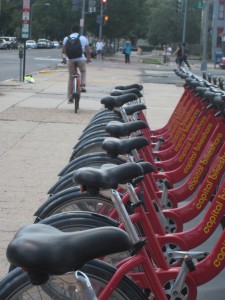
On April 24, the Prince George’s County Council passed a law that requires developers to make improvements for pedestrians and bicyclists to ensure adequate public pedestrian and bikeway facilities in County Centers and Corridors.

The Washington Post article, “Prince George’s Backs Plan to ease the way of pedestrians and cyclists,” on this progressive measure, however, does not fully portray similar measures already in place in Montgomery County to improve the environment for pedestrians, bicyclists, transit riders and trail users. Montgomery County has had similar requirements for developers for almost a decade, and has moved on multiple fronts to further strengthen measures to achieve a pedestrian, bicyclist, and transit-friendly and accessible environment.

With each application considered by the Planning Board, developers must submit counts of vehicles, bicylists and pedestrians at each intersection in the affected area. The counts and the identification of deficiencies in the area may trigger a requirement that developers pay for substantial transportation improvements, such as sidewalks, bikeways and trails.

The developer of the Fenwick Station project also set aside land for Montgomery County’s first bike-sharing station, similar to the Capital Bikeshare stations in DC.

Other policies approved in the last decade also set the stage for enhanced pedestrian and cyclist use:

  • In 2002, Montgomery County’s Blue Ribbon Panel on Pedestrian and Traffic Safety included a recommendation for a Pedestrian Impact Statement in its final report. Two years later,  the County began requiring that Pedestrian Impact Statements be submitted as part of the traffic studies for development applications requiring Planning Board approval. The pedestrian impact reports were  codified in the  Local Area Transportation Review and Policy Area Mobility Review Guidelines that accompany each development application, as well as bicyclist accommodations.
  • In 2007, the County required that the statement be submitted for all County-funded projects.

Montgomery County’s creation of the Pedestrian Impact Statement is cited by several organizations and publications as a contributor to improving public health:

  • By the Active Living Network as a model practice on their website.
  • In a technical report on public health by the Centers for Disease Control
  • In a technical paper entitled “Trimming Maryland’s Waistline” that recommended that all Maryland counties follow Montgomery County’s lead and require developers to submit impact statements
  • In the 2005 book Building Healthy Cities – Legal Frameworks and Considerations by Wendy C. Perdue

We’ve seen the payoff here in Montgomery County. Recent examples include the Montgomery General Hospital expansion project in Olney, Fenwick Station residential development in Silver Spring, Falkland North mixed-use development in Silver Spring, and Woodmont 7200 development in Bethesda. The developer of the Fenwick Station project set aside land for Montgomery County’s first bike-sharing station, similar to the Capital Bikeshare stations in DC. In addition, another developer will be contributing almost $200,000 toward the design and construction of the County’s first stand-alone bike station in Gene Lynch Urban Park, where bike owners will be able to leave their bikes in a secure facility adjacent to the Silver Spring Transit Center. The bike station may include additional amenities such as repair facilities.

Chapter 49 of the Montgomery County Code (the Road Code), which governs the classification, design, and construction of roads in the county, as well as use of the public right-of-way, was revised in 2007 to promote pedestrian and bicycle safety and accommodation and to make our roads more environmentally friendly. Executive Regulations were developed the following year to translate the law’s requirements into standards that would be used to design and construct these roads. This Complete Streets effort is continuing via a collaborative process between the Planning Department and County Executive agencies.

Downtown Silver Spring enjoys wide sidewalks that typically are filled with pedestrians.

Last but not least, Montgomery County also has worked with the Maryland State Highway Administration (SHA) to ensure that those areas where we have the most pedestrians and bicyclists are designed to accommodate them safely. The White Flint Sector Plan area was approved by SHA on January 31, 2011 as Maryland’s first Bicycle-Pedestrian Priority Area (BPPA). This designation requires SHA to consider changes to the location, construction, geometrics, design, and maintenance of the State highway system to increase safety and access for bicycle and pedestrian traffic in the BPPA, and to consider the use of various traffic control devices to further those goals. SHA is already working on a plan of pedestrian and bicyclist improvements for this area and expects to complete this plan shortly.

In the last few weeks, Montgomery County has designated two additional areas as BPPAs – Takoma-Langley Crossroads and Wheaton – in the Sector Plans for those areas, which now await SHA approval.

We also will include many additional BPPAs around existing and proposed transit stations in the staff draft of the Countywide Transit Corridors Functional Master Plan, anticipated to be reviewed by the Planning Board later this year. The plans and guidelines that SHA prepares for BPPAs will be incorporated into the recommended pedestrian and bicyclist improvements required of developers who work in these areas.

We’re glad that Prince George’s County has taken this important step and look forward to working together to make sure our shared goal of improved accommodation and safety for bicyclists and pedestrians is achieved.

 
Cherian Eapen and Ed Axler contributed to this post.

Apr 10 12

Take a Walk

by claudia kousoulas

Or try to. That’s the message of Tom Vanderbilt’s series this week on Slate about pedestrians–or without the perjorative that he points out–people walking.

He makes a point that’s long frustrated me. Sooner or later, we all walk, even if it’s only from the parking lot to the mall. Something inside us loves to stroll. What is a mall if not a re-creation of an urban boulevard and witness the success of retail neo-main streets.

But we spend so little of our time, money, and thought on establishing and securing pedestrian environments. Even the fact that I describe it as a “pedestrian environment,” as a place apart and separate, rather than woven through our lives and communties–speaks to our separation from our feet.

Check out what Vanderbilt has to say…


Nov 16 11

Planning Board to hear recommendations about Capital Crescent Trail

by Matt Johnson
Georgetown Branch Trail

Interim Georgetown Branch Trail. Photo by thecourtyard on Flickr.

As a part of the Purple Line, Montgomery County will fund upgrades to the Capital Crescent Trail between Bethesda and Silver Spring. Tomorrow, the Planning Board will hear recommendations from its transportation planning staff about several issues facing the trail. After hearing testimony, the Planning Board will send recommendations to the Montgomery County Council.

The current design from the Maryland Transit Administration includes a number of improvements to the trail. The upgraded trail will be expanded to 12 feet wide, where  feasible, and paved. Additionally, the trail will be extended from its current terminus at Lyttonsville 1.5 miles farther east to Downtown Silver Spring. New overpasses or underpasses will be provided over Connecticut Avenue, Jones Mill Road, 16th Street, and Colesville Road.

This is good news for trail users.

Planning staff is calling for the installation of lighting along the new trail from Bethesda to Silver Spring. The trail would be lit during the hours the Purple Line is open, and would allow the trail to be used safely during commuting hours. The recommendation is to design lighting so that it does not disturb neighboring properties.

Staff is also calling for emergency call boxes to be placed at intervals along the trail. This will help to promote security and reduce crime. New landscaping will help to create a pleasing trail experience and will screen trail users and neighbors from the Purple Line.

Bethesda tunnel

The Bethesda tunnel. Photo by thisisbossi on Flickr.

The most costly decision that will have to be made is whether to put the trail above the train in the tunnel under Wisconsin Avenue.  Right now, estimates place the cost of keeping the trail in the tunnel at $40.5 million, which is 43% of the cost of the entire trail. Planning staff have recommended against putting the trail in the tunnel if the price remains so high. For a fraction of that cost, the surface alignment could be significantly improved. The Planning Department is calling for more study before making a final decision.

Not having the trail in the tunnel would mean that trail users would need to cross Wisconsin Avenue at grade. If a surface alignment is chosen, the staff recommends prioritizing pedestrians and cyclists crossing Wisconsin Avenue. They recommend a working group be convened to hammer out the design details.

A surface alignment is clearly not as nice for pedestrians and cyclists because of the Wisconsin Avenue crossing. But there are plenty of ways to make the crossing of Wisconsin safe and efficient for trail users.

The Planning Department recommends that if the surface alignment is used through Bethesda, that the trail will be made as user-friendly and safe as possible. While the exact design solutions have not been determined, many solutions will be considered, including creating a bicycle/pedestrian only signal phase for crossing Wisconsin Avenue, a separated “cycle track”, raised crosswalks, and more.

Hornby Street cycle track

Above: a separated cycle track in Vancouver. Image from Paul Krueger on Flickr.

And let’s not forget that even if the tunnel under Wisconsin is lost to the Purple Line, the trail will still be vastly improved. It will be paved, bridge several major arterials where people have to cross at grade now, and extend 1.5 miles farther to downtown Silver Spring.

May 31 11

Dangerous by Design

by claudia kousoulas

No, not the bad boys your mother warned you about, but the streets you may (try to) walk along everyday.

Transportation for America’s latest report has plenty of media-catching data:

  • between 2000 and 2009 more than 47,700 pedestrians were killed in the United States, the equivalent of a jumbo jet crash every month
  • in that same time period, a pedestrian was struck by a car or truck every 7 minutes
  • while motorist deaths have dropped 27 percent in the past decade, pedestrian fatalities have fallen at only half that rate, by just over 14 percent.

But you won’t be surprised to hear that a scant fraction of federal transportation funding distributed to states for local projects is dedicated to pedestrian safety. An attitude shift needs to drive a funding shift. “Taxpayer money…should be used to build streets, roads, and highways that are safe for all users.”

Part of that attitude shift could be encouraged by viewing the transportation bill as a health bill–it affects our air quality and our ability to safely get exercise by walking more and driving less.

Of course, the most fun part of these kind of reports is seeing where we stand compared to other metro areas. The most dangerous–Orlando-Kissimmee, Florida–with a pedestrian danger index of 255.4. The D.C. metro area rated a 54.6 danger index. Not bad, but not as good as the safest metro area, Boston, with a pedestrian danger index of 21.6.

If you’re curious about just how walkable your neighborhood is, try this site.

Dec 2 10

Biking the ‘Burbs

by claudia kousoulas

According to articles in the Washington Post and the City Paper, the District’s Department of Transportation has taken big steps in making the city more bike- and pedestrian-friendly.

Barne’s dance crossings and hawk signals give pedestrians priority over cars at intersections, and out of a goal of 80 miles of bike lanes, 49 have been completed. The city’s bike-share program is an early success with residents and visitors. Residents find it easier and cheaper to pick up a bike at a corner station than owning their own and schleping it into their homes.

In fact, according to the City Paper, one of the biggest problems seems to be developing enough places to bike to. As they quoted Gabe Klein, Director of the D.C. Department of Transportation, “…the biggest obstacle to the development of a walkable, bikeable city is, in many parts of the city, a dearth of places to walk and bike to.”

Montgomery has a planning tradition of extending District patterns into the county, primarily the major avenues like Georgia, Connecticut, and Wisconsin, as well as the Rock Creek Park system. Why not extend the District’s bike routes and bike sharing program as well. How great would it be to cycle down Wisconsin from NIH to Georgetown? (I admit, the ride back uphill is more of a challenge, but hey, bike over to Foggy Bottom and Metro back.)

Extending the District’s bike services into Montgomery is a natural support for planning goals that seek to create dense, mixed-use communities at Metro stations–that is, places to walk and bike to.

Nov 5 10

Let’s Not Cross That Bridge When We Get To It

by admin

Guest Post by Alex Hutchinson

Whether it’s the Boundary Bridge that straddles Rock Creek right outside Silver Spring or the Cabin John Bridge nestled into Glen Echo, I love the bridges our region boasts.  I’m no gephyrophobiac, bridges don’t scare me one bit. But there is one bridge that makes me uneasy–and no, it’s not the Tacoma Narrows– it’s the Downtown Silver Spring Library bridge. Despite the fact the Planning Board voted 8-1 against the bridge, it has once again become part of our local discourse. Here’s why I hope this bridge wobbles into oblivion.

It’s been argued that the proposed bridge is the best and most economic way of achieving accessibility for all. Silver Spring already has a skywalk: the bridge that connects the Ellsworth Drive parking garage to City Place Mall. This post isn’t about the untapped potential of City Place, but it’s worth remembering that the skywalk never transformed City Place into the attraction of Silver Spring it was intended to be.

Skywalks, the ill-conceived circulators dreamed in an era of automobile-centric planning, aren’t necessary in the paradigm of today. In the Board’s discussion, planners made the case that the structure would divert traffic from the active sidewalks and street level retail that have come to define Downtown Silver Spring.

The bridge also would encourage library users to drive, avoiding the highlights of Silver Spring altogether. Skywalks mainly serve drivers who, at some point, leave their cars to become pedestrians. A problem associated with skywalks is the reluctance of pedestrians to use their circuitous routes and instead brave a busy road, in turn running the risk of being struck by a vehicle. Less able pedestrians— people in wheelchairs, mothers with strollers, the elderly –similarly might opt to cross the road instead of taking the elevator up to the third floor of the parking garage. While the library intersection isn’t a tranquil, one-lane country road, removing pedestrians from the equation altogether is heading in the wrong direction.

Paul Holland, of the Washington Area Wheelchair Society, is glad accessibility is being emphasized. In a recent conversation, he thought the bridge wasn’t the only option to improve accessibility for those with limited mobility. In fact, pedestrian bridges can be difficult to climb depending on the grade of the incline. He pointed  out that the steep angle of Montgomery College’s pedestrian bridge can be strenuous for non-motorized wheelchair users.

According to Holland, the most important corrections for safe intersections are sight lines, gradients, smooth surface transitions from curb to street, light-timing, and driver behavior. The $750,000 estimated cost of the bridge could be more resourcefully spent in some of these problem areas. With just $120,000, affordable alternatives could turn the intersection into something that would be accessible for everyone. 

A pedestrian bridge might look good on paper, but one alternative solution might be a Barnes Dance. This year, 7th & H streets in D.C.’s Chinatown became the proud owner of a Barnes Dance Intersection. These intersections use three traffic signal phases. In one, pedestrians cross in all directions, including diagonally. The other two let traffic go in one of the two directions, but prohibit pedestrians from crossing parallel to the traffic. However, not all intersections are created equal, and with the future Purple Line running through this area, the intersection might be too complex for this solution. In addition, teaching drivers to behave in these unaccustomed settings is easier said than done. Pedestrians and traffic officials in the district are already reporting difficulty in enforcing drivers to obey no turn on red signs. 

One only has to walk around the relocated Fenton Street Market at Veterans Plaza to see the effect of a pedestrian-friendly environment: streets and sidewalks are brimming with artists, merchants, retail, and as a result everyone is more connected to the growing exceptional architecture Silver Spring has to offer. Let’s improve on the Civic Center’s success and learn from the mistakes of City Place.

Alex Hutchinson, a Takoma Park native, is a Planning Department intern. When he’s not applying to graduate schools in Urban Planning you can find him teaching English as a second language, riding his bike on the Capital Crescent Trail, experimenting  and failing with the Ride On bus system, or making loud music. Alex became interested in the field of planning after learning about Curitiba Brazil’s Bus Rapid Transit System. If you have any questions or bones to pick please contact him at alexanderehutchinson@gmail.com

Jul 27 10

Streetscape Challenges for Planners and Users

by claudia kousoulas

This Thursday, the Planning Board will review the County’s DHCA plans to upgrade the 25-year old streetscaping along Georgia Avenue between Selim Street and Silver Spring Avenue. The goals are to meet ADA standards  and to install new soil panels that will help street trees reach full maturity.

But it’s more than a matter of setting in a few bricks and new trees. The design of the sidewalk space and its elements has to mediate among the needs of all users. Business owners want trees that don’t obscure their storefronts and signs. Curb edges and varied paving materials can hold up wheelchair users but can help blind pedestrians navigate. Agencies undertaking the work, trying to make the most out of taxpayers’ money, are looking for effective project coordination and maintenance.

The staff report’s recommendations address these sometimes conflicting needs. The proposed brick pavers will be set on a concrete base, “glued” in place with asphalt and finished with sand between the joints to create a surface with a minimal amount of heaves. It’s a technique that has worked well in the Bethesda CBD. The brick itself is has been updated by the manufacturer with a slightly rough surface that is less slippery for pedestrians but still smooth for wheels.

The new trees, American  and Lacebark Elms have proven to be hardy street trees. Their high branching pattern will keep storefronts visible and the proposed amended soil panel will give them a fighting chance to develop a full canopy.

Coordination has been extensive on this project. DHCA has worked with Silver Spring citizens, property owners and Planning staff.   The Planning Board’s review will give citizens another chance to be heard.

Apr 16 10

Rethink Infrastructure

by claudia kousoulas

At the second event of the Rethink speaker’s series, Casey Anderson of WABA and Richard Layman of Rebuilding Place in the Urban Space talked about making (or trying to make) the suburbs more bike friendly for cyclists, both commuters and recreational riders.

Anderson has interviewed 10,000 federal employees about their attitudes and experiences and found some not surprising stats—potential riders are afraid of car traffic, and some surprising ones—even those who would never consider riding a bike think it’s worthwhile to invest in bike and pedestrian infrastructure.

Anderson says the take-away for policy-makers and politicians is that this is not flaky, the community will support this investment.

Layman is seeking to make cycling “irresistible,” and emphasized that a bike-friendly cities like Portland or Amsterdam are created by “breakthrough decisions” and “incremental steps,” and that this can take 40 years. So it’s past time to start.

So rather than lamenting lost opportunities, what are the connections we can make in our plans, policies, maintenance and management structures that will build a long-term commitment to making Montgomery safely and enjoyably bike-able?

Apr 13 10

Cool Communities

by claudia kousoulas

The Coalition for Smarter Growth came out today with its Cool Communities report, that is, places that are mixed use and walkable, generating fewer auto trips and lower greenhouse gas emissions. The report has found a way to quantify diversity and local design, characteristics that are essential to community function and character, but often overlooked in more technical discussions.

Based on recommendations in the executive summary, Montgomery County seems to be doing a few things right—focusing development at Metro stations and making infill development and infill transit top priorities.

Another recommendation is to “create urban street grids” that support “walk and bicycle access to transit.” In Montgomery, all projects in most urban and suburban area include sidewalks, and outside urban areas, projects on transit routes also include sidewalks, whether they are requirements of private development or part of public projects.

It’s more of a challenge to retrofit older neighborhoods with paths, sidewalks, and pedestrian cut-throughs—from finding those routes to getting them built. A sidewalk survey could help us identify the small connections that could have a big impact on people’s willingness to walk.

Kittleson often works with communites, asking residents to map the connections they’d like to see. Here’s a study they did for the County on pedestrian safety in Wheaton.

I’ve got my community sidewalk wish list, do you?

Switch to our mobile site